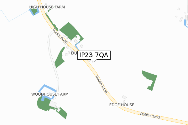
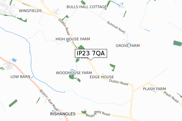
IP23 7QA is located in the Eye electoral ward, within the local authority district of Mid Suffolk and the English Parliamentary constituency of Central Suffolk and North Ipswich. The Sub Integrated Care Board (ICB) Location is NHS Suffolk and North East Essex ICB - 06L and the police force is Suffolk. This postcode has been in use since April 2020.


GetTheData
Source: OS Open Zoomstack (Ordnance Survey)
Licence: Open Government Licence (requires attribution)
Attribution: Contains OS data © Crown copyright and database right 2025
Source: Open Postcode Geo
Licence: Open Government Licence (requires attribution)
Attribution: Contains OS data © Crown copyright and database right 2025; Contains Royal Mail data © Royal Mail copyright and database right 2025; Source: Office for National Statistics licensed under the Open Government Licence v.3.0
| Easting | 615392 |
| Northing | 270922 |
| Latitude | 52.294199 |
| Longitude | 1.157174 |
GetTheData
Source: Open Postcode Geo
Licence: Open Government Licence
| Country | England |
| Postcode District | IP23 |
➜ See where IP23 is on a map ➜ Where is Occold? | |
GetTheData
Source: Land Registry Price Paid Data
Licence: Open Government Licence
| Ward | Eye |
| Constituency | Central Suffolk And North Ipswich |
GetTheData
Source: ONS Postcode Database
Licence: Open Government Licence
3, CEDARS RISE, OCCOLD, EYE, IP23 7QA 2024 6 DEC £407,500 |
3, CEDARS RISE, OCCOLD, EYE, IP23 7QA 2021 22 MAR £320,000 |
8, CEDARS RISE, OCCOLD, EYE, IP23 7QA 2020 4 DEC £497,500 |
2, CEDARS RISE, OCCOLD, EYE, IP23 7QA 2020 23 OCT £312,500 |
7, CEDARS RISE, OCCOLD, EYE, IP23 7QA 2020 2 OCT £437,500 |
6, CEDARS RISE, OCCOLD, EYE, IP23 7QA 2020 18 SEP £406,000 |
1, CEDARS RISE, OCCOLD, EYE, IP23 7QA 2020 2 JUL £445,000 |
GetTheData
Source: HM Land Registry Price Paid Data
Licence: Contains HM Land Registry data © Crown copyright and database right 2025. This data is licensed under the Open Government Licence v3.0.
| Occold Turn (B1027) | Occold | 155m |
| Occold Turn (B1027) | Occold | 164m |
| The Green (The Street) | Occold | 298m |
| The Green (The Street) | Occold | 303m |
| The Wash (B1077) | Thorndon | 1,332m |
GetTheData
Source: NaPTAN
Licence: Open Government Licence
GetTheData
Source: ONS Postcode Database
Licence: Open Government Licence

➜ Get more ratings from the Food Standards Agency
GetTheData
Source: Food Standards Agency
Licence: FSA terms & conditions
| Last Collection | |||
|---|---|---|---|
| Location | Mon-Fri | Sat | Distance |
| Church Street | 16:00 | 11:00 | 308m |
| Dublin Road | 09:45 | 11:00 | 1,785m |
| High Street | 16:00 | 10:45 | 2,183m |
GetTheData
Source: Dracos
Licence: Creative Commons Attribution-ShareAlike
The below table lists the International Territorial Level (ITL) codes (formerly Nomenclature of Territorial Units for Statistics (NUTS) codes) and Local Administrative Units (LAU) codes for IP23 7QA:
| ITL 1 Code | Name |
|---|---|
| TLH | East |
| ITL 2 Code | Name |
| TLH1 | East Anglia |
| ITL 3 Code | Name |
| TLH14 | Suffolk CC |
| LAU 1 Code | Name |
| E07000203 | Mid Suffolk |
GetTheData
Source: ONS Postcode Directory
Licence: Open Government Licence
The below table lists the Census Output Area (OA), Lower Layer Super Output Area (LSOA), and Middle Layer Super Output Area (MSOA) for IP23 7QA:
| Code | Name | |
|---|---|---|
| OA | E00153356 | |
| LSOA | E01030088 | Mid Suffolk 001D |
| MSOA | E02006261 | Mid Suffolk 001 |
GetTheData
Source: ONS Postcode Directory
Licence: Open Government Licence
| IP23 7PS | Church Street | 70m |
| IP23 7PB | Cedars Close | 108m |
| IP23 7PZ | Tudor Court | 108m |
| IP23 7PR | Church Lane | 175m |
| IP23 7PD | Old Rectory Gardens | 273m |
| IP23 7PW | The Street | 356m |
| IP23 7PP | The Causeway | 371m |
| IP23 7PL | The Street | 422m |
| IP23 7PT | Eye Road | 470m |
| IP23 7PN | Mill Road | 504m |
GetTheData
Source: Open Postcode Geo; Land Registry Price Paid Data
Licence: Open Government Licence