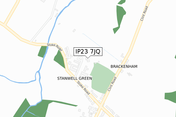
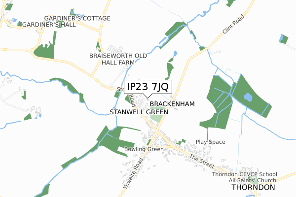
IP23 7JQ is located in the Mendlesham electoral ward, within the local authority district of Mid Suffolk and the English Parliamentary constituency of Central Suffolk and North Ipswich. The Sub Integrated Care Board (ICB) Location is NHS Suffolk and North East Essex ICB - 06L and the police force is Suffolk. This postcode has been in use since April 2018.


GetTheData
Source: OS Open Zoomstack (Ordnance Survey)
Licence: Open Government Licence (requires attribution)
Attribution: Contains OS data © Crown copyright and database right 2025
Source: Open Postcode Geo
Licence: Open Government Licence (requires attribution)
Attribution: Contains OS data © Crown copyright and database right 2025; Contains Royal Mail data © Royal Mail copyright and database right 2025; Source: Office for National Statistics licensed under the Open Government Licence v.3.0
| Easting | 613227 |
| Northing | 270289 |
| Latitude | 52.289360 |
| Longitude | 1.125077 |
GetTheData
Source: Open Postcode Geo
Licence: Open Government Licence
| Country | England |
| Postcode District | IP23 |
➜ See where IP23 is on a map ➜ Where is Thorndon? | |
GetTheData
Source: Land Registry Price Paid Data
Licence: Open Government Licence
| Ward | Mendlesham |
| Constituency | Central Suffolk And North Ipswich |
GetTheData
Source: ONS Postcode Database
Licence: Open Government Licence
29, KERRISON GARDENS, THORNDON, EYE, IP23 7JQ 2021 10 SEP £280,000 |
28, KERRISON GARDENS, THORNDON, EYE, IP23 7JQ 2020 12 NOV £344,000 |
GetTheData
Source: HM Land Registry Price Paid Data
Licence: Contains HM Land Registry data © Crown copyright and database right 2025. This data is licensed under the Open Government Licence v3.0.
| Black Horse (The Street) | Thorndon | 732m |
| Black Horse (The Street) | Thorndon | 745m |
| Church | Thorndon | 1,177m |
| Church | Thorndon | 1,185m |
| Post Office (The Street) | Stoke Ash | 1,543m |
GetTheData
Source: NaPTAN
Licence: Open Government Licence
GetTheData
Source: ONS Postcode Database
Licence: Open Government Licence

➜ Get more ratings from the Food Standards Agency
GetTheData
Source: Food Standards Agency
Licence: FSA terms & conditions
| Last Collection | |||
|---|---|---|---|
| Location | Mon-Fri | Sat | Distance |
| 1 Stanwell Green | 16:00 | 07:30 | 291m |
| The Orchards | 15:15 | 07:00 | 1,520m |
| High Street | 16:00 | 10:45 | 1,595m |
GetTheData
Source: Dracos
Licence: Creative Commons Attribution-ShareAlike
The below table lists the International Territorial Level (ITL) codes (formerly Nomenclature of Territorial Units for Statistics (NUTS) codes) and Local Administrative Units (LAU) codes for IP23 7JQ:
| ITL 1 Code | Name |
|---|---|
| TLH | East |
| ITL 2 Code | Name |
| TLH1 | East Anglia |
| ITL 3 Code | Name |
| TLH14 | Suffolk CC |
| LAU 1 Code | Name |
| E07000203 | Mid Suffolk |
GetTheData
Source: ONS Postcode Directory
Licence: Open Government Licence
The below table lists the Census Output Area (OA), Lower Layer Super Output Area (LSOA), and Middle Layer Super Output Area (MSOA) for IP23 7JQ:
| Code | Name | |
|---|---|---|
| OA | E00153359 | |
| LSOA | E01030088 | Mid Suffolk 001D |
| MSOA | E02006261 | Mid Suffolk 001 |
GetTheData
Source: ONS Postcode Directory
Licence: Open Government Licence
| IP23 7JG | Stoke Road | 79m |
| IP23 7JF | Clint Road | 269m |
| IP23 7JH | Stanwell Green | 288m |
| IP23 7JL | Stanwell Green | 429m |
| IP23 7JN | The Street | 512m |
| IP23 7JJ | Thwaite Road | 550m |
| IP23 7LW | Pond Farm | 632m |
| IP23 7GB | Soers Close | 645m |
| IP23 7JW | Fen View | 685m |
| IP23 7ER | Grasshopper Lane | 872m |
GetTheData
Source: Open Postcode Geo; Land Registry Price Paid Data
Licence: Open Government Licence