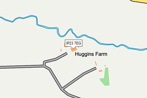
IP23 7EG is located in the Palgrave electoral ward, within the local authority district of Mid Suffolk and the English Parliamentary constituency of Central Suffolk and North Ipswich. The Sub Integrated Care Board (ICB) Location is NHS Suffolk and North East Essex ICB - 06L and the police force is Suffolk. This postcode has been in use since June 2010.


GetTheData
Source: OS OpenMap – Local (Ordnance Survey)
Source: OS VectorMap District (Ordnance Survey)
Licence: Open Government Licence (requires attribution)
| Easting | 612127 |
| Northing | 270473 |
| Latitude | 52.291419 |
| Longitude | 1.109060 |
GetTheData
Source: Open Postcode Geo
Licence: Open Government Licence
| Country | England |
| Postcode District | IP23 |
➜ See where IP23 is on a map | |
GetTheData
Source: Land Registry Price Paid Data
Licence: Open Government Licence
Elevation or altitude of IP23 7EG as distance above sea level:
| Metres | Feet | |
|---|---|---|
| Elevation | 40m | 131ft |
Elevation is measured from the approximate centre of the postcode, to the nearest point on an OS contour line from OS Terrain 50, which has contour spacing of ten vertical metres.
➜ How high above sea level am I? Find the elevation of your current position using your device's GPS.
GetTheData
Source: Open Postcode Elevation
Licence: Open Government Licence
| Ward | Palgrave |
| Constituency | Central Suffolk And North Ipswich |
GetTheData
Source: ONS Postcode Database
Licence: Open Government Licence
| Post Office (The Street) | Stoke Ash | 774m |
| Post Office (The Street) | Stoke Ash | 785m |
| White Horse (A140) | Stoke Ash | 937m |
| White Horse (A140) | Stoke Ash | 951m |
| White Horse (Workhouse Road) | Stoke Ash | 1,045m |
GetTheData
Source: NaPTAN
Licence: Open Government Licence
GetTheData
Source: ONS Postcode Database
Licence: Open Government Licence


➜ Get more ratings from the Food Standards Agency
GetTheData
Source: Food Standards Agency
Licence: FSA terms & conditions
| Last Collection | |||
|---|---|---|---|
| Location | Mon-Fri | Sat | Distance |
| 1 Stanwell Green | 16:00 | 07:30 | 1,319m |
| The Street | 09:00 | 10:30 | 1,791m |
| The Orchards | 15:15 | 07:00 | 1,800m |
GetTheData
Source: Dracos
Licence: Creative Commons Attribution-ShareAlike
The below table lists the International Territorial Level (ITL) codes (formerly Nomenclature of Territorial Units for Statistics (NUTS) codes) and Local Administrative Units (LAU) codes for IP23 7EG:
| ITL 1 Code | Name |
|---|---|
| TLH | East |
| ITL 2 Code | Name |
| TLH1 | East Anglia |
| ITL 3 Code | Name |
| TLH14 | Suffolk CC |
| LAU 1 Code | Name |
| E07000203 | Mid Suffolk |
GetTheData
Source: ONS Postcode Directory
Licence: Open Government Licence
The below table lists the Census Output Area (OA), Lower Layer Super Output Area (LSOA), and Middle Layer Super Output Area (MSOA) for IP23 7EG:
| Code | Name | |
|---|---|---|
| OA | E00153358 | |
| LSOA | E01030087 | Mid Suffolk 007D |
| MSOA | E02006267 | Mid Suffolk 007 |
GetTheData
Source: ONS Postcode Directory
Licence: Open Government Licence
| IP23 7ER | Grasshopper Lane | 355m |
| IP23 7DZ | Clay Lane | 486m |
| IP23 7EP | Roman Way | 654m |
| IP23 7ET | 667m | |
| IP23 7EW | The Street | 778m |
| IP23 7EX | Deadmans Lane | 845m |
| IP23 7EU | Chapel Lane | 1164m |
| IP23 7JG | Stoke Road | 1184m |
| IP23 7ES | Wood Hall Lane | 1189m |
| IP23 8EP | Mill Lane | 1222m |
GetTheData
Source: Open Postcode Geo; Land Registry Price Paid Data
Licence: Open Government Licence