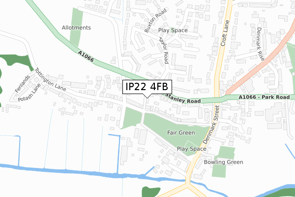
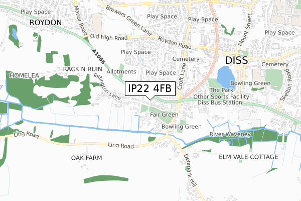
IP22 4FB is located in the Diss & Roydon electoral ward, within the local authority district of South Norfolk and the English Parliamentary constituency of South Norfolk. The Sub Integrated Care Board (ICB) Location is NHS Norfolk and Waveney ICB - 26A and the police force is Norfolk. This postcode has been in use since February 2020.


GetTheData
Source: OS Open Zoomstack (Ordnance Survey)
Licence: Open Government Licence (requires attribution)
Attribution: Contains OS data © Crown copyright and database right 2025
Source: Open Postcode Geo
Licence: Open Government Licence (requires attribution)
Attribution: Contains OS data © Crown copyright and database right 2025; Contains Royal Mail data © Royal Mail copyright and database right 2025; Source: Office for National Statistics licensed under the Open Government Licence v.3.0
| Easting | 610952 |
| Northing | 279640 |
| Latitude | 52.374183 |
| Longitude | 1.097635 |
GetTheData
Source: Open Postcode Geo
Licence: Open Government Licence
| Country | England |
| Postcode District | IP22 |
➜ See where IP22 is on a map ➜ Where is Diss? | |
GetTheData
Source: Land Registry Price Paid Data
Licence: Open Government Licence
| Ward | Diss & Roydon |
| Constituency | South Norfolk |
GetTheData
Source: ONS Postcode Database
Licence: Open Government Licence
| Taylor Road (Stanley Road) | Diss | 63m |
| Taylor Road (Stanley Road A1066) | Diss | 83m |
| Hall Hills (Roydon Road) | Diss | 528m |
| Greenacres (Old High Road) | Diss | 545m |
| Bus Station (Park Road) | Diss | 594m |
| Diss Station | 1.8km |
GetTheData
Source: NaPTAN
Licence: Open Government Licence
GetTheData
Source: ONS Postcode Database
Licence: Open Government Licence


➜ Get more ratings from the Food Standards Agency
GetTheData
Source: Food Standards Agency
Licence: FSA terms & conditions
| Last Collection | |||
|---|---|---|---|
| Location | Mon-Fri | Sat | Distance |
| Taylor Road | 17:30 | 10:45 | 189m |
| Denmark Green | 17:30 | 11:00 | 267m |
| Parkside Court | 17:30 | 10:45 | 454m |
GetTheData
Source: Dracos
Licence: Creative Commons Attribution-ShareAlike
The below table lists the International Territorial Level (ITL) codes (formerly Nomenclature of Territorial Units for Statistics (NUTS) codes) and Local Administrative Units (LAU) codes for IP22 4FB:
| ITL 1 Code | Name |
|---|---|
| TLH | East |
| ITL 2 Code | Name |
| TLH1 | East Anglia |
| ITL 3 Code | Name |
| TLH17 | Breckland and South Norfolk |
| LAU 1 Code | Name |
| E07000149 | South Norfolk |
GetTheData
Source: ONS Postcode Directory
Licence: Open Government Licence
The below table lists the Census Output Area (OA), Lower Layer Super Output Area (LSOA), and Middle Layer Super Output Area (MSOA) for IP22 4FB:
| Code | Name | |
|---|---|---|
| OA | E00136776 | |
| LSOA | E01026891 | South Norfolk 015D |
| MSOA | E02005611 | South Norfolk 015 |
GetTheData
Source: ONS Postcode Directory
Licence: Open Government Licence
| IP22 4DG | Denmark Lane | 38m |
| IP22 4BL | Denmark Lane | 89m |
| IP22 4BN | Stanley Road | 105m |
| IP22 4BQ | Fair Green | 111m |
| IP22 4BW | Stanley Road | 115m |
| IP22 4BA | Taylor Road | 115m |
| IP22 4EB | Sandstone Way | 120m |
| IP22 4BT | Stannard Close | 121m |
| IP22 4BH | Charles Terrace | 122m |
| IP22 4AZ | Stanley Road | 143m |
GetTheData
Source: Open Postcode Geo; Land Registry Price Paid Data
Licence: Open Government Licence