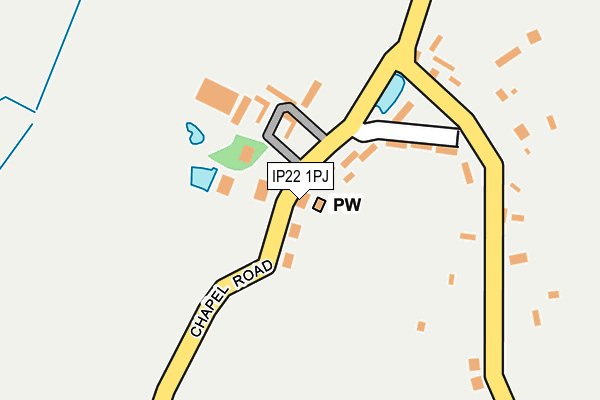
IP22 1PJ lies on Harmer Place in Wattisfield, Diss. IP22 1PJ is located in the Walsham-le-Willows electoral ward, within the local authority district of Mid Suffolk and the English Parliamentary constituency of Bury St Edmunds. The Sub Integrated Care Board (ICB) Location is NHS Suffolk and North East Essex ICB - 07K and the police force is Suffolk. This postcode has been in use since August 2005.


GetTheData
Source: OS OpenMap – Local (Ordnance Survey)
Source: OS VectorMap District (Ordnance Survey)
Licence: Open Government Licence (requires attribution)
| Easting | 600825 |
| Northing | 273767 |
| Latitude | 52.325255 |
| Longitude | 0.945574 |
GetTheData
Source: Open Postcode Geo
Licence: Open Government Licence
| Street | Harmer Place |
| Locality | Wattisfield |
| Town/City | Diss |
| Country | England |
| Postcode District | IP22 |
➜ See where IP22 is on a map ➜ Where is Wattisfield? | |
GetTheData
Source: Land Registry Price Paid Data
Licence: Open Government Licence
Elevation or altitude of IP22 1PJ as distance above sea level:
| Metres | Feet | |
|---|---|---|
| Elevation | 50m | 164ft |
Elevation is measured from the approximate centre of the postcode, to the nearest point on an OS contour line from OS Terrain 50, which has contour spacing of ten vertical metres.
➜ How high above sea level am I? Find the elevation of your current position using your device's GPS.
GetTheData
Source: Open Postcode Elevation
Licence: Open Government Licence
| Ward | Walsham-le-willows |
| Constituency | Bury St Edmunds |
GetTheData
Source: ONS Postcode Database
Licence: Open Government Licence
| Wattisfield Hall (Chapel Road) | Wattisfield | 45m |
| Wattisfield Hall (Chapel Road) | Wattisfield | 69m |
| Victoria Gardens (The Street) | Wattisfield | 572m |
| Victoria Gardens (The Street) | Wattisfield | 589m |
| The Street (Bury Road) | Wattisfield | 597m |
GetTheData
Source: NaPTAN
Licence: Open Government Licence
| Percentage of properties with Next Generation Access | 100.0% |
| Percentage of properties with Superfast Broadband | 100.0% |
| Percentage of properties with Ultrafast Broadband | 0.0% |
| Percentage of properties with Full Fibre Broadband | 0.0% |
Superfast Broadband is between 30Mbps and 300Mbps
Ultrafast Broadband is > 300Mbps
| Median download speed | 34.7Mbps |
| Average download speed | 30.8Mbps |
| Maximum download speed | 54.52Mbps |
| Median upload speed | 6.8Mbps |
| Average upload speed | 5.7Mbps |
| Maximum upload speed | 7.56Mbps |
| Percentage of properties unable to receive 2Mbps | 0.0% |
| Percentage of properties unable to receive 5Mbps | 0.0% |
| Percentage of properties unable to receive 10Mbps | 0.0% |
| Percentage of properties unable to receive 30Mbps | 0.0% |
GetTheData
Source: Ofcom
Licence: Ofcom Terms of Use (requires attribution)
GetTheData
Source: ONS Postcode Database
Licence: Open Government Licence


➜ Get more ratings from the Food Standards Agency
GetTheData
Source: Food Standards Agency
Licence: FSA terms & conditions
| Last Collection | |||
|---|---|---|---|
| Location | Mon-Fri | Sat | Distance |
| The Street | 16:00 | 09:30 | 206m |
| Post Office, The Street | 16:15 | 09:00 | 591m |
| South Common | 09:00 | 10:30 | 1,893m |
GetTheData
Source: Dracos
Licence: Creative Commons Attribution-ShareAlike
The below table lists the International Territorial Level (ITL) codes (formerly Nomenclature of Territorial Units for Statistics (NUTS) codes) and Local Administrative Units (LAU) codes for IP22 1PJ:
| ITL 1 Code | Name |
|---|---|
| TLH | East |
| ITL 2 Code | Name |
| TLH1 | East Anglia |
| ITL 3 Code | Name |
| TLH14 | Suffolk CC |
| LAU 1 Code | Name |
| E07000203 | Mid Suffolk |
GetTheData
Source: ONS Postcode Directory
Licence: Open Government Licence
The below table lists the Census Output Area (OA), Lower Layer Super Output Area (LSOA), and Middle Layer Super Output Area (MSOA) for IP22 1PJ:
| Code | Name | |
|---|---|---|
| OA | E00153260 | |
| LSOA | E01030068 | Mid Suffolk 002F |
| MSOA | E02006262 | Mid Suffolk 002 |
GetTheData
Source: ONS Postcode Directory
Licence: Open Government Licence
| IP22 1NU | Chapel Road | 75m |
| IP22 1NX | Chapel Road | 94m |
| IP22 1PB | Walsham Road | 258m |
| IP22 1NT | The Street | 277m |
| IP22 1NS | The Street | 472m |
| IP22 1HL | The Oaks | 488m |
| IP22 1NW | Bury Road | 562m |
| IP22 1NZ | Walsham Road | 628m |
| IP22 1FW | Church Green Lane | 629m |
| IP22 1PA | Honeypot Lane | 697m |
GetTheData
Source: Open Postcode Geo; Land Registry Price Paid Data
Licence: Open Government Licence