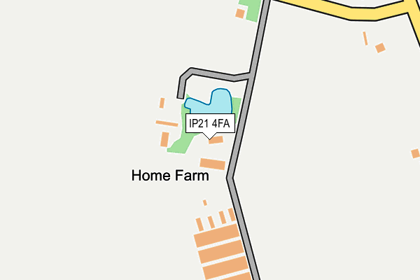
IP21 4FA is located in the Beck Vale, Dickleburgh & Scole electoral ward, within the local authority district of South Norfolk and the English Parliamentary constituency of South Norfolk. The Sub Integrated Care Board (ICB) Location is NHS Norfolk and Waveney ICB - 26A and the police force is Norfolk. This postcode has been in use since January 2017.


GetTheData
Source: OS OpenMap – Local (Ordnance Survey)
Source: OS VectorMap District (Ordnance Survey)
Licence: Open Government Licence (requires attribution)
| Easting | 620349 |
| Northing | 284075 |
| Latitude | 52.410296 |
| Longitude | 1.238363 |
GetTheData
Source: Open Postcode Geo
Licence: Open Government Licence
| Country | England |
| Postcode District | IP21 |
➜ See where IP21 is on a map | |
GetTheData
Source: Land Registry Price Paid Data
Licence: Open Government Licence
Elevation or altitude of IP21 4FA as distance above sea level:
| Metres | Feet | |
|---|---|---|
| Elevation | 40m | 131ft |
Elevation is measured from the approximate centre of the postcode, to the nearest point on an OS contour line from OS Terrain 50, which has contour spacing of ten vertical metres.
➜ How high above sea level am I? Find the elevation of your current position using your device's GPS.
GetTheData
Source: Open Postcode Elevation
Licence: Open Government Licence
| Ward | Beck Vale, Dickleburgh & Scole |
| Constituency | South Norfolk |
GetTheData
Source: ONS Postcode Database
Licence: Open Government Licence
| Mill Lane (Norwich Road) | Pulham St Mary | 1,376m |
| The Half Moon (Harleston Road) | Rushall | 1,382m |
| Kings Head (Station Road) | Pulham St Mary | 1,385m |
| Mill Lane (Norwich Road) | Pulham St Mary | 1,389m |
| The Half Moon (Harleston Road) | Rushall | 1,400m |
GetTheData
Source: NaPTAN
Licence: Open Government Licence
GetTheData
Source: ONS Postcode Database
Licence: Open Government Licence


➜ Get more ratings from the Food Standards Agency
GetTheData
Source: Food Standards Agency
Licence: FSA terms & conditions
| Last Collection | |||
|---|---|---|---|
| Location | Mon-Fri | Sat | Distance |
| Post Office, The Street | 16:00 | 11:00 | 1,390m |
| Post Office, Rectory Road | 16:30 | 11:30 | 3,848m |
| London Road | 16:30 | 10:30 | 4,120m |
GetTheData
Source: Dracos
Licence: Creative Commons Attribution-ShareAlike
The below table lists the International Territorial Level (ITL) codes (formerly Nomenclature of Territorial Units for Statistics (NUTS) codes) and Local Administrative Units (LAU) codes for IP21 4FA:
| ITL 1 Code | Name |
|---|---|
| TLH | East |
| ITL 2 Code | Name |
| TLH1 | East Anglia |
| ITL 3 Code | Name |
| TLH17 | Breckland and South Norfolk |
| LAU 1 Code | Name |
| E07000149 | South Norfolk |
GetTheData
Source: ONS Postcode Directory
Licence: Open Government Licence
The below table lists the Census Output Area (OA), Lower Layer Super Output Area (LSOA), and Middle Layer Super Output Area (MSOA) for IP21 4FA:
| Code | Name | |
|---|---|---|
| OA | E00136684 | |
| LSOA | E01026872 | South Norfolk 013A |
| MSOA | E02005609 | South Norfolk 013 |
GetTheData
Source: ONS Postcode Directory
Licence: Open Government Licence
| IP21 4QQ | Station Road | 428m |
| IP21 4QS | Station Road | 626m |
| IP21 4QR | Semere Lane | 649m |
| IP21 4QG | Waterworks Lane | 818m |
| IP21 4QF | Air Station Lane | 1182m |
| IP21 4RJ | Doctors Lane | 1206m |
| IP21 4QT | Station Road | 1215m |
| IP21 4RU | The Maltings | 1280m |
| IP21 4QY | Mill Lane | 1298m |
| IP21 4QE | The Street | 1312m |
GetTheData
Source: Open Postcode Geo; Land Registry Price Paid Data
Licence: Open Government Licence