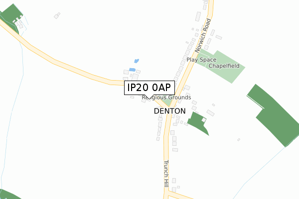
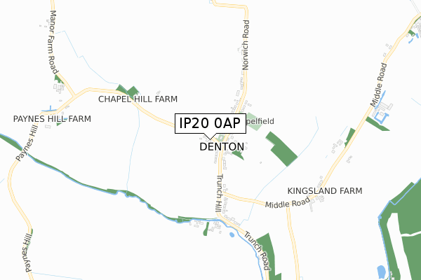
IP20 0AP is located in the Fressingfield electoral ward, within the local authority district of Mid Suffolk and the English Parliamentary constituency of Central Suffolk and North Ipswich. The Sub Integrated Care Board (ICB) Location is NHS Suffolk and North East Essex ICB - 06L and the police force is Suffolk. This postcode has been in use since January 2020.


GetTheData
Source: OS Open Zoomstack (Ordnance Survey)
Licence: Open Government Licence (requires attribution)
Attribution: Contains OS data © Crown copyright and database right 2025
Source: Open Postcode Geo
Licence: Open Government Licence (requires attribution)
Attribution: Contains OS data © Crown copyright and database right 2025; Contains Royal Mail data © Royal Mail copyright and database right 2025; Source: Office for National Statistics licensed under the Open Government Licence v.3.0
| Easting | 629498 |
| Northing | 280466 |
| Latitude | 52.374150 |
| Longitude | 1.370164 |
GetTheData
Source: Open Postcode Geo
Licence: Open Government Licence
| Country | England |
| Postcode District | IP20 |
➜ See where IP20 is on a map ➜ Where is Metfield? | |
GetTheData
Source: Land Registry Price Paid Data
Licence: Open Government Licence
| Ward | Fressingfield |
| Constituency | Central Suffolk And North Ipswich |
GetTheData
Source: ONS Postcode Database
Licence: Open Government Licence
| Church (B1123) | Metfield | 151m |
| Church (B1123) | Metfield | 159m |
| Honeymoon Row (The Street) | Metfield | 279m |
| Honeymoon Row (The Street) | Metfield | 279m |
| Office Farm (B1123) | Metfield Common | 1,458m |
GetTheData
Source: NaPTAN
Licence: Open Government Licence
GetTheData
Source: ONS Postcode Database
Licence: Open Government Licence


➜ Get more ratings from the Food Standards Agency
GetTheData
Source: Food Standards Agency
Licence: FSA terms & conditions
| Last Collection | |||
|---|---|---|---|
| Location | Mon-Fri | Sat | Distance |
| The Corner | 15:45 | 07:45 | 60m |
| Post Office, The Street | 16:00 | 09:00 | 188m |
| The Street | 15:55 | 09:20 | 2,600m |
GetTheData
Source: Dracos
Licence: Creative Commons Attribution-ShareAlike
The below table lists the International Territorial Level (ITL) codes (formerly Nomenclature of Territorial Units for Statistics (NUTS) codes) and Local Administrative Units (LAU) codes for IP20 0AP:
| ITL 1 Code | Name |
|---|---|
| TLH | East |
| ITL 2 Code | Name |
| TLH1 | East Anglia |
| ITL 3 Code | Name |
| TLH14 | Suffolk CC |
| LAU 1 Code | Name |
| E07000203 | Mid Suffolk |
GetTheData
Source: ONS Postcode Directory
Licence: Open Government Licence
The below table lists the Census Output Area (OA), Lower Layer Super Output Area (LSOA), and Middle Layer Super Output Area (MSOA) for IP20 0AP:
| Code | Name | |
|---|---|---|
| OA | E00153169 | |
| LSOA | E01030053 | Mid Suffolk 003A |
| MSOA | E02006263 | Mid Suffolk 003 |
GetTheData
Source: ONS Postcode Directory
Licence: Open Government Licence
| IP20 0LA | The Street | 87m |
| IP20 0LJ | School Lane | 159m |
| IP20 0LQ | Town Farm Close | 204m |
| IP20 0JY | 205m | |
| IP20 0LH | Skinners Lane | 252m |
| IP20 0LB | The Street | 264m |
| IP20 0LY | St Johns Meadow | 301m |
| IP20 0LT | Skinners Close | 314m |
| IP20 0JX | 397m | |
| IP20 0LE | The Street | 397m |
GetTheData
Source: Open Postcode Geo; Land Registry Price Paid Data
Licence: Open Government Licence