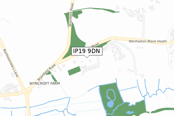
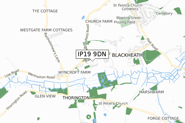
IP19 9DN is located in the Halesworth & Blything electoral ward, within the local authority district of East Suffolk and the English Parliamentary constituency of Suffolk Coastal. The Sub Integrated Care Board (ICB) Location is NHS Suffolk and North East Essex ICB - 06L and the police force is Suffolk. This postcode has been in use since January 2019.


GetTheData
Source: OS Open Zoomstack (Ordnance Survey)
Licence: Open Government Licence (requires attribution)
Attribution: Contains OS data © Crown copyright and database right 2025
Source: Open Postcode Geo
Licence: Open Government Licence (requires attribution)
Attribution: Contains OS data © Crown copyright and database right 2025; Contains Royal Mail data © Royal Mail copyright and database right 2025; Source: Office for National Statistics licensed under the Open Government Licence v.3.0
| Easting | 642002 |
| Northing | 274703 |
| Latitude | 52.317065 |
| Longitude | 1.549340 |
GetTheData
Source: Open Postcode Geo
Licence: Open Government Licence
| Country | England |
| Postcode District | IP19 |
➜ See where IP19 is on a map | |
GetTheData
Source: Land Registry Price Paid Data
Licence: Open Government Licence
| Ward | Halesworth & Blything |
| Constituency | Suffolk Coastal |
GetTheData
Source: ONS Postcode Database
Licence: Open Government Licence
| St Peter's Church (Thorington Road) | Thorington | 591m |
| St Peter's Church (Thorington Road) | Thorington | 591m |
| Hammonds Walk (Hall Road) | Wenhaston | 815m |
| Hammonds Walk (Hall Road) | Wenhaston | 840m |
| The Star Inn (Hall Road) | Wenhaston | 841m |
| Halesworth Station | 4.5km |
| Darsham Station | 5.2km |
GetTheData
Source: NaPTAN
Licence: Open Government Licence
GetTheData
Source: ONS Postcode Database
Licence: Open Government Licence


➜ Get more ratings from the Food Standards Agency
GetTheData
Source: Food Standards Agency
Licence: FSA terms & conditions
| Last Collection | |||
|---|---|---|---|
| Location | Mon-Fri | Sat | Distance |
| Orchard Valley | 16:30 | 11:15 | 3,674m |
| High Street | 09:00 | 09:00 | 3,891m |
| The Drive | 17:10 | 12:00 | 4,375m |
GetTheData
Source: Dracos
Licence: Creative Commons Attribution-ShareAlike
The below table lists the International Territorial Level (ITL) codes (formerly Nomenclature of Territorial Units for Statistics (NUTS) codes) and Local Administrative Units (LAU) codes for IP19 9DN:
| ITL 1 Code | Name |
|---|---|
| TLH | East |
| ITL 2 Code | Name |
| TLH1 | East Anglia |
| ITL 3 Code | Name |
| TLH14 | Suffolk CC |
| LAU 1 Code | Name |
| E07000244 | East Suffolk |
GetTheData
Source: ONS Postcode Directory
Licence: Open Government Licence
The below table lists the Census Output Area (OA), Lower Layer Super Output Area (LSOA), and Middle Layer Super Output Area (MSOA) for IP19 9DN:
| Code | Name | |
|---|---|---|
| OA | E00154113 | |
| LSOA | E01030219 | Suffolk Coastal 001B |
| MSOA | E02006287 | Suffolk Coastal 001 |
GetTheData
Source: ONS Postcode Directory
Licence: Open Government Licence
| IP19 9DH | Blackheath | 51m |
| IP19 9DQ | 267m | |
| IP19 9EX | Blackheath | 290m |
| IP19 9EU | Blackheath | 381m |
| IP19 9ET | Blackheath | 567m |
| IP19 9HB | Blackheath | 569m |
| IP19 9JF | 578m | |
| IP19 9EZ | Blackheath | 581m |
| IP19 9JG | Thorington Road | 589m |
| IP19 9HA | Hog Lane | 675m |
GetTheData
Source: Open Postcode Geo; Land Registry Price Paid Data
Licence: Open Government Licence