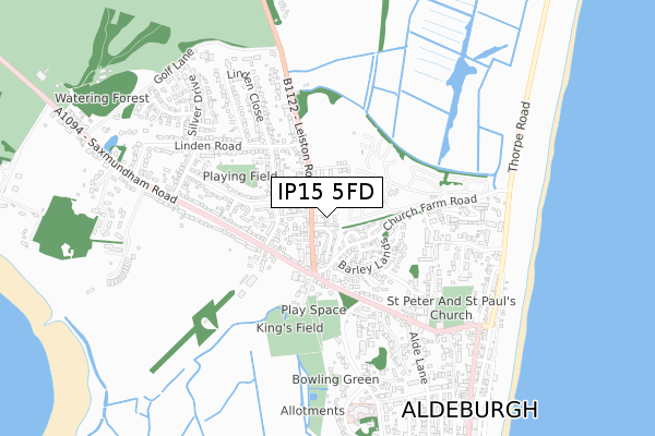
IP15 5FD is located in the Aldeburgh & Leiston electoral ward, within the local authority district of East Suffolk and the English Parliamentary constituency of Suffolk Coastal. The Sub Integrated Care Board (ICB) Location is NHS Suffolk and North East Essex ICB - 06L and the police force is Suffolk. This postcode has been in use since February 2020.


GetTheData
Source: OS Open Zoomstack (Ordnance Survey)
Licence: Open Government Licence (requires attribution)
Attribution: Contains OS data © Crown copyright and database right 2025
Source: Open Postcode Geo
Licence: Open Government Licence (requires attribution)
Attribution: Contains OS data © Crown copyright and database right 2025; Contains Royal Mail data © Royal Mail copyright and database right 2025; Source: Office for National Statistics licensed under the Open Government Licence v.3.0
| Easting | 645916 |
| Northing | 257264 |
| Latitude | 52.158852 |
| Longitude | 1.593971 |
GetTheData
Source: Open Postcode Geo
Licence: Open Government Licence
| Country | England |
| Postcode District | IP15 |
➜ See where IP15 is on a map ➜ Where is Aldeburgh? | |
GetTheData
Source: Land Registry Price Paid Data
Licence: Open Government Licence
| Ward | Aldeburgh & Leiston |
| Constituency | Suffolk Coastal |
GetTheData
Source: ONS Postcode Database
Licence: Open Government Licence
| Police Station (B1122) | Aldeburgh | 60m |
| Police Station (B1122) | Aldeburgh | 93m |
| Linden Road (Leiston Road) | Aldeburgh | 310m |
| Linden Road (Leiston Road) | Aldeburgh | 317m |
| Linden Close (Linden Road) | Aldeburgh | 356m |
GetTheData
Source: NaPTAN
Licence: Open Government Licence
GetTheData
Source: ONS Postcode Database
Licence: Open Government Licence


➜ Get more ratings from the Food Standards Agency
GetTheData
Source: Food Standards Agency
Licence: FSA terms & conditions
| Last Collection | |||
|---|---|---|---|
| Location | Mon-Fri | Sat | Distance |
| Post Office, Fairfield Road | 16:15 | 11:45 | 207m |
| Victoria Road | 16:15 | 10:30 | 278m |
| Leiston Road | 16:30 | 11:00 | 555m |
GetTheData
Source: Dracos
Licence: Creative Commons Attribution-ShareAlike
The below table lists the International Territorial Level (ITL) codes (formerly Nomenclature of Territorial Units for Statistics (NUTS) codes) and Local Administrative Units (LAU) codes for IP15 5FD:
| ITL 1 Code | Name |
|---|---|
| TLH | East |
| ITL 2 Code | Name |
| TLH1 | East Anglia |
| ITL 3 Code | Name |
| TLH14 | Suffolk CC |
| LAU 1 Code | Name |
| E07000244 | East Suffolk |
GetTheData
Source: ONS Postcode Directory
Licence: Open Government Licence
The below table lists the Census Output Area (OA), Lower Layer Super Output Area (LSOA), and Middle Layer Super Output Area (MSOA) for IP15 5FD:
| Code | Name | |
|---|---|---|
| OA | E00153731 | |
| LSOA | E01030153 | Suffolk Coastal 004B |
| MSOA | E02006290 | Suffolk Coastal 004 |
GetTheData
Source: ONS Postcode Directory
Licence: Open Government Licence
| IP15 5QG | The Plantation | 73m |
| IP15 5QH | Mariners Way | 87m |
| IP15 5PP | Leiston Road | 103m |
| IP15 5HS | Britten Close | 118m |
| IP15 5PS | Leiston Road | 130m |
| IP15 5PW | Leiston Road | 142m |
| IP15 5JR | Cherry Lane | 144m |
| IP15 5EB | Church Farm Road | 146m |
| IP15 5QQ | The Plantation | 147m |
| IP15 5PR | Leiston Road | 156m |
GetTheData
Source: Open Postcode Geo; Land Registry Price Paid Data
Licence: Open Government Licence