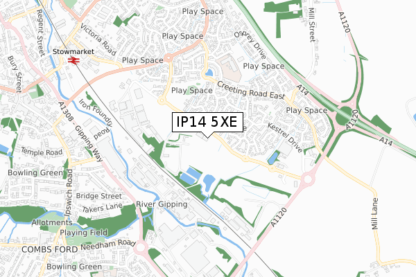
IP14 5XE is located in the Stow Thorney electoral ward, within the local authority district of Mid Suffolk and the English Parliamentary constituency of Bury St Edmunds. The Sub Integrated Care Board (ICB) Location is NHS Suffolk and North East Essex ICB - 06L and the police force is Suffolk. This postcode has been in use since July 2019.


GetTheData
Source: OS Open Zoomstack (Ordnance Survey)
Licence: Open Government Licence (requires attribution)
Attribution: Contains OS data © Crown copyright and database right 2025
Source: Open Postcode Geo
Licence: Open Government Licence (requires attribution)
Attribution: Contains OS data © Crown copyright and database right 2025; Contains Royal Mail data © Royal Mail copyright and database right 2025; Source: Office for National Statistics licensed under the Open Government Licence v.3.0
| Easting | 605937 |
| Northing | 258411 |
| Latitude | 52.185497 |
| Longitude | 1.011121 |
GetTheData
Source: Open Postcode Geo
Licence: Open Government Licence
| Country | England |
| Postcode District | IP14 |
➜ See where IP14 is on a map | |
GetTheData
Source: Land Registry Price Paid Data
Licence: Open Government Licence
| Ward | Stow Thorney |
| Constituency | Bury St Edmunds |
GetTheData
Source: ONS Postcode Database
Licence: Open Government Licence
| Gun Cotton Way Park (Distributor Road) | Stowmarket | 205m |
| Gun Cotton Way Park (Distributor Road) | Stowmarket | 209m |
| Woodpecker Close (Distributor Road) | Cedars Park | 216m |
| Woodpecker Close (Distributor Road) | Cedars Park | 243m |
| Wren Close (Kestrel Drive) | Cedars Park | 341m |
| Stowmarket Station | 0.9km |
| Needham Market Station | 4.7km |
GetTheData
Source: NaPTAN
Licence: Open Government Licence
GetTheData
Source: ONS Postcode Database
Licence: Open Government Licence


➜ Get more ratings from the Food Standards Agency
GetTheData
Source: Food Standards Agency
Licence: FSA terms & conditions
| Last Collection | |||
|---|---|---|---|
| Location | Mon-Fri | Sat | Distance |
| Royal Mail 62 Ipswich Street | 17:45 | 13:00 | 887m |
| Edgecomb Road | 17:00 | 11:00 | 1,667m |
| Post Office, Church Road | 17:15 | 10:15 | 2,032m |
GetTheData
Source: Dracos
Licence: Creative Commons Attribution-ShareAlike
The below table lists the International Territorial Level (ITL) codes (formerly Nomenclature of Territorial Units for Statistics (NUTS) codes) and Local Administrative Units (LAU) codes for IP14 5XE:
| ITL 1 Code | Name |
|---|---|
| TLH | East |
| ITL 2 Code | Name |
| TLH1 | East Anglia |
| ITL 3 Code | Name |
| TLH14 | Suffolk CC |
| LAU 1 Code | Name |
| E07000203 | Mid Suffolk |
GetTheData
Source: ONS Postcode Directory
Licence: Open Government Licence
The below table lists the Census Output Area (OA), Lower Layer Super Output Area (LSOA), and Middle Layer Super Output Area (MSOA) for IP14 5XE:
| Code | Name | |
|---|---|---|
| OA | E00173690 | |
| LSOA | E01033319 | Mid Suffolk 010H |
| MSOA | E02006270 | Mid Suffolk 010 |
GetTheData
Source: ONS Postcode Directory
Licence: Open Government Licence
| IP14 5UN | Brambling Close | 107m |
| IP14 5UL | Dotterel Way | 110m |
| IP14 5UJ | Fieldfare Close | 164m |
| IP14 5UP | Plover Close | 182m |
| IP14 5UE | Cormorant Drive | 203m |
| IP14 5UF | Avocet Gardens | 228m |
| IP14 5UD | Woodpecker Close | 229m |
| IP14 5UB | Linnet Drive | 232m |
| IP14 5NG | Robin Close | 249m |
| IP14 5UG | Shearwater Way | 268m |
GetTheData
Source: Open Postcode Geo; Land Registry Price Paid Data
Licence: Open Government Licence