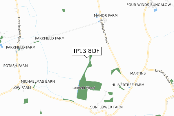
IP13 8DF is located in the Stradbroke & Laxfield electoral ward, within the local authority district of Mid Suffolk and the English Parliamentary constituency of Central Suffolk and North Ipswich. The Sub Integrated Care Board (ICB) Location is NHS Suffolk and North East Essex ICB - 06L and the police force is Suffolk. This postcode has been in use since April 2020.


GetTheData
Source: OS Open Zoomstack (Ordnance Survey)
Licence: Open Government Licence (requires attribution)
Attribution: Contains OS data © Crown copyright and database right 2025
Source: Open Postcode Geo
Licence: Open Government Licence (requires attribution)
Attribution: Contains OS data © Crown copyright and database right 2025; Contains Royal Mail data © Royal Mail copyright and database right 2025; Source: Office for National Statistics licensed under the Open Government Licence v.3.0
| Easting | 626487 |
| Northing | 271379 |
| Latitude | 52.293843 |
| Longitude | 1.319894 |
GetTheData
Source: Open Postcode Geo
Licence: Open Government Licence
| Country | England |
| Postcode District | IP13 |
➜ See where IP13 is on a map | |
GetTheData
Source: Land Registry Price Paid Data
Licence: Open Government Licence
| Ward | Stradbroke & Laxfield |
| Constituency | Central Suffolk And North Ipswich |
GetTheData
Source: ONS Postcode Database
Licence: Open Government Licence
| St Edmund Farm (The Street) | Brundish Street | 694m |
| St Edmund Farm (The Street) | Brundish Street | 702m |
| Elms Farm (Framlingham Road) | Wells Corner | 1,302m |
| Elms Farm (Framlingham Road) | Wells Corner | 1,307m |
| The Crown (B1118) | Crown Corner | 1,515m |
GetTheData
Source: NaPTAN
Licence: Open Government Licence
GetTheData
Source: ONS Postcode Database
Licence: Open Government Licence

➜ Get more ratings from the Food Standards Agency
GetTheData
Source: Food Standards Agency
Licence: FSA terms & conditions
| Last Collection | |||
|---|---|---|---|
| Location | Mon-Fri | Sat | Distance |
| Village Pond | 16:00 | 09:15 | 2,936m |
| Laxfield | 16:00 | 09:15 | 3,280m |
| Wooten Green | 09:00 | 09:00 | 3,393m |
GetTheData
Source: Dracos
Licence: Creative Commons Attribution-ShareAlike
The below table lists the International Territorial Level (ITL) codes (formerly Nomenclature of Territorial Units for Statistics (NUTS) codes) and Local Administrative Units (LAU) codes for IP13 8DF:
| ITL 1 Code | Name |
|---|---|
| TLH | East |
| ITL 2 Code | Name |
| TLH1 | East Anglia |
| ITL 3 Code | Name |
| TLH14 | Suffolk CC |
| LAU 1 Code | Name |
| E07000203 | Mid Suffolk |
GetTheData
Source: ONS Postcode Directory
Licence: Open Government Licence
The below table lists the Census Output Area (OA), Lower Layer Super Output Area (LSOA), and Middle Layer Super Output Area (MSOA) for IP13 8DF:
| Code | Name | |
|---|---|---|
| OA | E00173699 | |
| LSOA | E01030090 | Mid Suffolk 003C |
| MSOA | E02006263 | Mid Suffolk 003 |
GetTheData
Source: ONS Postcode Directory
Licence: Open Government Licence
| IP13 8BN | The Street | 535m |
| IP13 8BL | The Street | 589m |
| IP13 8BP | The Street | 747m |
| IP21 5LU | Foals Green | 1046m |
| IP21 5LW | Foals Green | 1099m |
| IP13 8EF | Wells Corner | 1312m |
| IP13 8EQ | Stirrup Street | 1449m |
| IP13 8BE | Tannington Long Road | 1541m |
| IP13 8BD | Crown Corner | 1556m |
| IP13 8BB | The Thorofare | 1580m |
GetTheData
Source: Open Postcode Geo; Land Registry Price Paid Data
Licence: Open Government Licence