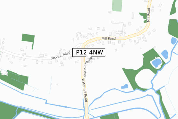
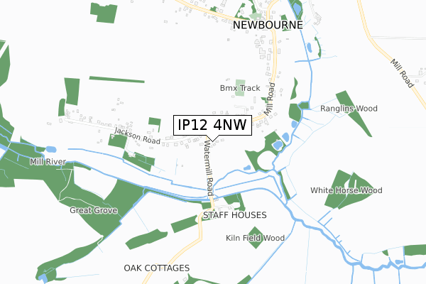
IP12 4NW is located in the Orwell & Villages electoral ward, within the local authority district of East Suffolk and the English Parliamentary constituency of Suffolk Coastal. The Sub Integrated Care Board (ICB) Location is NHS Suffolk and North East Essex ICB - 06L and the police force is Suffolk. This postcode has been in use since October 2018.


GetTheData
Source: OS Open Zoomstack (Ordnance Survey)
Licence: Open Government Licence (requires attribution)
Attribution: Contains OS data © Crown copyright and database right 2024
Source: Open Postcode Geo
Licence: Open Government Licence (requires attribution)
Attribution: Contains OS data © Crown copyright and database right 2024; Contains Royal Mail data © Royal Mail copyright and database right 2024; Source: Office for National Statistics licensed under the Open Government Licence v.3.0
| Easting | 627037 |
| Northing | 242342 |
| Latitude | 52.032995 |
| Longitude | 1.308539 |
GetTheData
Source: Open Postcode Geo
Licence: Open Government Licence
| Country | England |
| Postcode District | IP12 |
➜ See where IP12 is on a map ➜ Where is Newbourne? | |
GetTheData
Source: Land Registry Price Paid Data
Licence: Open Government Licence
| Ward | Orwell & Villages |
| Constituency | Suffolk Coastal |
GetTheData
Source: ONS Postcode Database
Licence: Open Government Licence
| Jacksons Road (Watermill Road) | Newbourne | 67m |
| Jacksons Road (Watermill Road) | Newbourne | 81m |
| Hall (Mill Road) | Newbourne | 624m |
| Hall (Mill Road) | Newbourne | 628m |
| Blackthorns (Ipswich Road) | Newbourne | 711m |
GetTheData
Source: NaPTAN
Licence: Open Government Licence
GetTheData
Source: ONS Postcode Database
Licence: Open Government Licence


➜ Get more ratings from the Food Standards Agency
GetTheData
Source: Food Standards Agency
Licence: FSA terms & conditions
| Last Collection | |||
|---|---|---|---|
| Location | Mon-Fri | Sat | Distance |
| Jacksons Corner | 15:45 | 09:00 | 84m |
| Ipswich Road | 16:15 | 09:00 | 718m |
| Hemley | 15:00 | 10:00 | 1,462m |
GetTheData
Source: Dracos
Licence: Creative Commons Attribution-ShareAlike
| Risk of IP12 4NW flooding from rivers and sea | Medium |
| ➜ IP12 4NW flood map | |
GetTheData
Source: Open Flood Risk by Postcode
Licence: Open Government Licence
The below table lists the International Territorial Level (ITL) codes (formerly Nomenclature of Territorial Units for Statistics (NUTS) codes) and Local Administrative Units (LAU) codes for IP12 4NW:
| ITL 1 Code | Name |
|---|---|
| TLH | East |
| ITL 2 Code | Name |
| TLH1 | East Anglia |
| ITL 3 Code | Name |
| TLH14 | Suffolk CC |
| LAU 1 Code | Name |
| E07000244 | East Suffolk |
GetTheData
Source: ONS Postcode Directory
Licence: Open Government Licence
The below table lists the Census Output Area (OA), Lower Layer Super Output Area (LSOA), and Middle Layer Super Output Area (MSOA) for IP12 4NW:
| Code | Name | |
|---|---|---|
| OA | E00153978 | |
| LSOA | E01030198 | Suffolk Coastal 010F |
| MSOA | E02006296 | Suffolk Coastal 010 |
GetTheData
Source: ONS Postcode Directory
Licence: Open Government Licence
| IP12 4NP | Mill Road | 445m |
| IP10 0BY | Newbourn Road | 451m |
| IP12 4NR | Jackson Road | 494m |
| IP12 4NU | Blackthorns | 691m |
| IP12 4NT | Ipswich Road | 721m |
| IP12 4NS | Ipswich Road | 793m |
| IP10 0BX | Newbourn Road | 816m |
| IP12 4NZ | Fenn Lane | 834m |
| IP12 4NY | The Street | 874m |
| IP10 0BU | Newbourn Road | 1105m |
GetTheData
Source: Open Postcode Geo; Land Registry Price Paid Data
Licence: Open Government Licence