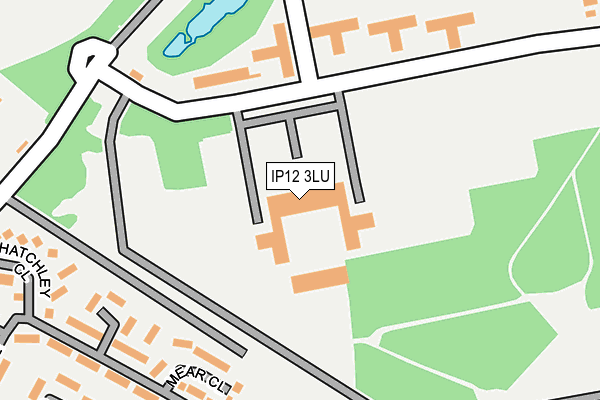
IP12 3LU is located in the Deben electoral ward, within the local authority district of East Suffolk and the English Parliamentary constituency of Suffolk Coastal. The Sub Integrated Care Board (ICB) Location is NHS Suffolk and North East Essex ICB - 06L and the police force is Suffolk. This postcode has been in use since May 2006.


GetTheData
Source: OS OpenMap – Local (Ordnance Survey)
Source: OS VectorMap District (Ordnance Survey)
Licence: Open Government Licence (requires attribution)
| Easting | 632648 |
| Northing | 248099 |
| Latitude | 52.082325 |
| Longitude | 1.394076 |
GetTheData
Source: Open Postcode Geo
Licence: Open Government Licence
| Country | England |
| Postcode District | IP12 |
➜ See where IP12 is on a map ➜ Where is Sutton Common? | |
GetTheData
Source: Land Registry Price Paid Data
Licence: Open Government Licence
Elevation or altitude of IP12 3LU as distance above sea level:
| Metres | Feet | |
|---|---|---|
| Elevation | 30m | 98ft |
Elevation is measured from the approximate centre of the postcode, to the nearest point on an OS contour line from OS Terrain 50, which has contour spacing of ten vertical metres.
➜ How high above sea level am I? Find the elevation of your current position using your device's GPS.
GetTheData
Source: Open Postcode Elevation
Licence: Open Government Licence
| Ward | Deben |
| Constituency | Suffolk Coastal |
GetTheData
Source: ONS Postcode Database
Licence: Open Government Licence
| Turning Point (Otley Road) | Sutton Heath Estate | 468m |
| Picnic Site (Woodbridge Road) | Hollesley | 1,329m |
| Picnic Site (Woodbridge Road) | Hollesley | 1,331m |
| Melton (Suffolk) Station | 4.6km |
GetTheData
Source: NaPTAN
Licence: Open Government Licence
GetTheData
Source: ONS Postcode Database
Licence: Open Government Licence


➜ Get more ratings from the Food Standards Agency
GetTheData
Source: Food Standards Agency
Licence: FSA terms & conditions
| Last Collection | |||
|---|---|---|---|
| Location | Mon-Fri | Sat | Distance |
| Raf Camp | 15:00 | 09:30 | 569m |
| Tangham Forest | 12:00 | 09:30 | 2,579m |
| Post Office 1 Ipswich Avenue | 16:45 | 09:30 | 2,786m |
GetTheData
Source: Dracos
Licence: Creative Commons Attribution-ShareAlike
The below table lists the International Territorial Level (ITL) codes (formerly Nomenclature of Territorial Units for Statistics (NUTS) codes) and Local Administrative Units (LAU) codes for IP12 3LU:
| ITL 1 Code | Name |
|---|---|
| TLH | East |
| ITL 2 Code | Name |
| TLH1 | East Anglia |
| ITL 3 Code | Name |
| TLH14 | Suffolk CC |
| LAU 1 Code | Name |
| E07000244 | East Suffolk |
GetTheData
Source: ONS Postcode Directory
Licence: Open Government Licence
The below table lists the Census Output Area (OA), Lower Layer Super Output Area (LSOA), and Middle Layer Super Output Area (MSOA) for IP12 3LU:
| Code | Name | |
|---|---|---|
| OA | E00173880 | |
| LSOA | E01033443 | Suffolk Coastal 007F |
| MSOA | E02006293 | Suffolk Coastal 007 |
GetTheData
Source: ONS Postcode Directory
Licence: Open Government Licence
| IP12 3TR | Greenways | 266m |
| IP12 3TT | Chequer Field | 347m |
| IP12 3TS | Firebrass Lane | 387m |
| IP12 3TP | Greenways | 454m |
| IP12 3TU | Thorn Walk | 476m |
| IP12 3TD | Easton Road | 702m |
| IP12 3TH | Yoxford Mews | 787m |
| IP12 3DT | 2545m | |
| IP12 2RY | 2572m | |
| IP12 2PR | Sandy Lane | 2615m |
GetTheData
Source: Open Postcode Geo; Land Registry Price Paid Data
Licence: Open Government Licence