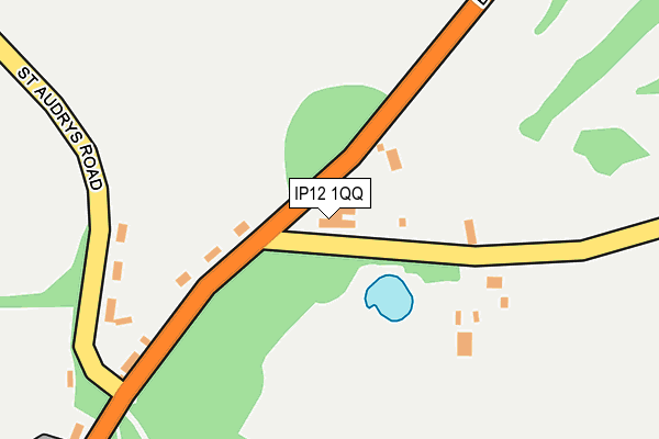
IP12 1QQ is located in the Melton electoral ward, within the local authority district of East Suffolk and the English Parliamentary constituency of Suffolk Coastal. The Sub Integrated Care Board (ICB) Location is NHS Suffolk and North East Essex ICB - 06L and the police force is Suffolk. This postcode has been in use since September 2005.


GetTheData
Source: OS OpenMap – Local (Ordnance Survey)
Source: OS VectorMap District (Ordnance Survey)
Licence: Open Government Licence (requires attribution)
| Easting | 628633 |
| Northing | 251158 |
| Latitude | 52.111452 |
| Longitude | 1.337636 |
GetTheData
Source: Open Postcode Geo
Licence: Open Government Licence
| Country | England |
| Postcode District | IP12 |
➜ See where IP12 is on a map ➜ Where is Melton? | |
GetTheData
Source: Land Registry Price Paid Data
Licence: Open Government Licence
Elevation or altitude of IP12 1QQ as distance above sea level:
| Metres | Feet | |
|---|---|---|
| Elevation | 20m | 66ft |
Elevation is measured from the approximate centre of the postcode, to the nearest point on an OS contour line from OS Terrain 50, which has contour spacing of ten vertical metres.
➜ How high above sea level am I? Find the elevation of your current position using your device's GPS.
GetTheData
Source: Open Postcode Elevation
Licence: Open Government Licence
| Ward | Melton |
| Constituency | Suffolk Coastal |
GetTheData
Source: ONS Postcode Database
Licence: Open Government Licence
| Tollgate Cottages (Yarmouth Road) | Melton | 236m |
| Tollgate Cottages (Yarmouth Road) | Melton | 237m |
| Turning Circle (St Andrews Place) | Melton | 437m |
| Melton Park (B1438) | Melton | 555m |
| Melton Park (B1438) | Melton | 579m |
| Melton (Suffolk) Station | 0.8km |
| Woodbridge Station | 2.7km |
| Wickham Market Station | 6.1km |
GetTheData
Source: NaPTAN
Licence: Open Government Licence
GetTheData
Source: ONS Postcode Database
Licence: Open Government Licence


➜ Get more ratings from the Food Standards Agency
GetTheData
Source: Food Standards Agency
Licence: FSA terms & conditions
| Last Collection | |||
|---|---|---|---|
| Location | Mon-Fri | Sat | Distance |
| St. Andrews Place | 16:45 | 09:00 | 631m |
| The Street | 17:30 | 09:00 | 676m |
| Railway Station | 17:00 | 10:00 | 781m |
GetTheData
Source: Dracos
Licence: Creative Commons Attribution-ShareAlike
The below table lists the International Territorial Level (ITL) codes (formerly Nomenclature of Territorial Units for Statistics (NUTS) codes) and Local Administrative Units (LAU) codes for IP12 1QQ:
| ITL 1 Code | Name |
|---|---|
| TLH | East |
| ITL 2 Code | Name |
| TLH1 | East Anglia |
| ITL 3 Code | Name |
| TLH14 | Suffolk CC |
| LAU 1 Code | Name |
| E07000244 | East Suffolk |
GetTheData
Source: ONS Postcode Directory
Licence: Open Government Licence
The below table lists the Census Output Area (OA), Lower Layer Super Output Area (LSOA), and Middle Layer Super Output Area (MSOA) for IP12 1QQ:
| Code | Name | |
|---|---|---|
| OA | E00153958 | |
| LSOA | E01030193 | Suffolk Coastal 005A |
| MSOA | E02006291 | Suffolk Coastal 005 |
GetTheData
Source: ONS Postcode Directory
Licence: Open Government Licence
| IP12 1QG | Yarmouth Road | 110m |
| IP12 1QP | St Audrys Lane | 203m |
| IP12 1QF | Yarmouth Road | 221m |
| IP12 1QJ | Upper Melton Terrace | 374m |
| IP12 1QR | South Close | 426m |
| IP12 1LU | 450m | |
| IP12 1QS | St Audrys | 474m |
| IP12 1QX | St Andrews Place | 506m |
| IP12 1PZ | St Andrews Place | 536m |
| IP12 1QE | Yarmouth Road | 558m |
GetTheData
Source: Open Postcode Geo; Land Registry Price Paid Data
Licence: Open Government Licence