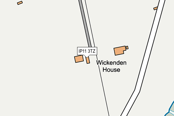
IP11 3TZ is located in the Western Felixstowe electoral ward, within the local authority district of East Suffolk and the English Parliamentary constituency of Suffolk Coastal. The Sub Integrated Care Board (ICB) Location is NHS Suffolk and North East Essex ICB - 06L and the police force is Suffolk. This postcode has been in use since December 1999.


GetTheData
Source: OS OpenMap – Local (Ordnance Survey)
Source: OS VectorMap District (Ordnance Survey)
Licence: Open Government Licence (requires attribution)
| Easting | 628576 |
| Northing | 232425 |
| Latitude | 51.943338 |
| Longitude | 1.324302 |
GetTheData
Source: Open Postcode Geo
Licence: Open Government Licence
| Country | England |
| Postcode District | IP11 |
➜ See where IP11 is on a map ➜ Where is Felixstowe? | |
GetTheData
Source: Land Registry Price Paid Data
Licence: Open Government Licence
Elevation or altitude of IP11 3TZ as distance above sea level:
| Metres | Feet | |
|---|---|---|
| Elevation | 10m | 33ft |
Elevation is measured from the approximate centre of the postcode, to the nearest point on an OS contour line from OS Terrain 50, which has contour spacing of ten vertical metres.
➜ How high above sea level am I? Find the elevation of your current position using your device's GPS.
GetTheData
Source: Open Postcode Elevation
Licence: Open Government Licence
| Ward | Western Felixstowe |
| Constituency | Suffolk Coastal |
GetTheData
Source: ONS Postcode Database
Licence: Open Government Licence
| Landguard Fort (Viewpoint Road) | Felixstowe Dock | 457m |
| Landguard Fort (Viewpoint Road) | Felixstowe Dock | 471m |
| Haven Caravan Park (Carr Road) | Felixstowe Dock | 645m |
| Haven Caravan Park (Carr Road) | Felixstowe Dock | 656m |
| Manor Road (Langer Road) | Felixstowe Dock | 769m |
| Harwich Town Station | 2.6km |
| Dovercourt Station | 3km |
| Felixstowe Station | 3.2km |
GetTheData
Source: NaPTAN
Licence: Open Government Licence
GetTheData
Source: ONS Postcode Database
Licence: Open Government Licence


➜ Get more ratings from the Food Standards Agency
GetTheData
Source: Food Standards Agency
Licence: FSA terms & conditions
| Last Collection | |||
|---|---|---|---|
| Location | Mon-Fri | Sat | Distance |
| Arwela Road | 17:30 | 12:00 | 1,682m |
| Church Street Post Office | 17:15 | 11:30 | 2,538m |
| Mayflower Avenue | 17:30 | 11:30 | 2,585m |
GetTheData
Source: Dracos
Licence: Creative Commons Attribution-ShareAlike
| Risk of IP11 3TZ flooding from rivers and sea | Low |
| ➜ IP11 3TZ flood map | |
GetTheData
Source: Open Flood Risk by Postcode
Licence: Open Government Licence
The below table lists the International Territorial Level (ITL) codes (formerly Nomenclature of Territorial Units for Statistics (NUTS) codes) and Local Administrative Units (LAU) codes for IP11 3TZ:
| ITL 1 Code | Name |
|---|---|
| TLH | East |
| ITL 2 Code | Name |
| TLH1 | East Anglia |
| ITL 3 Code | Name |
| TLH14 | Suffolk CC |
| LAU 1 Code | Name |
| E07000244 | East Suffolk |
GetTheData
Source: ONS Postcode Directory
Licence: Open Government Licence
The below table lists the Census Output Area (OA), Lower Layer Super Output Area (LSOA), and Middle Layer Super Output Area (MSOA) for IP11 3TZ:
| Code | Name | |
|---|---|---|
| OA | E00153798 | |
| LSOA | E01030163 | Suffolk Coastal 015B |
| MSOA | E02006301 | Suffolk Coastal 015 |
GetTheData
Source: ONS Postcode Directory
Licence: Open Government Licence
| IP11 2EL | Manor Terrace | 525m |
| IP11 3BQ | Schneider Close | 560m |
| IP11 3SS | Schneider Close | 565m |
| IP11 2GE | Manor Terrace | 740m |
| IP11 2EN | Manor Terrace | 773m |
| IP11 2GD | Manor Terrace | 831m |
| IP11 2EJ | Manor Road | 847m |
| IP11 2GJ | Marine Parade Walk | 904m |
| IP11 2GF | Old Fort Road | 910m |
| IP11 2JB | Summit Business Park | 952m |
GetTheData
Source: Open Postcode Geo; Land Registry Price Paid Data
Licence: Open Government Licence