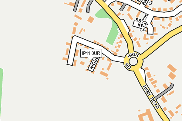
IP11 0UR is located in the Orwell & Villages electoral ward, within the local authority district of East Suffolk and the English Parliamentary constituency of Suffolk Coastal. The Sub Integrated Care Board (ICB) Location is NHS Suffolk and North East Essex ICB - 06L and the police force is Suffolk. This postcode has been in use since February 2017.


GetTheData
Source: OS OpenMap – Local (Ordnance Survey)
Source: OS VectorMap District (Ordnance Survey)
Licence: Open Government Licence (requires attribution)
| Easting | 627315 |
| Northing | 237357 |
| Latitude | 51.988137 |
| Longitude | 1.309280 |
GetTheData
Source: Open Postcode Geo
Licence: Open Government Licence
| Country | England |
| Postcode District | IP11 |
➜ See where IP11 is on a map ➜ Where is Trimley St Martin? | |
GetTheData
Source: Land Registry Price Paid Data
Licence: Open Government Licence
| Ward | Orwell & Villages |
| Constituency | Suffolk Coastal |
GetTheData
Source: ONS Postcode Database
Licence: Open Government Licence
| St Martins Green (High Road) | Trimley St Martin | 161m |
| St Martins Green (High Road) | Trimley St Martin | 199m |
| Bus Shelter (Howlett Way) | Trimley St Martin | 213m |
| Bus Shelter (Howlett Way) | Trimley St Martin | 227m |
| Reeve Lodge (High Road) | Trimley St Martin | 301m |
| Trimley Station | 1.5km |
| Felixstowe Station | 3.7km |
| Harwich Town Station | 5.1km |
GetTheData
Source: NaPTAN
Licence: Open Government Licence
| Percentage of properties with Next Generation Access | 100.0% |
| Percentage of properties with Superfast Broadband | 100.0% |
| Percentage of properties with Ultrafast Broadband | 0.0% |
| Percentage of properties with Full Fibre Broadband | 0.0% |
Superfast Broadband is between 30Mbps and 300Mbps
Ultrafast Broadband is > 300Mbps
| Median download speed | 100.0Mbps |
| Average download speed | 132.2Mbps |
| Maximum download speed | 350.00Mbps |
| Median upload speed | 15.0Mbps |
| Average upload speed | 15.0Mbps |
| Maximum upload speed | 20.00Mbps |
| Percentage of properties unable to receive 2Mbps | 0.0% |
| Percentage of properties unable to receive 5Mbps | 0.0% |
| Percentage of properties unable to receive 10Mbps | 0.0% |
| Percentage of properties unable to receive 30Mbps | 0.0% |
GetTheData
Source: Ofcom
Licence: Ofcom Terms of Use (requires attribution)
GetTheData
Source: ONS Postcode Database
Licence: Open Government Licence


➜ Get more ratings from the Food Standards Agency
GetTheData
Source: Food Standards Agency
Licence: FSA terms & conditions
| Last Collection | |||
|---|---|---|---|
| Location | Mon-Fri | Sat | Distance |
| 57 St. Martin's Green | 17:15 | 08:00 | 466m |
| Langstons, Faulkeners Way | 17:00 | 07:00 | 1,563m |
| Levington Marina | 17:00 | 11:30 | 2,098m |
GetTheData
Source: Dracos
Licence: Creative Commons Attribution-ShareAlike
The below table lists the International Territorial Level (ITL) codes (formerly Nomenclature of Territorial Units for Statistics (NUTS) codes) and Local Administrative Units (LAU) codes for IP11 0UR:
| ITL 1 Code | Name |
|---|---|
| TLH | East |
| ITL 2 Code | Name |
| TLH1 | East Anglia |
| ITL 3 Code | Name |
| TLH14 | Suffolk CC |
| LAU 1 Code | Name |
| E07000244 | East Suffolk |
GetTheData
Source: ONS Postcode Directory
Licence: Open Government Licence
The below table lists the Census Output Area (OA), Lower Layer Super Output Area (LSOA), and Middle Layer Super Output Area (MSOA) for IP11 0UR:
| Code | Name | |
|---|---|---|
| OA | E00154094 | |
| LSOA | E01030215 | Suffolk Coastal 012C |
| MSOA | E02006298 | Suffolk Coastal 012 |
GetTheData
Source: ONS Postcode Directory
Licence: Open Government Licence
| IP11 0RH | High Road | 157m |
| IP11 0RJ | High Road | 188m |
| IP11 0YF | Brick Kiln Close | 209m |
| IP11 0YE | St Martins Green | 212m |
| IP11 0YQ | Heath Court | 311m |
| IP11 0YD | St Martins Green | 312m |
| IP11 0YX | Blue Barn Close | 318m |
| IP11 0YU | Cavendish Gardens | 318m |
| IP11 0RG | High Road | 320m |
| IP11 0SJ | Gun Lane | 321m |
GetTheData
Source: Open Postcode Geo; Land Registry Price Paid Data
Licence: Open Government Licence