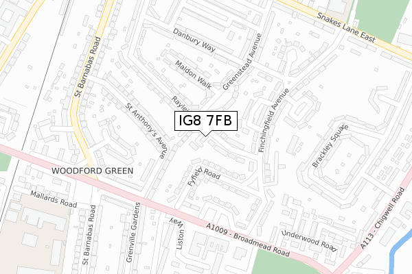
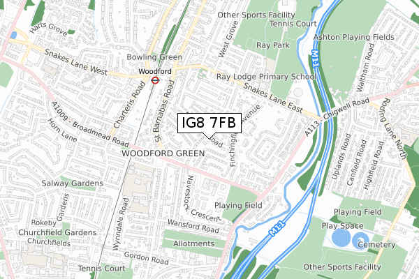
IG8 7FB is located in the Bridge electoral ward, within the London borough of Redbridge and the English Parliamentary constituency of Ilford North. The Sub Integrated Care Board (ICB) Location is NHS North East London ICB - A3A8R and the police force is Metropolitan Police. This postcode has been in use since January 2018.


GetTheData
Source: OS Open Zoomstack (Ordnance Survey)
Licence: Open Government Licence (requires attribution)
Attribution: Contains OS data © Crown copyright and database right 2025
Source: Open Postcode Geo
Licence: Open Government Licence (requires attribution)
Attribution: Contains OS data © Crown copyright and database right 2025; Contains Royal Mail data © Royal Mail copyright and database right 2025; Source: Office for National Statistics licensed under the Open Government Licence v.3.0
| Easting | 541288 |
| Northing | 191419 |
| Latitude | 51.603893 |
| Longitude | 0.038787 |
GetTheData
Source: Open Postcode Geo
Licence: Open Government Licence
| Country | England |
| Postcode District | IG8 |
➜ See where IG8 is on a map ➜ Where is Woodford? | |
GetTheData
Source: Land Registry Price Paid Data
Licence: Open Government Licence
| Ward | Bridge |
| Constituency | Ilford North |
GetTheData
Source: ONS Postcode Database
Licence: Open Government Licence
| Orchard Estate (Broadmead Road) | Woodford | 214m |
| Orchard Estate | Woodford | 245m |
| Spring Gardensst Barnabas Rd (St Barnabas Road) | Woodford | 291m |
| St. Anthony's Avenue (St Barnabas Road) | Woodford | 325m |
| Milkwell Gardens (St Barnabas Road) | Woodford | 335m |
| Woodford Underground Station | Woodford | 471m |
| Roding Valley Underground Station | Woodford | 1,518m |
| South Woodford Underground Station | South Woodford | 1,551m |
| Highams Park Station | 2.7km |
| Wood Street Station | 3.4km |
| Chingford Station | 3.8km |
GetTheData
Source: NaPTAN
Licence: Open Government Licence
| Percentage of properties with Next Generation Access | 100.0% |
| Percentage of properties with Superfast Broadband | 100.0% |
| Percentage of properties with Ultrafast Broadband | 0.0% |
| Percentage of properties with Full Fibre Broadband | 0.0% |
Superfast Broadband is between 30Mbps and 300Mbps
Ultrafast Broadband is > 300Mbps
| Median download speed | 13.9Mbps |
| Average download speed | 25.6Mbps |
| Maximum download speed | 53.51Mbps |
| Median upload speed | 1.2Mbps |
| Average upload speed | 3.8Mbps |
| Maximum upload speed | 8.02Mbps |
| Percentage of properties unable to receive 2Mbps | 0.0% |
| Percentage of properties unable to receive 5Mbps | 0.0% |
| Percentage of properties unable to receive 10Mbps | 0.0% |
| Percentage of properties unable to receive 30Mbps | 0.0% |
GetTheData
Source: Ofcom
Licence: Ofcom Terms of Use (requires attribution)
GetTheData
Source: ONS Postcode Database
Licence: Open Government Licence


➜ Get more ratings from the Food Standards Agency
GetTheData
Source: Food Standards Agency
Licence: FSA terms & conditions
| Last Collection | |||
|---|---|---|---|
| Location | Mon-Fri | Sat | Distance |
| Greenstead Avenue | 17:00 | 12:00 | 202m |
| Navestock Crescent | 17:30 | 12:00 | 282m |
| St Anthonys | 17:00 | 12:00 | 317m |
GetTheData
Source: Dracos
Licence: Creative Commons Attribution-ShareAlike
The below table lists the International Territorial Level (ITL) codes (formerly Nomenclature of Territorial Units for Statistics (NUTS) codes) and Local Administrative Units (LAU) codes for IG8 7FB:
| ITL 1 Code | Name |
|---|---|
| TLI | London |
| ITL 2 Code | Name |
| TLI5 | Outer London - East and North East |
| ITL 3 Code | Name |
| TLI53 | Redbridge and Waltham Forest |
| LAU 1 Code | Name |
| E09000026 | Redbridge |
GetTheData
Source: ONS Postcode Directory
Licence: Open Government Licence
The below table lists the Census Output Area (OA), Lower Layer Super Output Area (LSOA), and Middle Layer Super Output Area (MSOA) for IG8 7FB:
| Code | Name | |
|---|---|---|
| OA | E00018438 | |
| LSOA | E01003654 | Redbridge 004A |
| MSOA | E02000754 | Redbridge 004 |
GetTheData
Source: ONS Postcode Directory
Licence: Open Government Licence
| IG8 7ER | Greenstead Avenue | 43m |
| IG8 7HF | Rayleigh Road | 54m |
| IG8 7JU | Fyfield Road | 104m |
| IG8 7HE | Greenstead Avenue | 107m |
| IG8 7JY | Roxwell Way | 120m |
| IG8 7ES | Greenstead Avenue | 121m |
| IG8 7JX | Finchingfield Avenue | 133m |
| IG8 7EN | St Anthonys Avenue | 137m |
| IG8 7JZ | Finchingfield Avenue | 148m |
| IG8 7JR | Finchingfield Avenue | 153m |
GetTheData
Source: Open Postcode Geo; Land Registry Price Paid Data
Licence: Open Government Licence