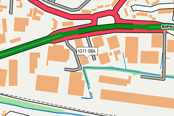
IG11 0BA is located in the Eastbury electoral ward, within the London borough of Barking and Dagenham and the English Parliamentary constituency of Barking. The Sub Integrated Care Board (ICB) Location is NHS North East London ICB - A3A8R and the police force is Metropolitan Police. This postcode has been in use since December 1999.


GetTheData
Source: OS OpenMap – Local (Ordnance Survey)
Source: OS VectorMap District (Ordnance Survey)
Licence: Open Government Licence (requires attribution)
| Easting | 546294 |
| Northing | 183590 |
| Latitude | 51.532270 |
| Longitude | 0.107765 |
GetTheData
Source: Open Postcode Geo
Licence: Open Government Licence
| Country | England |
| Postcode District | IG11 |
➜ See where IG11 is on a map ➜ Where is Barking? | |
GetTheData
Source: Land Registry Price Paid Data
Licence: Open Government Licence
Elevation or altitude of IG11 0BA as distance above sea level:
| Metres | Feet | |
|---|---|---|
| Elevation | 0m | 0ft |
Elevation is measured from the approximate centre of the postcode, to the nearest point on an OS contour line from OS Terrain 50, which has contour spacing of ten vertical metres.
➜ How high above sea level am I? Find the elevation of your current position using your device's GPS.
GetTheData
Source: Open Postcode Elevation
Licence: Open Government Licence
| Ward | Eastbury |
| Constituency | Barking |
GetTheData
Source: ONS Postcode Database
Licence: Open Government Licence
| Ripple Road Lodge Avenue | Creekmouth | 32m |
| Ripple Road Lodge Avenue | Creekmouth | 69m |
| Barking Industrial Park | Upney | 170m |
| Lodge Avenue (Rm9) | Creekmouth | 188m |
| Barking Industrial Park | Upney | 190m |
| Upney Underground Station | Upney | 804m |
| Becontree Underground Station | Dagenham | 1,610m |
| Barking Station | 2km |
| Dagenham Dock Station | 2.7km |
| Seven Kings Station | 3.6km |
GetTheData
Source: NaPTAN
Licence: Open Government Licence
GetTheData
Source: ONS Postcode Database
Licence: Open Government Licence


➜ Get more ratings from the Food Standards Agency
GetTheData
Source: Food Standards Agency
Licence: FSA terms & conditions
| Last Collection | |||
|---|---|---|---|
| Location | Mon-Fri | Sat | Distance |
| Thames View Post Office | 17:30 | 12:15 | 483m |
| Blake Avenue | 17:30 | 12:00 | 544m |
| Julia Gardens | 16:45 | 12:00 | 701m |
GetTheData
Source: Dracos
Licence: Creative Commons Attribution-ShareAlike
| Risk of IG11 0BA flooding from rivers and sea | Low |
| ➜ IG11 0BA flood map | |
GetTheData
Source: Open Flood Risk by Postcode
Licence: Open Government Licence
The below table lists the International Territorial Level (ITL) codes (formerly Nomenclature of Territorial Units for Statistics (NUTS) codes) and Local Administrative Units (LAU) codes for IG11 0BA:
| ITL 1 Code | Name |
|---|---|
| TLI | London |
| ITL 2 Code | Name |
| TLI5 | Outer London - East and North East |
| ITL 3 Code | Name |
| TLI52 | Barking & Dagenham and Havering |
| LAU 1 Code | Name |
| E09000002 | Barking and Dagenham |
GetTheData
Source: ONS Postcode Directory
Licence: Open Government Licence
The below table lists the Census Output Area (OA), Lower Layer Super Output Area (LSOA), and Middle Layer Super Output Area (MSOA) for IG11 0BA:
| Code | Name | |
|---|---|---|
| OA | E00000462 | |
| LSOA | E01000093 | Barking and Dagenham 022B |
| MSOA | E02000023 | Barking and Dagenham 022 |
GetTheData
Source: ONS Postcode Directory
Licence: Open Government Licence
| RM9 4QP | Ripple Road | 141m |
| RM9 4QL | Ripple Road | 226m |
| RM9 4QR | Lodge Avenue | 239m |
| RM9 4QJ | Lodge Avenue | 257m |
| IG11 0PG | Maybury Road | 298m |
| RM9 4XP | Moore Crescent | 298m |
| IG11 0RE | Wivenhoe Road | 304m |
| RM9 4XW | Castle Road | 322m |
| IG11 0RD | Stebbing Way | 330m |
| IG11 0PQ | Maybury Road | 336m |
GetTheData
Source: Open Postcode Geo; Land Registry Price Paid Data
Licence: Open Government Licence