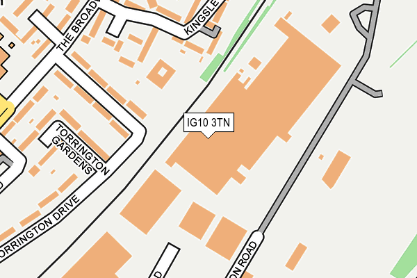
IG10 3TN is located in the Loughton Broadway electoral ward, within the local authority district of Epping Forest and the English Parliamentary constituency of Epping Forest. The Sub Integrated Care Board (ICB) Location is NHS Hertfordshire and West Essex ICB - 07H and the police force is Essex. This postcode has been in use since January 1980.


GetTheData
Source: OS OpenMap – Local (Ordnance Survey)
Source: OS VectorMap District (Ordnance Survey)
Licence: Open Government Licence (requires attribution)
| Easting | 544668 |
| Northing | 196449 |
| Latitude | 51.648231 |
| Longitude | 0.089608 |
GetTheData
Source: Open Postcode Geo
Licence: Open Government Licence
| Country | England |
| Postcode District | IG10 |
➜ See where IG10 is on a map ➜ Where is Loughton? | |
GetTheData
Source: Land Registry Price Paid Data
Licence: Open Government Licence
Elevation or altitude of IG10 3TN as distance above sea level:
| Metres | Feet | |
|---|---|---|
| Elevation | 30m | 98ft |
Elevation is measured from the approximate centre of the postcode, to the nearest point on an OS contour line from OS Terrain 50, which has contour spacing of ten vertical metres.
➜ How high above sea level am I? Find the elevation of your current position using your device's GPS.
GetTheData
Source: Open Postcode Elevation
Licence: Open Government Licence
| Ward | Loughton Broadway |
| Constituency | Epping Forest |
GetTheData
Source: ONS Postcode Database
Licence: Open Government Licence
| Vere Road (Willingale Road) | Debden | 320m |
| Burton Road | Debden | 328m |
| Burton Road (The Broadway) | Debden | 336m |
| Vere Road (Willingale Road) | Debden | 387m |
| Torrington Drive (Broadway The) | Debden | 513m |
| Debden Underground Station | Debden | 513m |
GetTheData
Source: NaPTAN
Licence: Open Government Licence
GetTheData
Source: ONS Postcode Database
Licence: Open Government Licence


➜ Get more ratings from the Food Standards Agency
GetTheData
Source: Food Standards Agency
Licence: FSA terms & conditions
| Last Collection | |||
|---|---|---|---|
| Location | Mon-Fri | Sat | Distance |
| Debden Broadway Post Office | 18:30 | 12:00 | 492m |
| Newmans Lane | 17:30 | 12:00 | 991m |
| Burney Drive | 17:15 | 12:00 | 1,081m |
GetTheData
Source: Dracos
Licence: Creative Commons Attribution-ShareAlike
The below table lists the International Territorial Level (ITL) codes (formerly Nomenclature of Territorial Units for Statistics (NUTS) codes) and Local Administrative Units (LAU) codes for IG10 3TN:
| ITL 1 Code | Name |
|---|---|
| TLH | East |
| ITL 2 Code | Name |
| TLH3 | Essex |
| ITL 3 Code | Name |
| TLH35 | West Essex |
| LAU 1 Code | Name |
| E07000072 | Epping Forest |
GetTheData
Source: ONS Postcode Directory
Licence: Open Government Licence
The below table lists the Census Output Area (OA), Lower Layer Super Output Area (LSOA), and Middle Layer Super Output Area (MSOA) for IG10 3TN:
| Code | Name | |
|---|---|---|
| OA | E00110619 | |
| LSOA | E01021776 | Epping Forest 011C |
| MSOA | E02004537 | Epping Forest 011 |
GetTheData
Source: ONS Postcode Directory
Licence: Open Government Licence
| IG10 3TD | Torrington Drive | 169m |
| IG10 3TT | Lytton Close | 172m |
| IG10 3TY | Kingsley Road | 194m |
| IG10 3TB | Torrington Gardens | 210m |
| IG10 3TU | Kingsley Road | 233m |
| IG10 3TX | Austen Close | 261m |
| IG10 3TF | The Broadway | 262m |
| IG10 3SS | The Broadway | 270m |
| IG10 3TE | The Broadway | 292m |
| IG10 2DQ | Rookwood Gardens | 332m |
GetTheData
Source: Open Postcode Geo; Land Registry Price Paid Data
Licence: Open Government Licence