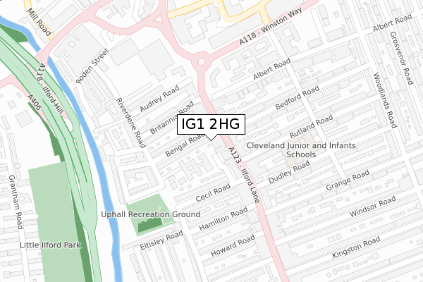
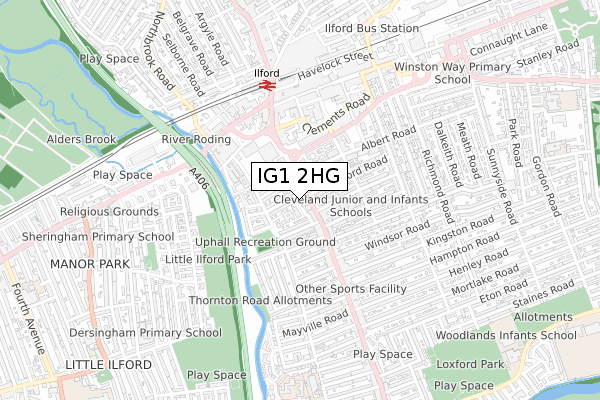
IG1 2HG is located in the Loxford electoral ward, within the London borough of Redbridge and the English Parliamentary constituency of Ilford South. The Sub Integrated Care Board (ICB) Location is NHS North East London ICB - A3A8R and the police force is Metropolitan Police. This postcode has been in use since April 2020.


GetTheData
Source: OS Open Zoomstack (Ordnance Survey)
Licence: Open Government Licence (requires attribution)
Attribution: Contains OS data © Crown copyright and database right 2024
Source: Open Postcode Geo
Licence: Open Government Licence (requires attribution)
Attribution: Contains OS data © Crown copyright and database right 2024; Contains Royal Mail data © Royal Mail copyright and database right 2024; Source: Office for National Statistics licensed under the Open Government Licence v.3.0
| Easting | 543720 |
| Northing | 186022 |
| Latitude | 51.554784 |
| Longitude | 0.071673 |
GetTheData
Source: Open Postcode Geo
Licence: Open Government Licence
| Country | England |
| Postcode District | IG1 |
➜ See where IG1 is on a map ➜ Where is Ilford? | |
GetTheData
Source: Land Registry Price Paid Data
Licence: Open Government Licence
| Ward | Loxford |
| Constituency | Ilford South |
GetTheData
Source: ONS Postcode Database
Licence: Open Government Licence
| Bengal Road | Ilford | 66m |
| Dudley Road Ilford | Ilford | 120m |
| Clementswood Baptist Church | Ilford | 219m |
| Pioneer Point | Ilford | 256m |
| Ilford Sainsbury's | Ilford | 269m |
| Ilford Station | 0.5km |
| Manor Park Station | 1.8km |
| Barking Station | 1.8km |
GetTheData
Source: NaPTAN
Licence: Open Government Licence
GetTheData
Source: ONS Postcode Database
Licence: Open Government Licence


➜ Get more ratings from the Food Standards Agency
GetTheData
Source: Food Standards Agency
Licence: FSA terms & conditions
| Last Collection | |||
|---|---|---|---|
| Location | Mon-Fri | Sat | Distance |
| Ilford Lane Post Office | 17:30 | 12:00 | 77m |
| Riverdene Road | 17:45 | 12:00 | 170m |
| High Road | 18:30 | 12:00 | 302m |
GetTheData
Source: Dracos
Licence: Creative Commons Attribution-ShareAlike
The below table lists the International Territorial Level (ITL) codes (formerly Nomenclature of Territorial Units for Statistics (NUTS) codes) and Local Administrative Units (LAU) codes for IG1 2HG:
| ITL 1 Code | Name |
|---|---|
| TLI | London |
| ITL 2 Code | Name |
| TLI5 | Outer London - East and North East |
| ITL 3 Code | Name |
| TLI53 | Redbridge and Waltham Forest |
| LAU 1 Code | Name |
| E09000026 | Redbridge |
GetTheData
Source: ONS Postcode Directory
Licence: Open Government Licence
The below table lists the Census Output Area (OA), Lower Layer Super Output Area (LSOA), and Middle Layer Super Output Area (MSOA) for IG1 2HG:
| Code | Name | |
|---|---|---|
| OA | E00018785 | |
| LSOA | E01003729 | Redbridge 032B |
| MSOA | E02000782 | Redbridge 032 |
GetTheData
Source: ONS Postcode Directory
Licence: Open Government Licence
| IG1 2LA | Ilford Lane | 12m |
| IG1 2JZ | Ilford Lane | 52m |
| IG1 2RJ | Ilford Lane | 66m |
| IG1 2RN | Ilford Lane | 66m |
| IG1 2LD | Ilford Lane | 74m |
| IG1 2EH | Bengal Road | 75m |
| IG1 2RP | Ilford Lane | 117m |
| IG1 2EW | Cecil Road | 119m |
| IG1 2JY | Ilford Lane | 120m |
| IG1 2EQ | Britannia Road | 123m |
GetTheData
Source: Open Postcode Geo; Land Registry Price Paid Data
Licence: Open Government Licence