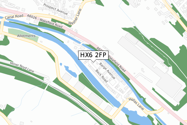
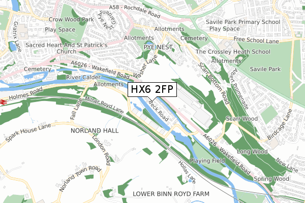
HX6 2FP is located in the Sowerby Bridge electoral ward, within the metropolitan district of Calderdale and the English Parliamentary constituency of Halifax. The Sub Integrated Care Board (ICB) Location is NHS West Yorkshire ICB - 02T and the police force is West Yorkshire. This postcode has been in use since December 2018.


GetTheData
Source: OS Open Zoomstack (Ordnance Survey)
Licence: Open Government Licence (requires attribution)
Attribution: Contains OS data © Crown copyright and database right 2025
Source: Open Postcode Geo
Licence: Open Government Licence (requires attribution)
Attribution: Contains OS data © Crown copyright and database right 2025; Contains Royal Mail data © Royal Mail copyright and database right 2025; Source: Office for National Statistics licensed under the Open Government Licence v.3.0
| Easting | 407493 |
| Northing | 423508 |
| Latitude | 53.707960 |
| Longitude | -1.887965 |
GetTheData
Source: Open Postcode Geo
Licence: Open Government Licence
| Country | England |
| Postcode District | HX6 |
➜ See where HX6 is on a map ➜ Where is Halifax? | |
GetTheData
Source: Land Registry Price Paid Data
Licence: Open Government Licence
| Ward | Sowerby Bridge |
| Constituency | Halifax |
GetTheData
Source: ONS Postcode Database
Licence: Open Government Licence
75, BARGE AVENUE, SOWERBY BRIDGE, HX6 2FP 2019 29 MAR £129,995 |
GetTheData
Source: HM Land Registry Price Paid Data
Licence: Contains HM Land Registry data © Crown copyright and database right 2025. This data is licensed under the Open Government Licence v3.0.
| Wakefield Road | Copley | 97m |
| Wakefield Road | Copley | 98m |
| Wakefield Road The Halifax Bank (Wakefield Road) | Savile Park | 158m |
| Wakefield Road The Halifax Bank (Wakefield Road) | Savile Park | 163m |
| Wakefield Rd Canal Road (Wakefield Road) | Sowerby Bridge | 362m |
| Sowerby Bridge Station | 1.3km |
| Halifax Station | 2.7km |
GetTheData
Source: NaPTAN
Licence: Open Government Licence
| Percentage of properties with Next Generation Access | 100.0% |
| Percentage of properties with Superfast Broadband | 100.0% |
| Percentage of properties with Ultrafast Broadband | 80.0% |
| Percentage of properties with Full Fibre Broadband | 0.0% |
Superfast Broadband is between 30Mbps and 300Mbps
Ultrafast Broadband is > 300Mbps
| Percentage of properties unable to receive 2Mbps | 0.0% |
| Percentage of properties unable to receive 5Mbps | 0.0% |
| Percentage of properties unable to receive 10Mbps | 0.0% |
| Percentage of properties unable to receive 30Mbps | 0.0% |
GetTheData
Source: Ofcom
Licence: Ofcom Terms of Use (requires attribution)
GetTheData
Source: ONS Postcode Database
Licence: Open Government Licence


➜ Get more ratings from the Food Standards Agency
GetTheData
Source: Food Standards Agency
Licence: FSA terms & conditions
| Last Collection | |||
|---|---|---|---|
| Location | Mon-Fri | Sat | Distance |
| Scarr Bottom Road | 17:15 | 11:45 | 543m |
| Scar Bottom P.o. Box | 17:30 | 11:45 | 591m |
| 2 Prospect Avenue | 17:30 | 11:45 | 663m |
GetTheData
Source: Dracos
Licence: Creative Commons Attribution-ShareAlike
The below table lists the International Territorial Level (ITL) codes (formerly Nomenclature of Territorial Units for Statistics (NUTS) codes) and Local Administrative Units (LAU) codes for HX6 2FP:
| ITL 1 Code | Name |
|---|---|
| TLE | Yorkshire and The Humber |
| ITL 2 Code | Name |
| TLE4 | West Yorkshire |
| ITL 3 Code | Name |
| TLE44 | Calderdale and Kirklees |
| LAU 1 Code | Name |
| E08000033 | Calderdale |
GetTheData
Source: ONS Postcode Directory
Licence: Open Government Licence
The below table lists the Census Output Area (OA), Lower Layer Super Output Area (LSOA), and Middle Layer Super Output Area (MSOA) for HX6 2FP:
| Code | Name | |
|---|---|---|
| OA | E00055331 | |
| LSOA | E01010977 | Calderdale 016D |
| MSOA | E02002259 | Calderdale 016 |
GetTheData
Source: ONS Postcode Directory
Licence: Open Government Licence
| HX6 2UX | Wakefield Road | 133m |
| HX2 7HR | Prospect Close | 348m |
| HX2 7DW | Washer Lane | 358m |
| HX2 7HP | Prospect Avenue | 381m |
| HX2 7HJ | Pye Nest Rise | 433m |
| HX2 7EW | Master Lane | 472m |
| HX2 7HH | Pye Nest Drive | 473m |
| HX2 7HN | Octagon Terrace | 478m |
| HX2 7AB | Master Lane | 484m |
| HX2 7DU | Undercliffe Terrace | 501m |
GetTheData
Source: Open Postcode Geo; Land Registry Price Paid Data
Licence: Open Government Licence