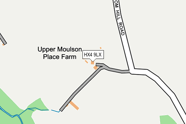
HX4 9LX is located in the Greetland and Stainland electoral ward, within the metropolitan district of Calderdale and the English Parliamentary constituency of Calder Valley. The Sub Integrated Care Board (ICB) Location is NHS West Yorkshire ICB - 02T and the police force is West Yorkshire. This postcode has been in use since February 2017.


GetTheData
Source: OS OpenMap – Local (Ordnance Survey)
Source: OS VectorMap District (Ordnance Survey)
Licence: Open Government Licence (requires attribution)
| Easting | 406805 |
| Northing | 417224 |
| Latitude | 53.651488 |
| Longitude | -1.898522 |
GetTheData
Source: Open Postcode Geo
Licence: Open Government Licence
| Country | England |
| Postcode District | HX4 |
➜ See where HX4 is on a map | |
GetTheData
Source: Land Registry Price Paid Data
Licence: Open Government Licence
| Ward | Greetland And Stainland |
| Constituency | Calder Valley |
GetTheData
Source: ONS Postcode Database
Licence: Open Government Licence
| New Hey Road Marsden Gate (New Hey Road) | Outlane | 595m |
| New Hey Road Marsden Gate (New Hey Road) | Outlane | 602m |
| Fieldhouse Farm (New Hey Road) | Outlane | 669m |
| Fieldhouse Farm (New Hey Road) | Outlane | 680m |
| New Hey Rd Round Ings Rd (New Hey Road) | Outlane | 800m |
| Slaithwaite Station | 3.3km |
GetTheData
Source: NaPTAN
Licence: Open Government Licence
| Percentage of properties with Next Generation Access | 100.0% |
| Percentage of properties with Superfast Broadband | 0.0% |
| Percentage of properties with Ultrafast Broadband | 0.0% |
| Percentage of properties with Full Fibre Broadband | 0.0% |
Superfast Broadband is between 30Mbps and 300Mbps
Ultrafast Broadband is > 300Mbps
| Percentage of properties unable to receive 2Mbps | 50.0% |
| Percentage of properties unable to receive 5Mbps | 50.0% |
| Percentage of properties unable to receive 10Mbps | 50.0% |
| Percentage of properties unable to receive 30Mbps | 100.0% |
GetTheData
Source: Ofcom
Licence: Ofcom Terms of Use (requires attribution)
GetTheData
Source: ONS Postcode Database
Licence: Open Government Licence


➜ Get more ratings from the Food Standards Agency
GetTheData
Source: Food Standards Agency
Licence: FSA terms & conditions
| Last Collection | |||
|---|---|---|---|
| Location | Mon-Fri | Sat | Distance |
| Krumlin House Barkisland | 17:15 | 08:00 | 1,684m |
| Sowood Green | 17:00 | 10:00 | 1,743m |
| Greenfield | 17:00 | 07:45 | 2,449m |
GetTheData
Source: Dracos
Licence: Creative Commons Attribution-ShareAlike
The below table lists the International Territorial Level (ITL) codes (formerly Nomenclature of Territorial Units for Statistics (NUTS) codes) and Local Administrative Units (LAU) codes for HX4 9LX:
| ITL 1 Code | Name |
|---|---|
| TLE | Yorkshire and The Humber |
| ITL 2 Code | Name |
| TLE4 | West Yorkshire |
| ITL 3 Code | Name |
| TLE44 | Calderdale and Kirklees |
| LAU 1 Code | Name |
| E08000033 | Calderdale |
GetTheData
Source: ONS Postcode Directory
Licence: Open Government Licence
The below table lists the Census Output Area (OA), Lower Layer Super Output Area (LSOA), and Middle Layer Super Output Area (MSOA) for HX4 9LX:
| Code | Name | |
|---|---|---|
| OA | E00054926 | |
| LSOA | E01010896 | Calderdale 026A |
| MSOA | E02002269 | Calderdale 026 |
GetTheData
Source: ONS Postcode Directory
Licence: Open Government Licence
| HX4 9LG | Dean House Lane | 507m |
| HD3 3FJ | New Hey Road | 664m |
| HX4 9LQ | Berrymill Lane | 713m |
| HX4 9LD | 748m | |
| HD3 3HG | Berry Mill Lane | 900m |
| HD3 3HP | Hey Lane | 904m |
| HD3 3FR | 927m | |
| HX4 9LF | 937m | |
| HD3 3FH | New Hey Road | 961m |
| HD3 3FN | More Pleasant | 1052m |
GetTheData
Source: Open Postcode Geo; Land Registry Price Paid Data
Licence: Open Government Licence