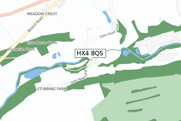
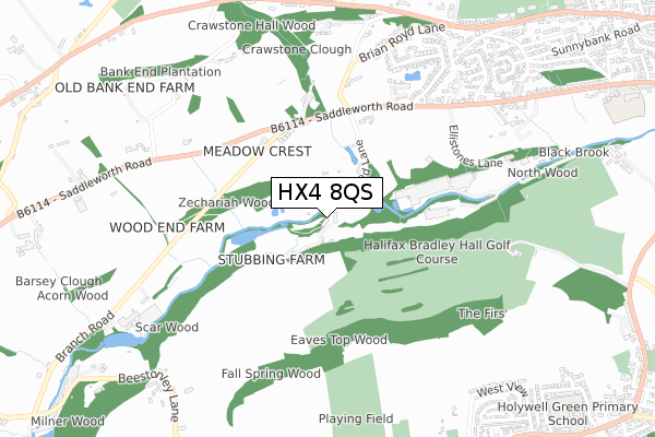
HX4 8QS is located in the Greetland and Stainland electoral ward, within the metropolitan district of Calderdale and the English Parliamentary constituency of Calder Valley. The Sub Integrated Care Board (ICB) Location is NHS West Yorkshire ICB - 02T and the police force is West Yorkshire. This postcode has been in use since January 2020.


GetTheData
Source: OS Open Zoomstack (Ordnance Survey)
Licence: Open Government Licence (requires attribution)
Attribution: Contains OS data © Crown copyright and database right 2025
Source: Open Postcode Geo
Licence: Open Government Licence (requires attribution)
Attribution: Contains OS data © Crown copyright and database right 2025; Contains Royal Mail data © Royal Mail copyright and database right 2025; Source: Office for National Statistics licensed under the Open Government Licence v.3.0
| Easting | 407668 |
| Northing | 420538 |
| Latitude | 53.681263 |
| Longitude | -1.885386 |
GetTheData
Source: Open Postcode Geo
Licence: Open Government Licence
| Country | England |
| Postcode District | HX4 |
➜ See where HX4 is on a map | |
GetTheData
Source: Land Registry Price Paid Data
Licence: Open Government Licence
| Ward | Greetland And Stainland |
| Constituency | Calder Valley |
GetTheData
Source: ONS Postcode Database
Licence: Open Government Licence
| Saddleworth Rd Branch Road (Saddleworth Road) | Greetland | 399m |
| Saddleworth Rd Branch Road (Saddleworth Road) | Greetland | 420m |
| Saddleworth Rd Scar Bottom Lane (Saddleworth Road) | Greetland | 424m |
| Saddleworth Rd Scar Bottom Lane (Saddleworth Road) | Greetland | 434m |
| Saddleworth Rd Trenance Gardens (Saddleworth Road) | Greetland | 529m |
| Sowerby Bridge Station | 3.3km |
| Halifax Station | 4.9km |
GetTheData
Source: NaPTAN
Licence: Open Government Licence
GetTheData
Source: ONS Postcode Database
Licence: Open Government Licence


➜ Get more ratings from the Food Standards Agency
GetTheData
Source: Food Standards Agency
Licence: FSA terms & conditions
| Last Collection | |||
|---|---|---|---|
| Location | Mon-Fri | Sat | Distance |
| The Branch Road Inn Scholes | 17:15 | 08:00 | 380m |
| Turbury Lane Greetland | 16:45 | 09:00 | 826m |
| Howcroft Head | 16:45 | 08:00 | 1,013m |
GetTheData
Source: Dracos
Licence: Creative Commons Attribution-ShareAlike
The below table lists the International Territorial Level (ITL) codes (formerly Nomenclature of Territorial Units for Statistics (NUTS) codes) and Local Administrative Units (LAU) codes for HX4 8QS:
| ITL 1 Code | Name |
|---|---|
| TLE | Yorkshire and The Humber |
| ITL 2 Code | Name |
| TLE4 | West Yorkshire |
| ITL 3 Code | Name |
| TLE44 | Calderdale and Kirklees |
| LAU 1 Code | Name |
| E08000033 | Calderdale |
GetTheData
Source: ONS Postcode Directory
Licence: Open Government Licence
The below table lists the Census Output Area (OA), Lower Layer Super Output Area (LSOA), and Middle Layer Super Output Area (MSOA) for HX4 8QS:
| Code | Name | |
|---|---|---|
| OA | E00054936 | |
| LSOA | E01010897 | Calderdale 026B |
| MSOA | E02002269 | Calderdale 026 |
GetTheData
Source: ONS Postcode Directory
Licence: Open Government Licence
| HX4 8NP | Gatehead | 37m |
| HX4 8NR | 265m | |
| HX4 8QR | Branch Road | 354m |
| HX4 8NT | Branch Road | 372m |
| HX4 8NS | Branch Road | 376m |
| HX4 8PB | Syke House Lane | 470m |
| HX4 8NW | Scar Bottom Lane | 539m |
| HX4 8NU | Saddleworth Road | 608m |
| HX4 0AA | Branch Road | 613m |
| HX4 8LW | Upper Ellistones Court | 665m |
GetTheData
Source: Open Postcode Geo; Land Registry Price Paid Data
Licence: Open Government Licence