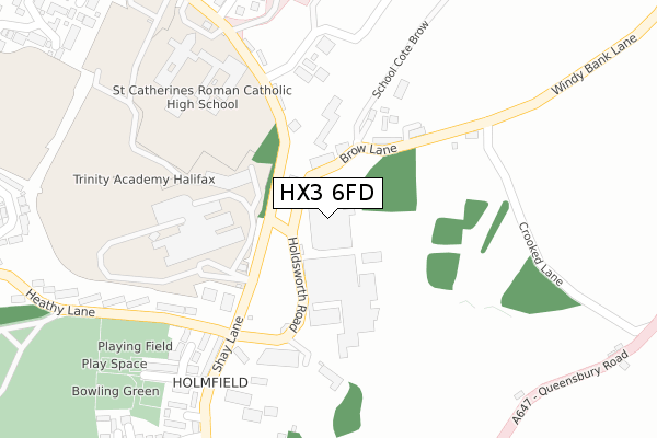
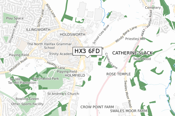
HX3 6FD is located in the Illingworth and Mixenden electoral ward, within the metropolitan district of Calderdale and the English Parliamentary constituency of Halifax. The Sub Integrated Care Board (ICB) Location is NHS West Yorkshire ICB - 02T and the police force is West Yorkshire. This postcode has been in use since July 2018.


GetTheData
Source: OS Open Zoomstack (Ordnance Survey)
Licence: Open Government Licence (requires attribution)
Attribution: Contains OS data © Crown copyright and database right 2025
Source: Open Postcode Geo
Licence: Open Government Licence (requires attribution)
Attribution: Contains OS data © Crown copyright and database right 2025; Contains Royal Mail data © Royal Mail copyright and database right 2025; Source: Office for National Statistics licensed under the Open Government Licence v.3.0
| Easting | 408459 |
| Northing | 428623 |
| Latitude | 53.753919 |
| Longitude | -1.873193 |
GetTheData
Source: Open Postcode Geo
Licence: Open Government Licence
| Country | England |
| Postcode District | HX3 |
➜ See where HX3 is on a map ➜ Where is Halifax? | |
GetTheData
Source: Land Registry Price Paid Data
Licence: Open Government Licence
| Ward | Illingworth And Mixenden |
| Constituency | Halifax |
GetTheData
Source: ONS Postcode Database
Licence: Open Government Licence
| Holdsworth Rd Brow Lane (Shay Lane) | Holmfield | 95m |
| Holdsworth Road (Shay Lane) | Holmfield | 104m |
| Holdsworth Road | Holmfield | 243m |
| Shay Lane Ivy House Ph (Shay Lane) | Holmfield | 259m |
| Shay Lane Heathy Ln (Shay Lane) | Holmfield | 276m |
| Halifax Station | 3.9km |
GetTheData
Source: NaPTAN
Licence: Open Government Licence
GetTheData
Source: ONS Postcode Database
Licence: Open Government Licence


➜ Get more ratings from the Food Standards Agency
GetTheData
Source: Food Standards Agency
Licence: FSA terms & conditions
| Last Collection | |||
|---|---|---|---|
| Location | Mon-Fri | Sat | Distance |
| 115 Haley Hill | 17:30 | 11:45 | 2,593m |
| King Cross P.o. Box | 17:30 | 12:00 | 3,052m |
| 2 Park Lane Queensbury | 17:45 | 12:00 | 3,062m |
GetTheData
Source: Dracos
Licence: Creative Commons Attribution-ShareAlike
The below table lists the International Territorial Level (ITL) codes (formerly Nomenclature of Territorial Units for Statistics (NUTS) codes) and Local Administrative Units (LAU) codes for HX3 6FD:
| ITL 1 Code | Name |
|---|---|
| TLE | Yorkshire and The Humber |
| ITL 2 Code | Name |
| TLE4 | West Yorkshire |
| ITL 3 Code | Name |
| TLE44 | Calderdale and Kirklees |
| LAU 1 Code | Name |
| E08000033 | Calderdale |
GetTheData
Source: ONS Postcode Directory
Licence: Open Government Licence
The below table lists the Census Output Area (OA), Lower Layer Super Output Area (LSOA), and Middle Layer Super Output Area (MSOA) for HX3 6FD:
| Code | Name | |
|---|---|---|
| OA | E00055004 | |
| LSOA | E01010915 | Calderdale 001D |
| MSOA | E02002244 | Calderdale 001 |
GetTheData
Source: ONS Postcode Directory
Licence: Open Government Licence
| HX3 6SN | Holdsworth Road | 147m |
| HX3 6SR | School Cote Brow | 153m |
| HX3 6SS | School Cote Terrace | 190m |
| HX2 9TH | Holdsworth Road | 258m |
| HX2 9UP | Heathy Avenue | 273m |
| HX2 9UW | South Cliffe | 282m |
| HX2 9BB | Shay Lane | 294m |
| HX2 9BE | Beechwood Avenue | 330m |
| HX2 9BD | Holmfield Gardens | 363m |
| HX2 9UN | Heathy Lane | 372m |
GetTheData
Source: Open Postcode Geo; Land Registry Price Paid Data
Licence: Open Government Licence