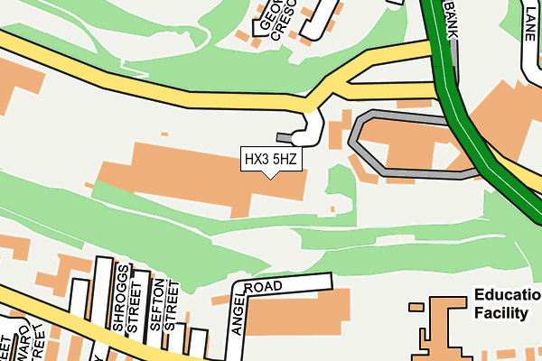
HX3 5HZ is located in the Ovenden electoral ward, within the metropolitan district of Calderdale and the English Parliamentary constituency of Halifax. The Sub Integrated Care Board (ICB) Location is NHS West Yorkshire ICB - 02T and the police force is West Yorkshire. This postcode has been in use since April 2009.


GetTheData
Source: OS OpenMap – Local (Ordnance Survey)
Source: OS VectorMap District (Ordnance Survey)
Licence: Open Government Licence (requires attribution)
| Easting | 408508 |
| Northing | 425823 |
| Latitude | 53.728752 |
| Longitude | -1.872526 |
GetTheData
Source: Open Postcode Geo
Licence: Open Government Licence
| Country | England |
| Postcode District | HX3 |
➜ See where HX3 is on a map ➜ Where is Halifax? | |
GetTheData
Source: Land Registry Price Paid Data
Licence: Open Government Licence
Elevation or altitude of HX3 5HZ as distance above sea level:
| Metres | Feet | |
|---|---|---|
| Elevation | 150m | 492ft |
Elevation is measured from the approximate centre of the postcode, to the nearest point on an OS contour line from OS Terrain 50, which has contour spacing of ten vertical metres.
➜ How high above sea level am I? Find the elevation of your current position using your device's GPS.
GetTheData
Source: Open Postcode Elevation
Licence: Open Government Licence
| Ward | Ovenden |
| Constituency | Halifax |
GetTheData
Source: ONS Postcode Database
Licence: Open Government Licence
| Shroggs Road Lee Bridge (Shroggs Road) | Lee Mount | 109m |
| Shroggs Road Lee Bridge (Shroggs Road) | Lee Mount | 110m |
| Lee Bridge Shroggs Rd (Lee Bridge) | Dean Clough | 171m |
| Lee Bridge Shroggs Rd (Lee Bridge) | Dean Clough | 179m |
| Pellon Lane Angel Rd (Pellon Lane) | Pellon | 218m |
| Halifax Station | 1.5km |
| Sowerby Bridge Station | 3.3km |
GetTheData
Source: NaPTAN
Licence: Open Government Licence
GetTheData
Source: ONS Postcode Database
Licence: Open Government Licence


➜ Get more ratings from the Food Standards Agency
GetTheData
Source: Food Standards Agency
Licence: FSA terms & conditions
| Last Collection | |||
|---|---|---|---|
| Location | Mon-Fri | Sat | Distance |
| King Cross P.o. Box | 17:30 | 12:00 | 331m |
| 115 Haley Hill | 17:30 | 11:45 | 616m |
| St James Road | 18:30 | 12:00 | 745m |
GetTheData
Source: Dracos
Licence: Creative Commons Attribution-ShareAlike
The below table lists the International Territorial Level (ITL) codes (formerly Nomenclature of Territorial Units for Statistics (NUTS) codes) and Local Administrative Units (LAU) codes for HX3 5HZ:
| ITL 1 Code | Name |
|---|---|
| TLE | Yorkshire and The Humber |
| ITL 2 Code | Name |
| TLE4 | West Yorkshire |
| ITL 3 Code | Name |
| TLE44 | Calderdale and Kirklees |
| LAU 1 Code | Name |
| E08000033 | Calderdale |
GetTheData
Source: ONS Postcode Directory
Licence: Open Government Licence
The below table lists the Census Output Area (OA), Lower Layer Super Output Area (LSOA), and Middle Layer Super Output Area (MSOA) for HX3 5HZ:
| Code | Name | |
|---|---|---|
| OA | E00055270 | |
| LSOA | E01010960 | Calderdale 012A |
| MSOA | E02002255 | Calderdale 012 |
GetTheData
Source: ONS Postcode Directory
Licence: Open Government Licence
| HX3 5AT | Lee Bridge | 155m |
| HX3 5LR | St Georges Crescent | 189m |
| HX1 5RE | Sefton Terrace | 198m |
| HX1 5RB | St Annes Place | 200m |
| HX1 5RF | Shroggs Vue Terrace | 209m |
| HX1 5RG | Birks Hall Terrace | 218m |
| HX3 5BU | St Georges Road | 226m |
| HX1 5RD | Pellon Lane | 240m |
| HX3 5BW | Fairview Terrace | 319m |
| HX1 5RY | Diamond Terrace | 330m |
GetTheData
Source: Open Postcode Geo; Land Registry Price Paid Data
Licence: Open Government Licence