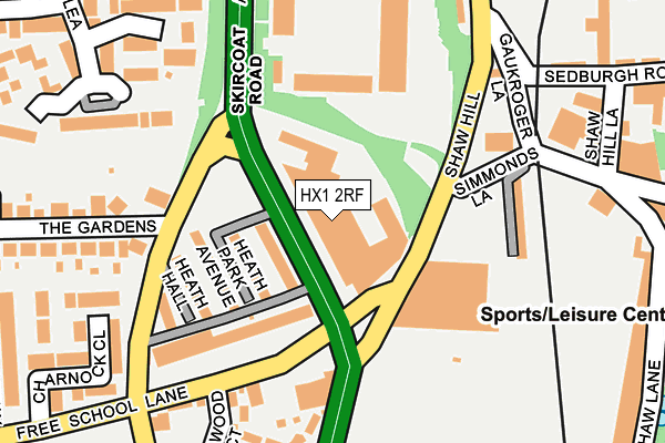
HX1 2RF is located in the Skircoat electoral ward, within the metropolitan district of Calderdale and the English Parliamentary constituency of Halifax. The Sub Integrated Care Board (ICB) Location is NHS West Yorkshire ICB - 02T and the police force is West Yorkshire. This postcode has been in use since January 1980.


GetTheData
Source: OS OpenMap – Local (Ordnance Survey)
Source: OS VectorMap District (Ordnance Survey)
Licence: Open Government Licence (requires attribution)
| Easting | 409393 |
| Northing | 424224 |
| Latitude | 53.714351 |
| Longitude | -1.859158 |
GetTheData
Source: Open Postcode Geo
Licence: Open Government Licence
| Country | England |
| Postcode District | HX1 |
➜ See where HX1 is on a map ➜ Where is Halifax? | |
GetTheData
Source: Land Registry Price Paid Data
Licence: Open Government Licence
Elevation or altitude of HX1 2RF as distance above sea level:
| Metres | Feet | |
|---|---|---|
| Elevation | 130m | 427ft |
Elevation is measured from the approximate centre of the postcode, to the nearest point on an OS contour line from OS Terrain 50, which has contour spacing of ten vertical metres.
➜ How high above sea level am I? Find the elevation of your current position using your device's GPS.
GetTheData
Source: Open Postcode Elevation
Licence: Open Government Licence
| Ward | Skircoat |
| Constituency | Halifax |
GetTheData
Source: ONS Postcode Database
Licence: Open Government Licence
| Skircoat Rd Free School Lane (Skircoat Road) | Skircoat | 32m |
| Skircoat Rd Free School Lane (Skircoat Road) | Skircoat | 57m |
| Skircoat Rd Heath Road (Skircoat Road) | Skircoat | 95m |
| Shaw Hill Simmonds Lane (Shaw Hill) | Halifax Town Centre | 124m |
| Heath Rd Skircoat Road (Heath Road) | Savile Park | 126m |
| Halifax Station | 0.8km |
| Sowerby Bridge Station | 3.2km |
GetTheData
Source: NaPTAN
Licence: Open Government Licence
GetTheData
Source: ONS Postcode Database
Licence: Open Government Licence

➜ Get more ratings from the Food Standards Agency
GetTheData
Source: Food Standards Agency
Licence: FSA terms & conditions
| Last Collection | |||
|---|---|---|---|
| Location | Mon-Fri | Sat | Distance |
| Hunger Hill | 18:30 | 12:00 | 380m |
| Infirmary | 17:30 | 12:00 | 550m |
| Coronation Road | 18:00 | 11:45 | 551m |
GetTheData
Source: Dracos
Licence: Creative Commons Attribution-ShareAlike
The below table lists the International Territorial Level (ITL) codes (formerly Nomenclature of Territorial Units for Statistics (NUTS) codes) and Local Administrative Units (LAU) codes for HX1 2RF:
| ITL 1 Code | Name |
|---|---|
| TLE | Yorkshire and The Humber |
| ITL 2 Code | Name |
| TLE4 | West Yorkshire |
| ITL 3 Code | Name |
| TLE44 | Calderdale and Kirklees |
| LAU 1 Code | Name |
| E08000033 | Calderdale |
GetTheData
Source: ONS Postcode Directory
Licence: Open Government Licence
The below table lists the Census Output Area (OA), Lower Layer Super Output Area (LSOA), and Middle Layer Super Output Area (MSOA) for HX1 2RF:
| Code | Name | |
|---|---|---|
| OA | E00055315 | |
| LSOA | E01010968 | Calderdale 021A |
| MSOA | E02002264 | Calderdale 021 |
GetTheData
Source: ONS Postcode Directory
Licence: Open Government Licence
| HX1 2RE | Skircoat Road | 60m |
| HX1 2PP | Heath Park Avenue | 116m |
| HX1 2PW | Heath Crescent | 139m |
| HX1 2PN | 141m | |
| HX1 2YZ | Holdsworth Terrace | 167m |
| HX1 2PR | Free School Lane | 202m |
| HX3 0AB | Elm Gardens | 210m |
| HX1 2PY | Hazelwood Court | 235m |
| HX1 2DA | Heath Lea | 247m |
| HX1 2NZ | Charnock Close | 267m |
GetTheData
Source: Open Postcode Geo; Land Registry Price Paid Data
Licence: Open Government Licence