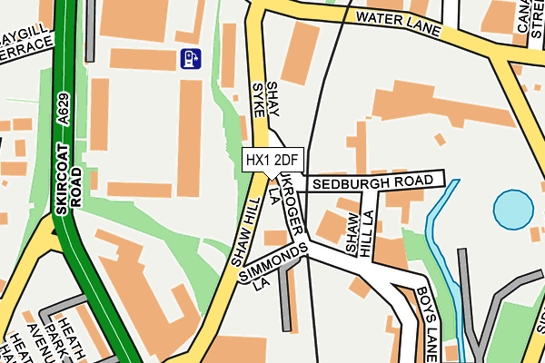
HX1 2DF is located in the Town electoral ward, within the metropolitan district of Calderdale and the English Parliamentary constituency of Halifax. The Sub Integrated Care Board (ICB) Location is NHS West Yorkshire ICB - 02T and the police force is West Yorkshire. This postcode has been in use since April 2010.


GetTheData
Source: OS OpenMap – Local (Ordnance Survey)
Source: OS VectorMap District (Ordnance Survey)
Licence: Open Government Licence (requires attribution)
| Easting | 409540 |
| Northing | 424358 |
| Latitude | 53.715552 |
| Longitude | -1.856927 |
GetTheData
Source: Open Postcode Geo
Licence: Open Government Licence
| Country | England |
| Postcode District | HX1 |
➜ See where HX1 is on a map ➜ Where is Halifax? | |
GetTheData
Source: Land Registry Price Paid Data
Licence: Open Government Licence
Elevation or altitude of HX1 2DF as distance above sea level:
| Metres | Feet | |
|---|---|---|
| Elevation | 110m | 361ft |
Elevation is measured from the approximate centre of the postcode, to the nearest point on an OS contour line from OS Terrain 50, which has contour spacing of ten vertical metres.
➜ How high above sea level am I? Find the elevation of your current position using your device's GPS.
GetTheData
Source: Open Postcode Elevation
Licence: Open Government Licence
| Ward | Town |
| Constituency | Halifax |
GetTheData
Source: ONS Postcode Database
Licence: Open Government Licence
| Shaw Hill Gaukroger Lane (Shaw Hill) | Halifax Town Centre | 45m |
| Shaw Hill Simmonds Lane (Shaw Hill) | Halifax Town Centre | 91m |
| Skircoat Rd Free School Lane (Skircoat Road) | Skircoat | 231m |
| South Parade Heath View Street (South Parade) | Halifax Town Centre | 234m |
| Union Street Heath View St (Union Street) | Halifax Town Centre | 242m |
| Halifax Station | 0.6km |
| Sowerby Bridge Station | 3.4km |
GetTheData
Source: NaPTAN
Licence: Open Government Licence
GetTheData
Source: ONS Postcode Database
Licence: Open Government Licence


➜ Get more ratings from the Food Standards Agency
GetTheData
Source: Food Standards Agency
Licence: FSA terms & conditions
| Last Collection | |||
|---|---|---|---|
| Location | Mon-Fri | Sat | Distance |
| Hunger Hill | 18:30 | 12:00 | 242m |
| 14 South Parade | 18:30 | 12:00 | 418m |
| Whitegate Road | 17:15 | 11:45 | 432m |
GetTheData
Source: Dracos
Licence: Creative Commons Attribution-ShareAlike
The below table lists the International Territorial Level (ITL) codes (formerly Nomenclature of Territorial Units for Statistics (NUTS) codes) and Local Administrative Units (LAU) codes for HX1 2DF:
| ITL 1 Code | Name |
|---|---|
| TLE | Yorkshire and The Humber |
| ITL 2 Code | Name |
| TLE4 | West Yorkshire |
| ITL 3 Code | Name |
| TLE44 | Calderdale and Kirklees |
| LAU 1 Code | Name |
| E08000033 | Calderdale |
GetTheData
Source: ONS Postcode Directory
Licence: Open Government Licence
The below table lists the Census Output Area (OA), Lower Layer Super Output Area (LSOA), and Middle Layer Super Output Area (MSOA) for HX1 2DF:
| Code | Name | |
|---|---|---|
| OA | E00055419 | |
| LSOA | E01010989 | Calderdale 018A |
| MSOA | E02002261 | Calderdale 018 |
GetTheData
Source: ONS Postcode Directory
Licence: Open Government Licence
| HX1 2YZ | Holdsworth Terrace | 134m |
| HX1 2JT | Hunger Hill | 235m |
| HX1 2JU | Heath View | 253m |
| HX3 9HG | Water Lane | 256m |
| HX1 2RE | Skircoat Road | 258m |
| HX1 2LY | South Parade | 259m |
| HX1 2LB | Union Street South | 282m |
| HX1 2JX | Hope Hall Terrace | 284m |
| HX3 9EZ | Paris Gates | 307m |
| HX3 9HR | Stoney Royd | 309m |
GetTheData
Source: Open Postcode Geo; Land Registry Price Paid Data
Licence: Open Government Licence