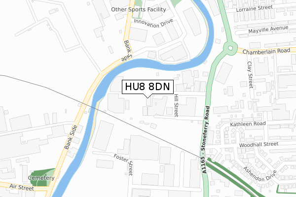
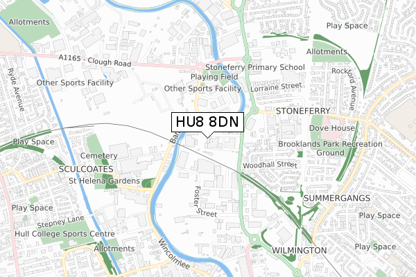
HU8 8DN is located in the Drypool electoral ward, within the unitary authority of Kingston upon Hull, City of and the English Parliamentary constituency of Kingston upon Hull East. The Sub Integrated Care Board (ICB) Location is NHS Humber and North Yorkshire ICB - 03F and the police force is Humberside. This postcode has been in use since January 2018.


GetTheData
Source: OS Open Zoomstack (Ordnance Survey)
Licence: Open Government Licence (requires attribution)
Attribution: Contains OS data © Crown copyright and database right 2025
Source: Open Postcode Geo
Licence: Open Government Licence (requires attribution)
Attribution: Contains OS data © Crown copyright and database right 2025; Contains Royal Mail data © Royal Mail copyright and database right 2025; Source: Office for National Statistics licensed under the Open Government Licence v.3.0
| Easting | 510108 |
| Northing | 430962 |
| Latitude | 53.763403 |
| Longitude | -0.331155 |
GetTheData
Source: Open Postcode Geo
Licence: Open Government Licence
| Country | England |
| Postcode District | HU8 |
➜ See where HU8 is on a map ➜ Where is Kingston upon Hull? | |
GetTheData
Source: Land Registry Price Paid Data
Licence: Open Government Licence
| Ward | Drypool |
| Constituency | Kingston Upon Hull East |
GetTheData
Source: ONS Postcode Database
Licence: Open Government Licence
| Maxwell Street (Stoneferry Road) | Stoneferry | 206m |
| Woodhall Street (Stoneferry Road) | Stoneferry | 227m |
| Chamberlain Road (Stoneferry Road) | Stoneferry | 246m |
| Lorraine Street (Stoneferry Road) | Stoneferry | 381m |
| Lorraine Street (Stoneferry Road) | Stoneferry | 398m |
| Hull Station | 2.3km |
GetTheData
Source: NaPTAN
Licence: Open Government Licence
GetTheData
Source: ONS Postcode Database
Licence: Open Government Licence

➜ Get more ratings from the Food Standards Agency
GetTheData
Source: Food Standards Agency
Licence: FSA terms & conditions
| Last Collection | |||
|---|---|---|---|
| Location | Mon-Fri | Sat | Distance |
| Stoneferry Road Hull | 16:30 | 10:30 | 237m |
| Ferry Lane Business Box | 463m | ||
| Air Street Hull | 17:45 | 12:00 | 593m |
GetTheData
Source: Dracos
Licence: Creative Commons Attribution-ShareAlike
| Risk of HU8 8DN flooding from rivers and sea | Low |
| ➜ HU8 8DN flood map | |
GetTheData
Source: Open Flood Risk by Postcode
Licence: Open Government Licence
The below table lists the International Territorial Level (ITL) codes (formerly Nomenclature of Territorial Units for Statistics (NUTS) codes) and Local Administrative Units (LAU) codes for HU8 8DN:
| ITL 1 Code | Name |
|---|---|
| TLE | Yorkshire and The Humber |
| ITL 2 Code | Name |
| TLE1 | East Yorkshire and Northern Lincolnshire |
| ITL 3 Code | Name |
| TLE11 | Kingston upon Hull, City of |
| LAU 1 Code | Name |
| E06000010 | Kingston upon Hull, City of |
GetTheData
Source: ONS Postcode Directory
Licence: Open Government Licence
The below table lists the Census Output Area (OA), Lower Layer Super Output Area (LSOA), and Middle Layer Super Output Area (MSOA) for HU8 8DN:
| Code | Name | |
|---|---|---|
| OA | E00064594 | |
| LSOA | E01012806 | Kingston upon Hull 016B |
| MSOA | E02002667 | Kingston upon Hull 016 |
GetTheData
Source: ONS Postcode Directory
Licence: Open Government Licence
| HU8 8DG | Stoneferry Road | 193m |
| HU5 1SG | Innovation Road | 207m |
| HU8 8DT | Easton Avenue | 309m |
| HU8 8DP | Kirkstead Avenue | 312m |
| HU8 8DR | Kirkstead Street | 312m |
| HU8 8EB | Kathleen Road | 319m |
| HU8 8BT | Foster Street | 404m |
| HU8 8DS | Woodhall Street | 411m |
| HU8 8DA | Stoneferry Road | 412m |
| HU8 8ES | Laburnum Grove | 418m |
GetTheData
Source: Open Postcode Geo; Land Registry Price Paid Data
Licence: Open Government Licence