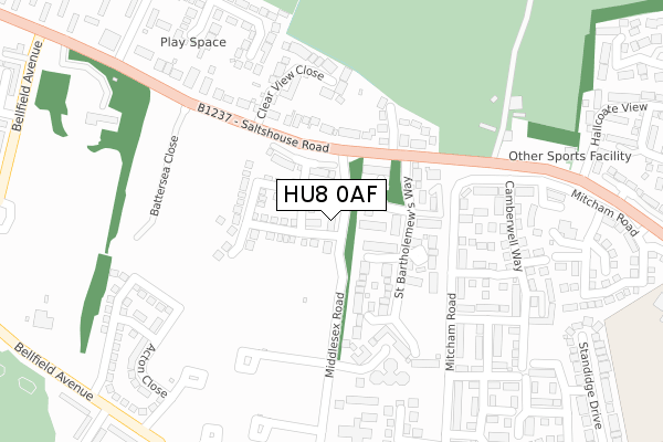
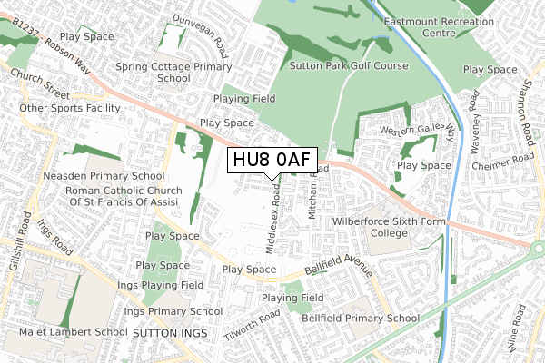
HU8 0AF is located in the Ings electoral ward, within the unitary authority of Kingston upon Hull, City of and the English Parliamentary constituency of Kingston upon Hull East. The Sub Integrated Care Board (ICB) Location is NHS Humber and North Yorkshire ICB - 03F and the police force is Humberside. This postcode has been in use since July 2018.


GetTheData
Source: OS Open Zoomstack (Ordnance Survey)
Licence: Open Government Licence (requires attribution)
Attribution: Contains OS data © Crown copyright and database right 2024
Source: Open Postcode Geo
Licence: Open Government Licence (requires attribution)
Attribution: Contains OS data © Crown copyright and database right 2024; Contains Royal Mail data © Royal Mail copyright and database right 2024; Source: Office for National Statistics licensed under the Open Government Licence v.3.0
| Easting | 512971 |
| Northing | 432441 |
| Latitude | 53.776078 |
| Longitude | -0.287204 |
GetTheData
Source: Open Postcode Geo
Licence: Open Government Licence
| Country | England |
| Postcode District | HU8 |
➜ See where HU8 is on a map ➜ Where is Kingston upon Hull? | |
GetTheData
Source: Land Registry Price Paid Data
Licence: Open Government Licence
| Ward | Ings |
| Constituency | Kingston Upon Hull East |
GetTheData
Source: ONS Postcode Database
Licence: Open Government Licence
63, MIDDLESEX ROAD, HULL, HU8 0AF 2018 7 DEC £224,995 |
61, MIDDLESEX ROAD, HULL, HU8 0AF 2018 18 OCT £224,995 |
➜ Kingston upon Hull house prices
GetTheData
Source: HM Land Registry Price Paid Data
Licence: Contains HM Land Registry data © Crown copyright and database right 2024. This data is licensed under the Open Government Licence v3.0.
| St Bartholomew's Way (Salthouse Road) | Sutton Ings | 120m |
| Clear View Close (Salthouse Road) | Sutton Ings | 207m |
| Salthouse Road (Camberwell Way) | Sutton Ings | 237m |
| Camberwell Close (Salthouse Road) | Sutton Ings | 278m |
| Battersea Close (Saltshouse Road) | Sutton Ings | 311m |
| Hull Station | 5.2km |
GetTheData
Source: NaPTAN
Licence: Open Government Licence
| Percentage of properties with Next Generation Access | 100.0% |
| Percentage of properties with Superfast Broadband | 100.0% |
| Percentage of properties with Ultrafast Broadband | 100.0% |
| Percentage of properties with Full Fibre Broadband | 100.0% |
Superfast Broadband is between 30Mbps and 300Mbps
Ultrafast Broadband is > 300Mbps
| Percentage of properties unable to receive 2Mbps | 0.0% |
| Percentage of properties unable to receive 5Mbps | 0.0% |
| Percentage of properties unable to receive 10Mbps | 0.0% |
| Percentage of properties unable to receive 30Mbps | 0.0% |
GetTheData
Source: Ofcom
Licence: Ofcom Terms of Use (requires attribution)
GetTheData
Source: ONS Postcode Database
Licence: Open Government Licence


➜ Get more ratings from the Food Standards Agency
GetTheData
Source: Food Standards Agency
Licence: FSA terms & conditions
| Last Collection | |||
|---|---|---|---|
| Location | Mon-Fri | Sat | Distance |
| Mitcham Road Hull | 17:15 | 11:30 | 325m |
| Balham Avenue Hull | 17:15 | 10:45 | 482m |
| Dalsetter Rise Post Office | 17:15 | 11:00 | 522m |
GetTheData
Source: Dracos
Licence: Creative Commons Attribution-ShareAlike
The below table lists the International Territorial Level (ITL) codes (formerly Nomenclature of Territorial Units for Statistics (NUTS) codes) and Local Administrative Units (LAU) codes for HU8 0AF:
| ITL 1 Code | Name |
|---|---|
| TLE | Yorkshire and The Humber |
| ITL 2 Code | Name |
| TLE1 | East Yorkshire and Northern Lincolnshire |
| ITL 3 Code | Name |
| TLE11 | Kingston upon Hull, City of |
| LAU 1 Code | Name |
| E06000010 | Kingston upon Hull, City of |
GetTheData
Source: ONS Postcode Directory
Licence: Open Government Licence
The below table lists the Census Output Area (OA), Lower Layer Super Output Area (LSOA), and Middle Layer Super Output Area (MSOA) for HU8 0AF:
| Code | Name | |
|---|---|---|
| OA | E00064692 | |
| LSOA | E01012823 | Kingston upon Hull 011B |
| MSOA | E02002662 | Kingston upon Hull 011 |
GetTheData
Source: ONS Postcode Directory
Licence: Open Government Licence
| HU8 0FE | Pinderfield Close | 68m |
| HU8 0FF | Alder Hey Drive | 86m |
| HU8 9HH | Saltshouse Road | 131m |
| HU8 0FD | St Bartholomews Way | 134m |
| HU8 9HG | Saltshouse Road | 157m |
| HU8 0FG | Guys Crescent | 163m |
| HU8 9HN | The Fairways | 184m |
| HU8 9GA | Clearview Close | 216m |
| HU8 0RS | Mitcham Road | 221m |
| HU8 0TA | Isleworth Close | 223m |
GetTheData
Source: Open Postcode Geo; Land Registry Price Paid Data
Licence: Open Government Licence