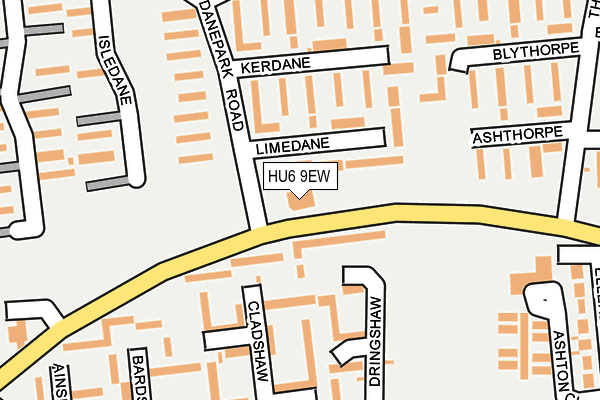
HU6 9EW is located in the Orchard Park electoral ward, within the unitary authority of Kingston upon Hull, City of and the English Parliamentary constituency of Kingston upon Hull North. The Sub Integrated Care Board (ICB) Location is NHS Humber and North Yorkshire ICB - 03F and the police force is Humberside. This postcode has been in use since April 2017.


GetTheData
Source: OS OpenMap – Local (Ordnance Survey)
Source: OS VectorMap District (Ordnance Survey)
Licence: Open Government Licence (requires attribution)
| Easting | 506702 |
| Northing | 433763 |
| Latitude | 53.789275 |
| Longitude | -0.381833 |
GetTheData
Source: Open Postcode Geo
Licence: Open Government Licence
| Country | England |
| Postcode District | HU6 |
➜ See where HU6 is on a map ➜ Where is Kingston upon Hull? | |
GetTheData
Source: Land Registry Price Paid Data
Licence: Open Government Licence
| Ward | Orchard Park |
| Constituency | Kingston Upon Hull North |
GetTheData
Source: ONS Postcode Database
Licence: Open Government Licence
| Hall Road | North Hull Estate | 73m |
| Hall Road | North Hull Estate | 154m |
| Cladshaw (Orchard Park Road) | North Hull Estate | 240m |
| Dringshaw (Orchard Park Road) | North Hull Estate | 261m |
| York Road (Orchard Park Road) | North Hull Estate | 277m |
| Cottingham Station | 1.8km |
| Hull Station | 5.6km |
GetTheData
Source: NaPTAN
Licence: Open Government Licence
GetTheData
Source: ONS Postcode Database
Licence: Open Government Licence


➜ Get more ratings from the Food Standards Agency
GetTheData
Source: Food Standards Agency
Licence: FSA terms & conditions
| Last Collection | |||
|---|---|---|---|
| Location | Mon-Fri | Sat | Distance |
| Orchard Park Post Office | 17:00 | 11:30 | 352m |
| Courtland Road Hull | 16:45 | 11:30 | 764m |
| York Road | 16:45 | 11:45 | 858m |
GetTheData
Source: Dracos
Licence: Creative Commons Attribution-ShareAlike
| Risk of HU6 9EW flooding from rivers and sea | Medium |
| ➜ HU6 9EW flood map | |
GetTheData
Source: Open Flood Risk by Postcode
Licence: Open Government Licence
The below table lists the International Territorial Level (ITL) codes (formerly Nomenclature of Territorial Units for Statistics (NUTS) codes) and Local Administrative Units (LAU) codes for HU6 9EW:
| ITL 1 Code | Name |
|---|---|
| TLE | Yorkshire and The Humber |
| ITL 2 Code | Name |
| TLE1 | East Yorkshire and Northern Lincolnshire |
| ITL 3 Code | Name |
| TLE11 | Kingston upon Hull, City of |
| LAU 1 Code | Name |
| E06000010 | Kingston upon Hull, City of |
GetTheData
Source: ONS Postcode Directory
Licence: Open Government Licence
The below table lists the Census Output Area (OA), Lower Layer Super Output Area (LSOA), and Middle Layer Super Output Area (MSOA) for HU6 9EW:
| Code | Name | |
|---|---|---|
| OA | E00064969 | |
| LSOA | E01012876 | Kingston upon Hull 003B |
| MSOA | E02002654 | Kingston upon Hull 003 |
GetTheData
Source: ONS Postcode Directory
Licence: Open Government Licence
| HU6 9EA | Limedane | 61m |
| HU6 9DA | Dringshaw | 120m |
| HU6 9EB | Kerdane | 129m |
| HU6 9DD | Cladshaw | 140m |
| HU6 9AF | Dane Park Road | 152m |
| HU6 9DB | Cladshaw | 170m |
| HU6 9ED | Jipdane | 192m |
| HU6 9DE | Bardshaw | 225m |
| HU6 9HH | Ashthorpe | 236m |
| HU6 9HG | Blythorpe | 237m |
GetTheData
Source: Open Postcode Geo; Land Registry Price Paid Data
Licence: Open Government Licence