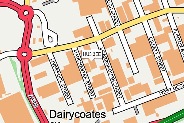
HU3 3EE is located in the St Andrew's & Docklands electoral ward, within the unitary authority of Kingston upon Hull, City of and the English Parliamentary constituency of Kingston upon Hull West and Hessle. The Sub Integrated Care Board (ICB) Location is NHS Humber and North Yorkshire ICB - 03F and the police force is Humberside. This postcode has been in use since February 1990.


GetTheData
Source: OS OpenMap – Local (Ordnance Survey)
Source: OS VectorMap District (Ordnance Survey)
Licence: Open Government Licence (requires attribution)
| Easting | 507428 |
| Northing | 427370 |
| Latitude | 53.731669 |
| Longitude | -0.373033 |
GetTheData
Source: Open Postcode Geo
Licence: Open Government Licence
| Country | England |
| Postcode District | HU3 |
➜ See where HU3 is on a map ➜ Where is Kingston upon Hull? | |
GetTheData
Source: Land Registry Price Paid Data
Licence: Open Government Licence
Elevation or altitude of HU3 3EE as distance above sea level:
| Metres | Feet | |
|---|---|---|
| Elevation | 10m | 33ft |
Elevation is measured from the approximate centre of the postcode, to the nearest point on an OS contour line from OS Terrain 50, which has contour spacing of ten vertical metres.
➜ How high above sea level am I? Find the elevation of your current position using your device's GPS.
GetTheData
Source: Open Postcode Elevation
Licence: Open Government Licence
| Ward | St Andrew's & Docklands |
| Constituency | Kingston Upon Hull West And Hessle |
GetTheData
Source: ONS Postcode Database
Licence: Open Government Licence
| Asda Hessle Road (Hessle Road) | St Andrews | 251m |
| Asda Hessle Road (Hessle Road) | St Andrews | 274m |
| Galliard Close (Hessle Road) | Dairycoates | 280m |
| Brighton Street (Hessle Road) | Gipsyville | 333m |
| Beecroft Court (St Georges Road) | St Andrews | 344m |
| Hull Station | 2.3km |
| New Holland Station | 3.4km |
| Barrow Haven Station | 4km |
GetTheData
Source: NaPTAN
Licence: Open Government Licence
GetTheData
Source: ONS Postcode Database
Licence: Open Government Licence


➜ Get more ratings from the Food Standards Agency
GetTheData
Source: Food Standards Agency
Licence: FSA terms & conditions
| Last Collection | |||
|---|---|---|---|
| Location | Mon-Fri | Sat | Distance |
| Galliard Close Hull | 17:00 | 12:30 | 274m |
| Goulton Street Hull | 17:30 | 12:30 | 463m |
| St Georges Road Hull | 17:30 | 12:30 | 626m |
GetTheData
Source: Dracos
Licence: Creative Commons Attribution-ShareAlike
| Risk of HU3 3EE flooding from rivers and sea | Low |
| ➜ HU3 3EE flood map | |
GetTheData
Source: Open Flood Risk by Postcode
Licence: Open Government Licence
The below table lists the International Territorial Level (ITL) codes (formerly Nomenclature of Territorial Units for Statistics (NUTS) codes) and Local Administrative Units (LAU) codes for HU3 3EE:
| ITL 1 Code | Name |
|---|---|
| TLE | Yorkshire and The Humber |
| ITL 2 Code | Name |
| TLE1 | East Yorkshire and Northern Lincolnshire |
| ITL 3 Code | Name |
| TLE11 | Kingston upon Hull, City of |
| LAU 1 Code | Name |
| E06000010 | Kingston upon Hull, City of |
GetTheData
Source: ONS Postcode Directory
Licence: Open Government Licence
The below table lists the Census Output Area (OA), Lower Layer Super Output Area (LSOA), and Middle Layer Super Output Area (MSOA) for HU3 3EE:
| Code | Name | |
|---|---|---|
| OA | E00065039 | |
| LSOA | E01012889 | Kingston upon Hull 030B |
| MSOA | E02002681 | Kingston upon Hull 030 |
GetTheData
Source: ONS Postcode Directory
Licence: Open Government Licence
| HU3 4JH | Havelock Street | 134m |
| HU3 4AE | Beacon Way | 210m |
| HU3 4JF | Gillett Street | 221m |
| HU3 4EH | Hessle Road | 276m |
| HU3 3LD | Hessle Road | 277m |
| HU3 4NA | Flinton Street | 281m |
| HU3 4UD | Hessle Road | 282m |
| HU3 3LB | Canopias Close | 288m |
| HU3 5BQ | Hessle Road | 316m |
| HU3 5AB | Borella Grove | 319m |
GetTheData
Source: Open Postcode Geo; Land Registry Price Paid Data
Licence: Open Government Licence