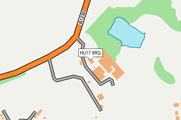
HU17 8RQ is located in the Minster and Woodmansey electoral ward, within the unitary authority of East Riding of Yorkshire and the English Parliamentary constituency of Beverley and Holderness. The Sub Integrated Care Board (ICB) Location is NHS Humber and North Yorkshire ICB - 02Y and the police force is Humberside. This postcode has been in use since January 1980.


GetTheData
Source: OS OpenMap – Local (Ordnance Survey)
Source: OS VectorMap District (Ordnance Survey)
Licence: Open Government Licence (requires attribution)
| Easting | 501997 |
| Northing | 438120 |
| Latitude | 53.829343 |
| Longitude | -0.451774 |
GetTheData
Source: Open Postcode Geo
Licence: Open Government Licence
| Country | England |
| Postcode District | HU17 |
➜ See where HU17 is on a map ➜ Where is Beverley? | |
GetTheData
Source: Land Registry Price Paid Data
Licence: Open Government Licence
Elevation or altitude of HU17 8RQ as distance above sea level:
| Metres | Feet | |
|---|---|---|
| Elevation | 40m | 131ft |
Elevation is measured from the approximate centre of the postcode, to the nearest point on an OS contour line from OS Terrain 50, which has contour spacing of ten vertical metres.
➜ How high above sea level am I? Find the elevation of your current position using your device's GPS.
GetTheData
Source: Open Postcode Elevation
Licence: Open Government Licence
| Ward | Minster And Woodmansey |
| Constituency | Beverley And Holderness |
GetTheData
Source: ONS Postcode Database
Licence: Open Government Licence
| Walkington Broadgate Est (Broadgate) | Beverley | 487m |
| Walkington Broadgate Est (Broadgate) | Beverley | 513m |
| Beverley Victoria Road (Victoria Road) | Beverley | 804m |
| Beverley Victoria Road (Victoria Road) | Beverley | 816m |
| Beverley Morrisons (Wingfield Way) | Beverley | 854m |
| Beverley Station | 2.4km |
GetTheData
Source: NaPTAN
Licence: Open Government Licence
GetTheData
Source: ONS Postcode Database
Licence: Open Government Licence


➜ Get more ratings from the Food Standards Agency
GetTheData
Source: Food Standards Agency
Licence: FSA terms & conditions
| Last Collection | |||
|---|---|---|---|
| Location | Mon-Fri | Sat | Distance |
| Normandy Avenue | 16:00 | 12:00 | 767m |
| Lincoln Way Post Office | 17:30 | 12:00 | 1,127m |
| Queensgate | 17:30 | 11:45 | 1,280m |
GetTheData
Source: Dracos
Licence: Creative Commons Attribution-ShareAlike
The below table lists the International Territorial Level (ITL) codes (formerly Nomenclature of Territorial Units for Statistics (NUTS) codes) and Local Administrative Units (LAU) codes for HU17 8RQ:
| ITL 1 Code | Name |
|---|---|
| TLE | Yorkshire and The Humber |
| ITL 2 Code | Name |
| TLE1 | East Yorkshire and Northern Lincolnshire |
| ITL 3 Code | Name |
| TLE12 | East Riding of Yorkshire |
| LAU 1 Code | Name |
| E06000011 | East Riding of Yorkshire |
GetTheData
Source: ONS Postcode Directory
Licence: Open Government Licence
The below table lists the Census Output Area (OA), Lower Layer Super Output Area (LSOA), and Middle Layer Super Output Area (MSOA) for HU17 8RQ:
| Code | Name | |
|---|---|---|
| OA | E00065783 | |
| LSOA | E01013044 | East Riding of Yorkshire 020F |
| MSOA | E02002703 | East Riding of Yorkshire 020 |
GetTheData
Source: ONS Postcode Directory
Licence: Open Government Licence
| HU17 8YH | The Haven | 349m |
| HU17 8RJ | Broadgate | 400m |
| HU17 8YA | Megson Way | 404m |
| HU17 8PF | Normandy Avenue | 426m |
| HU17 8XZ | Speedwell Lane | 428m |
| HU17 8PR | Normandy Avenue | 429m |
| HU17 8YG | Huzzard Close | 442m |
| HU17 8XX | George Lane | 456m |
| HU17 8XY | Ash Dene | 496m |
| HU17 8YF | Nightingale Close | 501m |
GetTheData
Source: Open Postcode Geo; Land Registry Price Paid Data
Licence: Open Government Licence