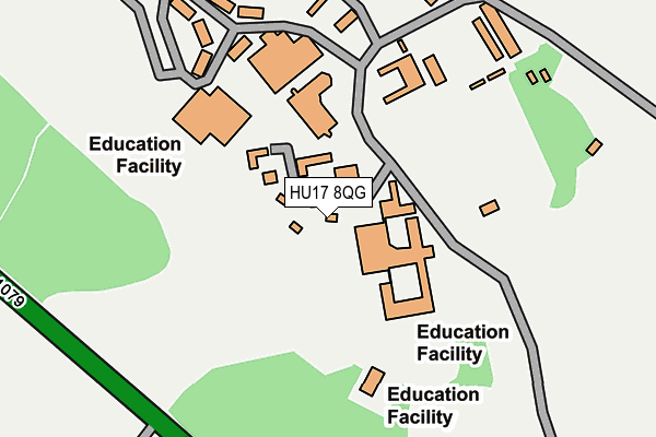
HU17 8QG is located in the Beverley Rural electoral ward, within the unitary authority of East Riding of Yorkshire and the English Parliamentary constituency of Beverley and Holderness. The Sub Integrated Care Board (ICB) Location is NHS Humber and North Yorkshire ICB - 02Y and the police force is Humberside. This postcode has been in use since January 1980.


GetTheData
Source: OS OpenMap – Local (Ordnance Survey)
Source: OS VectorMap District (Ordnance Survey)
Licence: Open Government Licence (requires attribution)
| Easting | 498513 |
| Northing | 440150 |
| Latitude | 53.848273 |
| Longitude | -0.504045 |
GetTheData
Source: Open Postcode Geo
Licence: Open Government Licence
| Country | England |
| Postcode District | HU17 |
➜ See where HU17 is on a map ➜ Where is Bishop Burton? | |
GetTheData
Source: Land Registry Price Paid Data
Licence: Open Government Licence
Elevation or altitude of HU17 8QG as distance above sea level:
| Metres | Feet | |
|---|---|---|
| Elevation | 50m | 164ft |
Elevation is measured from the approximate centre of the postcode, to the nearest point on an OS contour line from OS Terrain 50, which has contour spacing of ten vertical metres.
➜ How high above sea level am I? Find the elevation of your current position using your device's GPS.
GetTheData
Source: Open Postcode Elevation
Licence: Open Government Licence
| Ward | Beverley Rural |
| Constituency | Beverley And Holderness |
GetTheData
Source: ONS Postcode Database
Licence: Open Government Licence
| Bishop Burton York Road (York Road) | Bishop Burton | 473m |
| Bishop Burton York Road (York Road) | Bishop Burton | 505m |
| Bishop Burton College (York Road) | Bishop Burton | 654m |
GetTheData
Source: NaPTAN
Licence: Open Government Licence
GetTheData
Source: ONS Postcode Database
Licence: Open Government Licence


➜ Get more ratings from the Food Standards Agency
GetTheData
Source: Food Standards Agency
Licence: FSA terms & conditions
| Last Collection | |||
|---|---|---|---|
| Location | Mon-Fri | Sat | Distance |
| Woodhall Way Post Office | 17:15 | 11:15 | 4,373m |
| Beverley Delivery Office | 18:00 | 12:45 | 4,412m |
| Leconfield Post Office | 16:30 | 11:00 | 4,442m |
GetTheData
Source: Dracos
Licence: Creative Commons Attribution-ShareAlike
The below table lists the International Territorial Level (ITL) codes (formerly Nomenclature of Territorial Units for Statistics (NUTS) codes) and Local Administrative Units (LAU) codes for HU17 8QG:
| ITL 1 Code | Name |
|---|---|
| TLE | Yorkshire and The Humber |
| ITL 2 Code | Name |
| TLE1 | East Yorkshire and Northern Lincolnshire |
| ITL 3 Code | Name |
| TLE12 | East Riding of Yorkshire |
| LAU 1 Code | Name |
| E06000011 | East Riding of Yorkshire |
GetTheData
Source: ONS Postcode Directory
Licence: Open Government Licence
The below table lists the Census Output Area (OA), Lower Layer Super Output Area (LSOA), and Middle Layer Super Output Area (MSOA) for HU17 8QG:
| Code | Name | |
|---|---|---|
| OA | E00065168 | |
| LSOA | E01012919 | East Riding of Yorkshire 020A |
| MSOA | E02002703 | East Riding of Yorkshire 020 |
GetTheData
Source: ONS Postcode Directory
Licence: Open Government Licence
| HU17 8QF | York Road | 384m |
| HU17 8YE | Cottage Field | 429m |
| HU17 8QP | Finkle Street | 468m |
| HU17 8TT | Dale Gate | 554m |
| HU17 8QW | Bryan Mere | 554m |
| HU17 8QH | Pudding Gate | 568m |
| HU17 8QA | 576m | |
| HU17 8QD | School Green | 584m |
| HU17 8QS | Ratten Row | 603m |
| HU17 8QJ | Cold Harbour View | 609m |
GetTheData
Source: Open Postcode Geo; Land Registry Price Paid Data
Licence: Open Government Licence