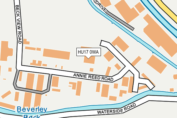
HU17 0WA is located in the Minster and Woodmansey electoral ward, within the unitary authority of East Riding of Yorkshire and the English Parliamentary constituency of Beverley and Holderness. The Sub Integrated Care Board (ICB) Location is NHS Humber and North Yorkshire ICB - 02Y and the police force is Humberside. This postcode has been in use since June 2000.


GetTheData
Source: OS OpenMap – Local (Ordnance Survey)
Source: OS VectorMap District (Ordnance Survey)
Licence: Open Government Licence (requires attribution)
| Easting | 505288 |
| Northing | 439463 |
| Latitude | 53.840754 |
| Longitude | -0.401333 |
GetTheData
Source: Open Postcode Geo
Licence: Open Government Licence
| Country | England |
| Postcode District | HU17 |
➜ See where HU17 is on a map ➜ Where is Beverley? | |
GetTheData
Source: Land Registry Price Paid Data
Licence: Open Government Licence
Elevation or altitude of HU17 0WA as distance above sea level:
| Metres | Feet | |
|---|---|---|
| Elevation | 10m | 33ft |
Elevation is measured from the approximate centre of the postcode, to the nearest point on an OS contour line from OS Terrain 50, which has contour spacing of ten vertical metres.
➜ How high above sea level am I? Find the elevation of your current position using your device's GPS.
GetTheData
Source: Open Postcode Elevation
Licence: Open Government Licence
| Ward | Minster And Woodmansey |
| Constituency | Beverley And Holderness |
GetTheData
Source: ONS Postcode Database
Licence: Open Government Licence
| Beverley Hull Road (Hull Road) | Beverley | 530m |
| Beverley Swinemoor Lane (Swinemoor Lane) | Beverley | 538m |
| Beverley Swinemoor Lane (Swinemoor Lane) | Beverley | 585m |
| Beverley Hull Road (Hull Road) | Beverley | 679m |
| Beverley Hull Road (Hull Road) | Beverley | 692m |
| Beverley Station | 1.4km |
| Arram Station | 5.1km |
GetTheData
Source: NaPTAN
Licence: Open Government Licence
GetTheData
Source: ONS Postcode Database
Licence: Open Government Licence


➜ Get more ratings from the Food Standards Agency
GetTheData
Source: Food Standards Agency
Licence: FSA terms & conditions
| Last Collection | |||
|---|---|---|---|
| Location | Mon-Fri | Sat | Distance |
| Beckview Road | 17:45 | 12:30 | 251m |
| Grovehill Road | 17:30 | 11:30 | 1,045m |
| Weel | 17:45 | 12:45 | 1,089m |
GetTheData
Source: Dracos
Licence: Creative Commons Attribution-ShareAlike
| Risk of HU17 0WA flooding from rivers and sea | Low |
| ➜ HU17 0WA flood map | |
GetTheData
Source: Open Flood Risk by Postcode
Licence: Open Government Licence
The below table lists the International Territorial Level (ITL) codes (formerly Nomenclature of Territorial Units for Statistics (NUTS) codes) and Local Administrative Units (LAU) codes for HU17 0WA:
| ITL 1 Code | Name |
|---|---|
| TLE | Yorkshire and The Humber |
| ITL 2 Code | Name |
| TLE1 | East Yorkshire and Northern Lincolnshire |
| ITL 3 Code | Name |
| TLE12 | East Riding of Yorkshire |
| LAU 1 Code | Name |
| E06000011 | East Riding of Yorkshire |
GetTheData
Source: ONS Postcode Directory
Licence: Open Government Licence
The below table lists the Census Output Area (OA), Lower Layer Super Output Area (LSOA), and Middle Layer Super Output Area (MSOA) for HU17 0WA:
| Code | Name | |
|---|---|---|
| OA | E00065803 | |
| LSOA | E01013037 | East Riding of Yorkshire 019B |
| MSOA | E02002702 | East Riding of Yorkshire 019 |
GetTheData
Source: ONS Postcode Directory
Licence: Open Government Licence
| HU17 0LF | Annie Reed Road | 39m |
| HU17 0HQ | Borwick Drive | 227m |
| HU17 0JT | Beck View Road | 242m |
| HU17 0JJ | Grovehill Road | 281m |
| HU17 0JG | Grovehill Road | 362m |
| HU17 0LQ | Meadley Court | 367m |
| HU17 0RY | Clare Court | 405m |
| HU17 0TY | Needham Close | 407m |
| HU17 0DD | West Street | 417m |
| HU17 0TZ | Akester Close | 451m |
GetTheData
Source: Open Postcode Geo; Land Registry Price Paid Data
Licence: Open Government Licence