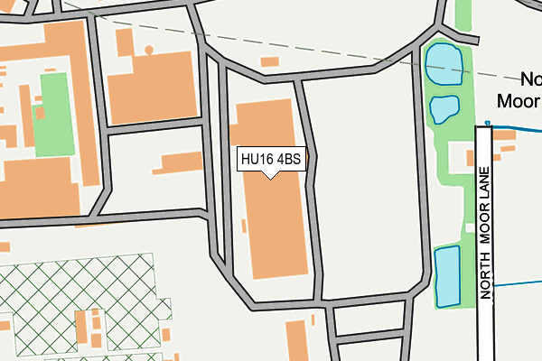
HU16 4BS is located in the Cottingham North electoral ward, within the unitary authority of East Riding of Yorkshire and the English Parliamentary constituency of Haltemprice and Howden. The Sub Integrated Care Board (ICB) Location is NHS Humber and North Yorkshire ICB - 02Y and the police force is Humberside. This postcode has been in use since July 2017.


GetTheData
Source: OS OpenMap – Local (Ordnance Survey)
Source: OS VectorMap District (Ordnance Survey)
Licence: Open Government Licence (requires attribution)
| Easting | 505326 |
| Northing | 434693 |
| Latitude | 53.797911 |
| Longitude | -0.402393 |
GetTheData
Source: Open Postcode Geo
Licence: Open Government Licence
| Country | England |
| Postcode District | HU16 |
➜ See where HU16 is on a map | |
GetTheData
Source: Land Registry Price Paid Data
Licence: Open Government Licence
| Ward | Cottingham North |
| Constituency | Haltemprice And Howden |
GetTheData
Source: ONS Postcode Database
Licence: Open Government Licence
| Cottingham Northgate (Northgate) | Cottingham | 1,468m |
| Cottingham Northgate (Northgate) | Cottingham | 1,479m |
| Riby Court (Hall Road) | North Hull Estate | 1,536m |
| The Rampant Horse Ph (Hall Road) | North Hull Estate | 1,550m |
| Cottingham Northgate (Northgate) | Cottingham | 1,594m |
| Cottingham Station | 1.8km |
| Beverley Station | 5.1km |
GetTheData
Source: NaPTAN
Licence: Open Government Licence
GetTheData
Source: ONS Postcode Database
Licence: Open Government Licence


➜ Get more ratings from the Food Standards Agency
GetTheData
Source: Food Standards Agency
Licence: FSA terms & conditions
| Last Collection | |||
|---|---|---|---|
| Location | Mon-Fri | Sat | Distance |
| New Village Road | 16:45 | 12:15 | 1,613m |
| Northgate | 17:00 | 12:15 | 1,673m |
| Park Lane | 16:15 | 11:00 | 1,767m |
GetTheData
Source: Dracos
Licence: Creative Commons Attribution-ShareAlike
| Risk of HU16 4BS flooding from rivers and sea | Medium |
| ➜ HU16 4BS flood map | |
GetTheData
Source: Open Flood Risk by Postcode
Licence: Open Government Licence
The below table lists the International Territorial Level (ITL) codes (formerly Nomenclature of Territorial Units for Statistics (NUTS) codes) and Local Administrative Units (LAU) codes for HU16 4BS:
| ITL 1 Code | Name |
|---|---|
| TLE | Yorkshire and The Humber |
| ITL 2 Code | Name |
| TLE1 | East Yorkshire and Northern Lincolnshire |
| ITL 3 Code | Name |
| TLE12 | East Riding of Yorkshire |
| LAU 1 Code | Name |
| E06000011 | East Riding of Yorkshire |
GetTheData
Source: ONS Postcode Directory
Licence: Open Government Licence
The below table lists the Census Output Area (OA), Lower Layer Super Output Area (LSOA), and Middle Layer Super Output Area (MSOA) for HU16 4BS:
| Code | Name | |
|---|---|---|
| OA | E00065366 | |
| LSOA | E01012953 | East Riding of Yorkshire 023A |
| MSOA | E02002706 | East Riding of Yorkshire 023 |
GetTheData
Source: ONS Postcode Directory
Licence: Open Government Licence
| HU16 4JW | North Moor Lane | 222m |
| HU16 4JT | Dunswell Road | 373m |
| HU16 4JS | Dunswell Road | 414m |
| HU16 4JN | North Moor Lane | 477m |
| HU16 4JR | Dunswell Road | 521m |
| HU16 4DQ | Swift Close | 645m |
| HU16 4AF | Holtby Avenue | 735m |
| HU16 4JP | Dunswell Lane | 753m |
| HU16 4BT | Holtby Avenue | 760m |
| HU16 4BY | Larkin Avenue | 772m |
GetTheData
Source: Open Postcode Geo; Land Registry Price Paid Data
Licence: Open Government Licence