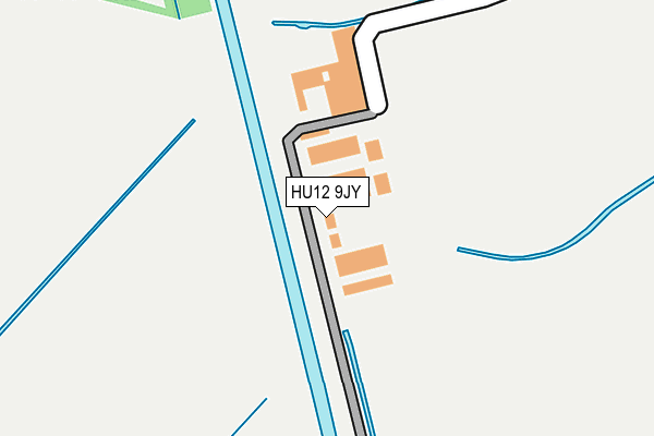
HU12 9JY lies on Saltaugh Sands Estate in Burstwick, Hull. HU12 9JY is located in the South West Holderness electoral ward, within the unitary authority of East Riding of Yorkshire and the English Parliamentary constituency of Beverley and Holderness. The Sub Integrated Care Board (ICB) Location is NHS Humber and North Yorkshire ICB - 02Y and the police force is Humberside. This postcode has been in use since January 1980.


GetTheData
Source: OS OpenMap – Local (Ordnance Survey)
Source: OS VectorMap District (Ordnance Survey)
Licence: Open Government Licence (requires attribution)
| Easting | 523449 |
| Northing | 420150 |
| Latitude | 53.663268 |
| Longitude | -0.133184 |
GetTheData
Source: Open Postcode Geo
Licence: Open Government Licence
| Street | Saltaugh Sands Estate |
| Locality | Burstwick |
| Town/City | Hull |
| Country | England |
| Postcode District | HU12 |
➜ See where HU12 is on a map | |
GetTheData
Source: Land Registry Price Paid Data
Licence: Open Government Licence
Elevation or altitude of HU12 9JY as distance above sea level:
| Metres | Feet | |
|---|---|---|
| Elevation | 0m | 0ft |
Elevation is measured from the approximate centre of the postcode, to the nearest point on an OS contour line from OS Terrain 50, which has contour spacing of ten vertical metres.
➜ How high above sea level am I? Find the elevation of your current position using your device's GPS.
GetTheData
Source: Open Postcode Elevation
Licence: Open Government Licence
| Ward | South West Holderness |
| Constituency | Beverley And Holderness |
GetTheData
Source: ONS Postcode Database
Licence: Open Government Licence
| Sunk Island (Stone Greek) | Sunk Island | 1,257m |
| Sunk Island (Stone Greek) | Sunk Island | 1,585m |
GetTheData
Source: NaPTAN
Licence: Open Government Licence
| Percentage of properties with Next Generation Access | 100.0% |
| Percentage of properties with Superfast Broadband | 0.0% |
| Percentage of properties with Ultrafast Broadband | 0.0% |
| Percentage of properties with Full Fibre Broadband | 0.0% |
Superfast Broadband is between 30Mbps and 300Mbps
Ultrafast Broadband is > 300Mbps
| Percentage of properties unable to receive 2Mbps | 100.0% |
| Percentage of properties unable to receive 5Mbps | 100.0% |
| Percentage of properties unable to receive 10Mbps | 100.0% |
| Percentage of properties unable to receive 30Mbps | 100.0% |
GetTheData
Source: Ofcom
Licence: Ofcom Terms of Use (requires attribution)
Estimated total energy consumption in HU12 9JY by fuel type, 2015.
| Consumption (kWh) | 48,221 |
|---|---|
| Meter count | 9 |
| Mean (kWh/meter) | 5,358 |
| Median (kWh/meter) | 3,873 |
GetTheData
Source: Postcode level gas estimates: 2015 (experimental)
Source: Postcode level electricity estimates: 2015 (experimental)
Licence: Open Government Licence
GetTheData
Source: ONS Postcode Database
Licence: Open Government Licence
| Last Collection | |||
|---|---|---|---|
| Location | Mon-Fri | Sat | Distance |
| Immingham Dock P.o. | 16:45 | 11:00 | 5,280m |
| Ottringham Post Office | 16:30 | 11:30 | 5,493m |
| Immingham Delivery Office | 17:30 | 12:00 | 6,377m |
GetTheData
Source: Dracos
Licence: Creative Commons Attribution-ShareAlike
| Risk of HU12 9JY flooding from rivers and sea | Low |
| ➜ HU12 9JY flood map | |
GetTheData
Source: Open Flood Risk by Postcode
Licence: Open Government Licence
The below table lists the International Territorial Level (ITL) codes (formerly Nomenclature of Territorial Units for Statistics (NUTS) codes) and Local Administrative Units (LAU) codes for HU12 9JY:
| ITL 1 Code | Name |
|---|---|
| TLE | Yorkshire and The Humber |
| ITL 2 Code | Name |
| TLE1 | East Yorkshire and Northern Lincolnshire |
| ITL 3 Code | Name |
| TLE12 | East Riding of Yorkshire |
| LAU 1 Code | Name |
| E06000011 | East Riding of Yorkshire |
GetTheData
Source: ONS Postcode Directory
Licence: Open Government Licence
The below table lists the Census Output Area (OA), Lower Layer Super Output Area (LSOA), and Middle Layer Super Output Area (MSOA) for HU12 9JY:
| Code | Name | |
|---|---|---|
| OA | E00066095 | |
| LSOA | E01013099 | East Riding of Yorkshire 033C |
| MSOA | E02002716 | East Riding of Yorkshire 033 |
GetTheData
Source: ONS Postcode Directory
Licence: Open Government Licence
| HU12 0AP | Stone Creek | 2157m |
| HU12 0AT | South Farm Road | 3315m |
| HU12 0ED | Village Road | 3327m |
| HU12 0DZ | Sunk Island Road | 3340m |
| HU12 9JU | Cherry Cob Sands Estate | 3557m |
| HU12 0EE | Old Hall Road | 4453m |
| HU12 0QN | Brick Road | 4804m |
| HU12 9SU | Marsh Lane | 4849m |
| HU12 0DX | Sunk Island Road | 4944m |
| HU12 9TX | The Leys | 5001m |
GetTheData
Source: Open Postcode Geo; Land Registry Price Paid Data
Licence: Open Government Licence