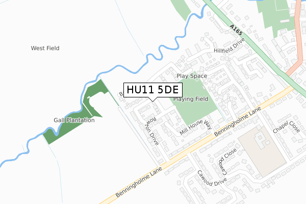
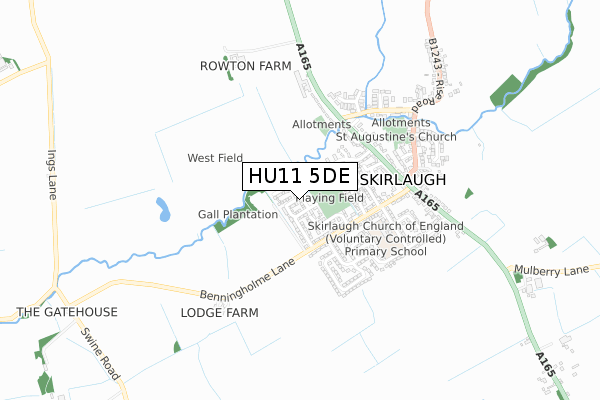
HU11 5DE is located in the Mid Holderness electoral ward, within the unitary authority of East Riding of Yorkshire and the English Parliamentary constituency of Beverley and Holderness. The Sub Integrated Care Board (ICB) Location is NHS Humber and North Yorkshire ICB - 02Y and the police force is Humberside. This postcode has been in use since November 2017.


GetTheData
Source: OS Open Zoomstack (Ordnance Survey)
Licence: Open Government Licence (requires attribution)
Attribution: Contains OS data © Crown copyright and database right 2024
Source: Open Postcode Geo
Licence: Open Government Licence (requires attribution)
Attribution: Contains OS data © Crown copyright and database right 2024; Contains Royal Mail data © Royal Mail copyright and database right 2024; Source: Office for National Statistics licensed under the Open Government Licence v.3.0
| Easting | 513738 |
| Northing | 439438 |
| Latitude | 53.838770 |
| Longitude | -0.272991 |
GetTheData
Source: Open Postcode Geo
Licence: Open Government Licence
| Country | England |
| Postcode District | HU11 |
➜ See where HU11 is on a map | |
GetTheData
Source: Land Registry Price Paid Data
Licence: Open Government Licence
| Ward | Mid Holderness |
| Constituency | Beverley And Holderness |
GetTheData
Source: ONS Postcode Database
Licence: Open Government Licence
| Skirlaugh Main Road (Main Road) | Skirlaugh | 354m |
| Skirlaugh Main Road (Main Road) | Skirlaugh | 369m |
| Skirlaugh Main Road (Main Road) | Skirlaugh | 392m |
| Skirlaugh Main Road (Main Road) | Skirlaugh | 397m |
| Skirlaugh Main Road (Main Road) | Skirlaugh | 420m |
GetTheData
Source: NaPTAN
Licence: Open Government Licence
| Percentage of properties with Next Generation Access | 100.0% |
| Percentage of properties with Superfast Broadband | 100.0% |
| Percentage of properties with Ultrafast Broadband | 0.0% |
| Percentage of properties with Full Fibre Broadband | 0.0% |
Superfast Broadband is between 30Mbps and 300Mbps
Ultrafast Broadband is > 300Mbps
| Median download speed | 43.9Mbps |
| Average download speed | 44.3Mbps |
| Maximum download speed | 55.10Mbps |
| Median upload speed | 10.0Mbps |
| Average upload speed | 8.9Mbps |
| Maximum upload speed | 12.78Mbps |
| Percentage of properties unable to receive 2Mbps | 0.0% |
| Percentage of properties unable to receive 5Mbps | 0.0% |
| Percentage of properties unable to receive 10Mbps | 0.0% |
| Percentage of properties unable to receive 30Mbps | 0.0% |
GetTheData
Source: Ofcom
Licence: Ofcom Terms of Use (requires attribution)
GetTheData
Source: ONS Postcode Database
Licence: Open Government Licence


➜ Get more ratings from the Food Standards Agency
GetTheData
Source: Food Standards Agency
Licence: FSA terms & conditions
| Last Collection | |||
|---|---|---|---|
| Location | Mon-Fri | Sat | Distance |
| Skirlaugh Post Office | 16:30 | 10:30 | 461m |
| Arnold | 16:30 | 10:30 | 2,246m |
| Long Riston Post Office | 16:30 | 10:45 | 2,927m |
GetTheData
Source: Dracos
Licence: Creative Commons Attribution-ShareAlike
The below table lists the International Territorial Level (ITL) codes (formerly Nomenclature of Territorial Units for Statistics (NUTS) codes) and Local Administrative Units (LAU) codes for HU11 5DE:
| ITL 1 Code | Name |
|---|---|
| TLE | Yorkshire and The Humber |
| ITL 2 Code | Name |
| TLE1 | East Yorkshire and Northern Lincolnshire |
| ITL 3 Code | Name |
| TLE12 | East Riding of Yorkshire |
| LAU 1 Code | Name |
| E06000011 | East Riding of Yorkshire |
GetTheData
Source: ONS Postcode Directory
Licence: Open Government Licence
The below table lists the Census Output Area (OA), Lower Layer Super Output Area (LSOA), and Middle Layer Super Output Area (MSOA) for HU11 5DE:
| Code | Name | |
|---|---|---|
| OA | E00065753 | |
| LSOA | E01013035 | East Riding of Yorkshire 021E |
| MSOA | E02002704 | East Riding of Yorkshire 021 |
GetTheData
Source: ONS Postcode Directory
Licence: Open Government Licence
| HU11 5DZ | Rowton Drive | 99m |
| HU11 5DY | Mill House Way | 126m |
| HU11 5DX | Old Forge Way | 251m |
| HU11 5EA | Benningholme Lane | 260m |
| HU11 5EQ | Orchard Way | 264m |
| HU11 5ES | Cawood Drive | 295m |
| HU11 5EP | Cawood Close | 309m |
| HU11 5DS | Lambwath Villas | 335m |
| HU11 5DR | Langdale Villas | 338m |
| HU11 5DW | Cawood Crescent | 359m |
GetTheData
Source: Open Postcode Geo; Land Registry Price Paid Data
Licence: Open Government Licence