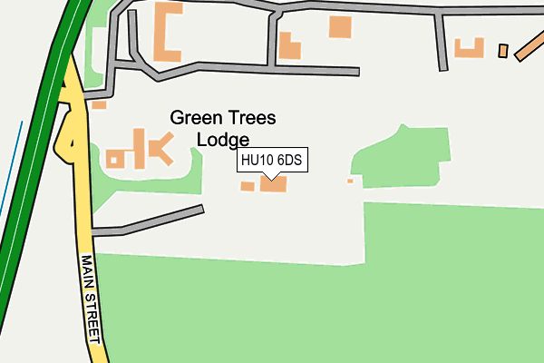
HU10 6DS is located in the Cottingham South electoral ward, within the unitary authority of East Riding of Yorkshire and the English Parliamentary constituency of Haltemprice and Howden. The Sub Integrated Care Board (ICB) Location is NHS Humber and North Yorkshire ICB - 02Y and the police force is Humberside. This postcode has been in use since September 1991.


GetTheData
Source: OS OpenMap – Local (Ordnance Survey)
Source: OS VectorMap District (Ordnance Survey)
Licence: Open Government Licence (requires attribution)
| Easting | 502417 |
| Northing | 431495 |
| Latitude | 53.769738 |
| Longitude | -0.447595 |
GetTheData
Source: Open Postcode Geo
Licence: Open Government Licence
| Country | England |
| Postcode District | HU10 |
➜ See where HU10 is on a map | |
GetTheData
Source: Land Registry Price Paid Data
Licence: Open Government Licence
Elevation or altitude of HU10 6DS as distance above sea level:
| Metres | Feet | |
|---|---|---|
| Elevation | 40m | 131ft |
Elevation is measured from the approximate centre of the postcode, to the nearest point on an OS contour line from OS Terrain 50, which has contour spacing of ten vertical metres.
➜ How high above sea level am I? Find the elevation of your current position using your device's GPS.
GetTheData
Source: Open Postcode Elevation
Licence: Open Government Licence
| Ward | Cottingham South |
| Constituency | Haltemprice And Howden |
GetTheData
Source: ONS Postcode Database
Licence: Open Government Licence
| Willerby Business Park (Willerby Hill) | Willerby | 186m |
| Cottingham Castle Road (Castle Road) | Cottingham | 702m |
| Cottingham Castle Road (Castle Road) | Cottingham | 733m |
| Castle Hill Hospital (Castle Road) | Cottingham | 829m |
| Castle Hill Hospital (Castle Road) | Cottingham | 845m |
| Cottingham Station | 3km |
GetTheData
Source: NaPTAN
Licence: Open Government Licence
GetTheData
Source: ONS Postcode Database
Licence: Open Government Licence


➜ Get more ratings from the Food Standards Agency
GetTheData
Source: Food Standards Agency
Licence: FSA terms & conditions
| Last Collection | |||
|---|---|---|---|
| Location | Mon-Fri | Sat | Distance |
| Well Lane Willerby | 17:30 | 12:00 | 904m |
| Green Lane | 16:15 | 11:15 | 1,358m |
| Willerby Square Post Office | 17:00 | 12:15 | 1,382m |
GetTheData
Source: Dracos
Licence: Creative Commons Attribution-ShareAlike
The below table lists the International Territorial Level (ITL) codes (formerly Nomenclature of Territorial Units for Statistics (NUTS) codes) and Local Administrative Units (LAU) codes for HU10 6DS:
| ITL 1 Code | Name |
|---|---|
| TLE | Yorkshire and The Humber |
| ITL 2 Code | Name |
| TLE1 | East Yorkshire and Northern Lincolnshire |
| ITL 3 Code | Name |
| TLE12 | East Riding of Yorkshire |
| LAU 1 Code | Name |
| E06000011 | East Riding of Yorkshire |
GetTheData
Source: ONS Postcode Directory
Licence: Open Government Licence
The below table lists the Census Output Area (OA), Lower Layer Super Output Area (LSOA), and Middle Layer Super Output Area (MSOA) for HU10 6DS:
| Code | Name | |
|---|---|---|
| OA | E00065400 | |
| LSOA | E01012961 | East Riding of Yorkshire 022D |
| MSOA | E02002705 | East Riding of Yorkshire 022 |
GetTheData
Source: ONS Postcode Directory
Licence: Open Government Licence
| HU10 6EE | Beverley Road | 211m |
| HU10 6ED | Beverley Road | 258m |
| HU10 6EF | Willerby Low Road | 481m |
| HU10 6EU | Ellerker Rise | 551m |
| HU10 6NT | Beverley Road | 603m |
| HU10 6GA | Luthers Rise | 609m |
| HU10 6DH | Oak Hill | 621m |
| HU10 6ET | Derrymore Road | 640m |
| HU10 6DY | Grange Farm Mews | 642m |
| HU10 6AQ | York Gardens | 666m |
GetTheData
Source: Open Postcode Geo; Land Registry Price Paid Data
Licence: Open Government Licence