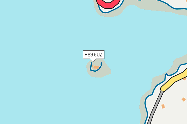
HS9 5UZ is located in the Barraigh agus Bhatarsaigh electoral ward, within the council area of Na h-Eileanan Siar and the Scottish Parliamentary constituency of Na h-Eileanan an Iar. The Community Health Partnership is Western Isles Community Health Partnership and the police force is Scotland. This postcode has been in use since July 1995.


GetTheData
Source: OS OpenMap – Local (Ordnance Survey)
Source: OS VectorMap District (Ordnance Survey)
Licence: Open Government Licence (requires attribution)
| Easting | 66509 |
| Northing | 797962 |
| Latitude | 56.952237 |
| Longitude | -7.487602 |
GetTheData
Source: Open Postcode Geo
Licence: Open Government Licence
| Country | Scotland |
| Postcode District | HS9 |
➜ See where HS9 is on a map | |
GetTheData
Source: Land Registry Price Paid Data
Licence: Open Government Licence
| Ward | Barraigh Agus Bhatarsaigh |
| Constituency | Na H-eileanan An Iar |
GetTheData
Source: ONS Postcode Database
Licence: Open Government Licence
| Post Office (Pier Road) | Castlebay | 191m |
| Craigard Hotel (A888) | Castlebay | 311m |
| The Square (Pier Road) | Castlebay | 323m |
| Craigard Hotel (A888) | Castlebay | 327m |
| Co-op (A888) | Castlebay | 337m |
GetTheData
Source: NaPTAN
Licence: Open Government Licence
GetTheData
Source: ONS Postcode Database
Licence: Open Government Licence


➜ Get more ratings from the Food Standards Agency
GetTheData
Source: Food Standards Agency
Licence: FSA terms & conditions
| Last Collection | |||
|---|---|---|---|
| Location | Mon-Fri | Sat | Distance |
| Castlebay Post Office | 08:00 | 08:00 | 218m |
| St Brendans Road | 07:45 | 07:45 | 710m |
| Tangasdale | 07:30 | 07:30 | 2,653m |
GetTheData
Source: Dracos
Licence: Creative Commons Attribution-ShareAlike
The below table lists the International Territorial Level (ITL) codes (formerly Nomenclature of Territorial Units for Statistics (NUTS) codes) and Local Administrative Units (LAU) codes for HS9 5UZ:
| ITL 1 Code | Name |
|---|---|
| TLM | Scotland |
| ITL 2 Code | Name |
| TLM6 | Highlands and Islands |
| ITL 3 Code | Name |
| TLM64 | Na h-Eileanan Siar |
| LAU 1 Code | Name |
| S30000039 | Na h-Eileanan Siar |
GetTheData
Source: ONS Postcode Directory
Licence: Open Government Licence
The below table lists the Census Output Area (OA), Lower Layer Super Output Area (LSOA), and Middle Layer Super Output Area (MSOA) for HS9 5UZ:
| Code | Name | |
|---|---|---|
| OA | S00135263 | |
| LSOA | S01009014 | Barra and South Uist - 01 |
| MSOA | S02001687 | Barra and South Uist |
GetTheData
Source: ONS Postcode Directory
Licence: Open Government Licence