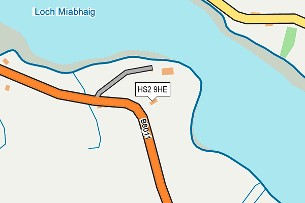
HS2 9HE is located in the Sgìr Ùige agus Cà rlabhagh electoral ward, within the council area of Na h-Eileanan Siar and the Scottish Parliamentary constituency of Na h-Eileanan an Iar. The Community Health Partnership is Western Isles Community Health Partnership and the police force is Scotland. This postcode has been in use since July 1995.


GetTheData
Source: OS OpenMap – Local (Ordnance Survey)
Source: OS VectorMap District (Ordnance Survey)
Licence: Open Government Licence (requires attribution)
| Easting | 109052 |
| Northing | 934329 |
| Latitude | 58.201409 |
| Longitude | -6.954329 |
GetTheData
Source: Open Postcode Geo
Licence: Open Government Licence
| Country | Scotland |
| Postcode District | HS2 |
➜ See where HS2 is on a map ➜ Where is Meavaig? | |
GetTheData
Source: Land Registry Price Paid Data
Licence: Open Government Licence
| Ward | Sgìr Ùige Agus Cà rlabhagh |
| Constituency | Na H-eileanan An Iar |
GetTheData
Source: ONS Postcode Database
Licence: Open Government Licence
| Quay Rd End (B8011) | Miavaig | 91m |
| Quay Rd End (B8011) | Miavaig | 121m |
| Township (Minor Road) | Uigen | 287m |
| Township (Minor Road) | Uigen | 306m |
| Road End (B8011) | Miavaig | 541m |
GetTheData
Source: NaPTAN
Licence: Open Government Licence
GetTheData
Source: ONS Postcode Database
Licence: Open Government Licence
| Last Collection | |||
|---|---|---|---|
| Location | Mon-Fri | Sat | Distance |
| Carishader | 09:00 | 09:00 | 1,603m |
| Reef | 15:15 | 15:15 | 1,795m |
GetTheData
Source: Dracos
Licence: Creative Commons Attribution-ShareAlike
The below table lists the International Territorial Level (ITL) codes (formerly Nomenclature of Territorial Units for Statistics (NUTS) codes) and Local Administrative Units (LAU) codes for HS2 9HE:
| ITL 1 Code | Name |
|---|---|
| TLM | Scotland |
| ITL 2 Code | Name |
| TLM6 | Highlands and Islands |
| ITL 3 Code | Name |
| TLM64 | Na h-Eileanan Siar |
| LAU 1 Code | Name |
| S30000039 | Na h-Eileanan Siar |
GetTheData
Source: ONS Postcode Directory
Licence: Open Government Licence
The below table lists the Census Output Area (OA), Lower Layer Super Output Area (LSOA), and Middle Layer Super Output Area (MSOA) for HS2 9HE:
| Code | Name | |
|---|---|---|
| OA | S00135119 | |
| LSOA | S01009027 | South Lewis - 03 |
| MSOA | S02001690 | South Lewis |
GetTheData
Source: ONS Postcode Directory
Licence: Open Government Licence