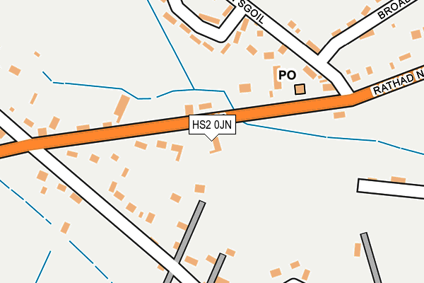
HS2 0JN is located in the Loch a Tuath electoral ward, within the council area of Na h-Eileanan Siar and the Scottish Parliamentary constituency of Na h-Eileanan an Iar. The Community Health Partnership is Western Isles Community Health Partnership and the police force is Scotland. This postcode has been in use since July 1995.


GetTheData
Source: OS OpenMap – Local (Ordnance Survey)
Source: OS VectorMap District (Ordnance Survey)
Licence: Open Government Licence (requires attribution)
| Easting | 147644 |
| Northing | 939862 |
| Latitude | 58.274733 |
| Longitude | -6.305700 |
GetTheData
Source: Open Postcode Geo
Licence: Open Government Licence
| Country | Scotland |
| Postcode District | HS2 |
➜ See where HS2 is on a map ➜ Where is Col? | |
GetTheData
Source: Land Registry Price Paid Data
Licence: Open Government Licence
| Ward | Loch A Tuath |
| Constituency | Na H-eileanan An Iar |
GetTheData
Source: ONS Postcode Database
Licence: Open Government Licence
| Garage (B895) | Back | 148m |
| Number 19 (Minor Road) | Inner Coll | 161m |
| Number 19 (Minor Road) | Inner Coll | 178m |
| Garage (B895) | Back | 205m |
| Road End (B895) | Inner Coll | 254m |
GetTheData
Source: NaPTAN
Licence: Open Government Licence
| Percentage of properties with Next Generation Access | 100.0% |
| Percentage of properties with Superfast Broadband | 100.0% |
| Percentage of properties with Ultrafast Broadband | 0.0% |
| Percentage of properties with Full Fibre Broadband | 0.0% |
Superfast Broadband is between 30Mbps and 300Mbps
Ultrafast Broadband is > 300Mbps
| Percentage of properties unable to receive 2Mbps | 0.0% |
| Percentage of properties unable to receive 5Mbps | 0.0% |
| Percentage of properties unable to receive 10Mbps | 0.0% |
| Percentage of properties unable to receive 30Mbps | 0.0% |
GetTheData
Source: Ofcom
Licence: Ofcom Terms of Use (requires attribution)
GetTheData
Source: ONS Postcode Database
Licence: Open Government Licence


➜ Get more ratings from the Food Standards Agency
GetTheData
Source: Food Standards Agency
Licence: FSA terms & conditions
The below table lists the International Territorial Level (ITL) codes (formerly Nomenclature of Territorial Units for Statistics (NUTS) codes) and Local Administrative Units (LAU) codes for HS2 0JN:
| ITL 1 Code | Name |
|---|---|
| TLM | Scotland |
| ITL 2 Code | Name |
| TLM6 | Highlands and Islands |
| ITL 3 Code | Name |
| TLM64 | Na h-Eileanan Siar |
| LAU 1 Code | Name |
| S30000039 | Na h-Eileanan Siar |
GetTheData
Source: ONS Postcode Directory
Licence: Open Government Licence
The below table lists the Census Output Area (OA), Lower Layer Super Output Area (LSOA), and Middle Layer Super Output Area (MSOA) for HS2 0JN:
| Code | Name | |
|---|---|---|
| OA | S00135224 | |
| LSOA | S01009035 | Broadbay - 02 |
| MSOA | S02001692 | Broadbay |
GetTheData
Source: ONS Postcode Directory
Licence: Open Government Licence