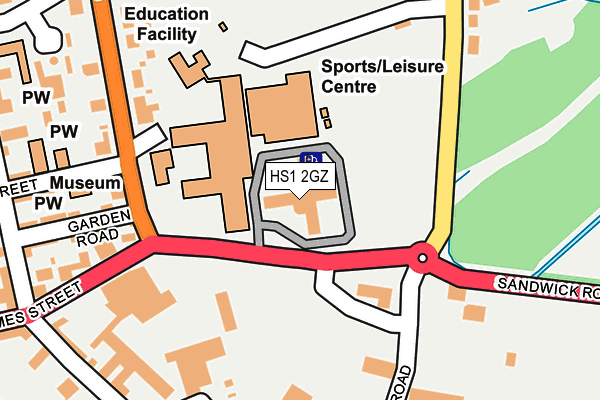
HS1 2GZ is located in the Steòrnabhagh a Deas electoral ward, within the council area of Na h-Eileanan Siar and the Scottish Parliamentary constituency of Na h-Eileanan an Iar. The Community Health Partnership is Western Isles Community Health Partnership and the police force is Scotland. This postcode has been in use since March 2005.


GetTheData
Source: OS OpenMap – Local (Ordnance Survey)
Source: OS VectorMap District (Ordnance Survey)
Licence: Open Government Licence (requires attribution)
| Easting | 142880 |
| Northing | 932845 |
| Latitude | 58.209105 |
| Longitude | -6.378920 |
GetTheData
Source: Open Postcode Geo
Licence: Open Government Licence
| Country | Scotland |
| Postcode District | HS1 |
➜ See where HS1 is on a map ➜ Where is Stornoway? | |
GetTheData
Source: Land Registry Price Paid Data
Licence: Open Government Licence
| Ward | Steòrnabhagh A Deas |
| Constituency | Na H-eileanan An Iar |
GetTheData
Source: ONS Postcode Database
Licence: Open Government Licence
| Council Offices (Sandwick Road) | Stornoway | 49m |
| Council Offices (Sandwick Road) | Stornoway | 67m |
| Nicholson Institute (Smith Avenue) | Stornoway | 209m |
| Nicholson Institute (Smith Avenue) | Stornoway | 233m |
| Tesco (Shell Street) | Stornoway | 375m |
GetTheData
Source: NaPTAN
Licence: Open Government Licence
GetTheData
Source: ONS Postcode Database
Licence: Open Government Licence


➜ Get more ratings from the Food Standards Agency
GetTheData
Source: Food Standards Agency
Licence: FSA terms & conditions
| Last Collection | |||
|---|---|---|---|
| Location | Mon-Fri | Sat | Distance |
| Rigs Road | 14:30 | 13:30 | 119m |
| James Street | 13:30 | 12:30 | 324m |
| Church Street | 13:30 | 12:30 | 400m |
GetTheData
Source: Dracos
Licence: Creative Commons Attribution-ShareAlike
The below table lists the International Territorial Level (ITL) codes (formerly Nomenclature of Territorial Units for Statistics (NUTS) codes) and Local Administrative Units (LAU) codes for HS1 2GZ:
| ITL 1 Code | Name |
|---|---|
| TLM | Scotland |
| ITL 2 Code | Name |
| TLM6 | Highlands and Islands |
| ITL 3 Code | Name |
| TLM64 | Na h-Eileanan Siar |
| LAU 1 Code | Name |
| S30000039 | Na h-Eileanan Siar |
GetTheData
Source: ONS Postcode Directory
Licence: Open Government Licence
The below table lists the Census Output Area (OA), Lower Layer Super Output Area (LSOA), and Middle Layer Super Output Area (MSOA) for HS1 2GZ:
| Code | Name | |
|---|---|---|
| OA | S00135186 | |
| LSOA | S01009041 | Stornoway West - 04 |
| MSOA | S02001693 | Stornoway West |
GetTheData
Source: ONS Postcode Directory
Licence: Open Government Licence