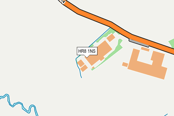
HR8 1NS is located in the Ledbury North electoral ward, within the unitary authority of Herefordshire, County of and the English Parliamentary constituency of North Herefordshire. The Sub Integrated Care Board (ICB) Location is NHS Herefordshire and Worcestershire ICB - 18C and the police force is West Mercia. This postcode has been in use since April 1985.


GetTheData
Source: OS OpenMap – Local (Ordnance Survey)
Source: OS VectorMap District (Ordnance Survey)
Licence: Open Government Licence (requires attribution)
| Easting | 370215 |
| Northing | 239162 |
| Latitude | 52.050050 |
| Longitude | -2.435747 |
GetTheData
Source: Open Postcode Geo
Licence: Open Government Licence
| Country | England |
| Postcode District | HR8 |
➜ See where HR8 is on a map ➜ Where is Ledbury? | |
GetTheData
Source: Land Registry Price Paid Data
Licence: Open Government Licence
Elevation or altitude of HR8 1NS as distance above sea level:
| Metres | Feet | |
|---|---|---|
| Elevation | 60m | 197ft |
Elevation is measured from the approximate centre of the postcode, to the nearest point on an OS contour line from OS Terrain 50, which has contour spacing of ten vertical metres.
➜ How high above sea level am I? Find the elevation of your current position using your device's GPS.
GetTheData
Source: Open Postcode Elevation
Licence: Open Government Licence
| Ward | Ledbury North |
| Constituency | North Herefordshire |
GetTheData
Source: ONS Postcode Database
Licence: Open Government Licence
| Golding Way (Hereford Road) | Ledbury | 635m |
| Golding Way (Hereford Road) | Ledbury | 637m |
| Frome Brook Road (New Mills Way) | Ledbury | 853m |
| Frome Brook Road (New Mills Way) | Ledbury | 858m |
| Railway Station (The Homend) | Ledbury | 920m |
| Ledbury Station | 0.9km |
GetTheData
Source: NaPTAN
Licence: Open Government Licence
GetTheData
Source: ONS Postcode Database
Licence: Open Government Licence


➜ Get more ratings from the Food Standards Agency
GetTheData
Source: Food Standards Agency
Licence: FSA terms & conditions
| Last Collection | |||
|---|---|---|---|
| Location | Mon-Fri | Sat | Distance |
| Northdown Close | 17:15 | 11:00 | 695m |
| New Mills Way | 17:15 | 11:00 | 897m |
| Langlands | 17:15 | 11:00 | 937m |
GetTheData
Source: Dracos
Licence: Creative Commons Attribution-ShareAlike
The below table lists the International Territorial Level (ITL) codes (formerly Nomenclature of Territorial Units for Statistics (NUTS) codes) and Local Administrative Units (LAU) codes for HR8 1NS:
| ITL 1 Code | Name |
|---|---|
| TLG | West Midlands (England) |
| ITL 2 Code | Name |
| TLG1 | Herefordshire, Worcestershire and Warwickshire |
| ITL 3 Code | Name |
| TLG11 | Herefordshire, County of |
| LAU 1 Code | Name |
| E06000019 | Herefordshire, County of |
GetTheData
Source: ONS Postcode Directory
Licence: Open Government Licence
The below table lists the Census Output Area (OA), Lower Layer Super Output Area (LSOA), and Middle Layer Super Output Area (MSOA) for HR8 1NS:
| Code | Name | |
|---|---|---|
| OA | E00070866 | |
| LSOA | E01014040 | Herefordshire 019F |
| MSOA | E02002923 | Herefordshire 019 |
GetTheData
Source: ONS Postcode Directory
Licence: Open Government Licence
| HR8 2QY | Saxon Way | 517m |
| HR8 1LG | Bromyard Road | 521m |
| HR8 2QX | Yeoman Close | 536m |
| HR8 2QZ | Progress Close | 558m |
| HR8 2PR | Hereford Road | 580m |
| HR8 2LZ | The Leasowes | 597m |
| HR8 1LN | Beggars Ash Cottages | 625m |
| HR8 2LQ | Hereford Road | 644m |
| HR8 2DZ | Sunshine Close | 651m |
| HR8 2PW | Challenger Close | 689m |
GetTheData
Source: Open Postcode Geo; Land Registry Price Paid Data
Licence: Open Government Licence