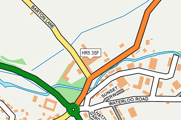
HR5 3SF is located in the Kington electoral ward, within the unitary authority of Herefordshire, County of and the English Parliamentary constituency of North Herefordshire. The Sub Integrated Care Board (ICB) Location is NHS Herefordshire and Worcestershire ICB - 18C and the police force is West Mercia. This postcode has been in use since January 1983.


GetTheData
Source: OS OpenMap – Local (Ordnance Survey)
Source: OS VectorMap District (Ordnance Survey)
Licence: Open Government Licence (requires attribution)
| Easting | 330305 |
| Northing | 257072 |
| Latitude | 52.207445 |
| Longitude | -3.021337 |
GetTheData
Source: Open Postcode Geo
Licence: Open Government Licence
| Country | England |
| Postcode District | HR5 |
➜ See where HR5 is on a map ➜ Where is Kington? | |
GetTheData
Source: Land Registry Price Paid Data
Licence: Open Government Licence
Elevation or altitude of HR5 3SF as distance above sea level:
| Metres | Feet | |
|---|---|---|
| Elevation | 150m | 492ft |
Elevation is measured from the approximate centre of the postcode, to the nearest point on an OS contour line from OS Terrain 50, which has contour spacing of ten vertical metres.
➜ How high above sea level am I? Find the elevation of your current position using your device's GPS.
GetTheData
Source: Open Postcode Elevation
Licence: Open Government Licence
| Ward | Kington |
| Constituency | North Herefordshire |
GetTheData
Source: ONS Postcode Database
Licence: Open Government Licence
| Telephone Box (Waterloo Road) | Hatton Gardens | 168m |
| Ye Olde Tavern (Victoria Road) | Kington | 208m |
| Elizabeth Road | Kington | 247m |
| Gravel Hill Drive (Greenfield Drive) | Kington | 336m |
| Old Doctor's Surgery (The Meads) | Kington | 407m |
GetTheData
Source: NaPTAN
Licence: Open Government Licence
GetTheData
Source: ONS Postcode Database
Licence: Open Government Licence


➜ Get more ratings from the Food Standards Agency
GetTheData
Source: Food Standards Agency
Licence: FSA terms & conditions
| Last Collection | |||
|---|---|---|---|
| Location | Mon-Fri | Sat | Distance |
| The Square | 17:00 | 11:00 | 843m |
| The Wych | 15:00 | 09:00 | 1,273m |
GetTheData
Source: Dracos
Licence: Creative Commons Attribution-ShareAlike
| Risk of HR5 3SF flooding from rivers and sea | Low |
| ➜ HR5 3SF flood map | |
GetTheData
Source: Open Flood Risk by Postcode
Licence: Open Government Licence
The below table lists the International Territorial Level (ITL) codes (formerly Nomenclature of Territorial Units for Statistics (NUTS) codes) and Local Administrative Units (LAU) codes for HR5 3SF:
| ITL 1 Code | Name |
|---|---|
| TLG | West Midlands (England) |
| ITL 2 Code | Name |
| TLG1 | Herefordshire, Worcestershire and Warwickshire |
| ITL 3 Code | Name |
| TLG11 | Herefordshire, County of |
| LAU 1 Code | Name |
| E06000019 | Herefordshire, County of |
GetTheData
Source: ONS Postcode Directory
Licence: Open Government Licence
The below table lists the Census Output Area (OA), Lower Layer Super Output Area (LSOA), and Middle Layer Super Output Area (MSOA) for HR5 3SF:
| Code | Name | |
|---|---|---|
| OA | E00070860 | |
| LSOA | E01014033 | Herefordshire 006C |
| MSOA | E02002910 | Herefordshire 006 |
GetTheData
Source: ONS Postcode Directory
Licence: Open Government Licence
| HR5 3SG | Sunset Yard | 53m |
| HR5 3DE | Waterloo Road | 117m |
| HR5 3DF | Sunset Row | 147m |
| HR5 3RB | Hatton Gardens Industrial Estate | 171m |
| HR5 3DD | Hatton Gardens | 211m |
| HR5 3DA | Foundry Bungalows | 217m |
| HR5 3DB | Elizabeth Road | 305m |
| HR5 3TB | Meads Close | 318m |
| HR5 3AE | Gravel Hill Drive | 337m |
| HR5 3BX | Victoria Road | 338m |
GetTheData
Source: Open Postcode Geo; Land Registry Price Paid Data
Licence: Open Government Licence