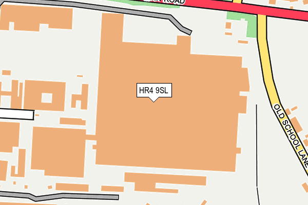
HR4 9SL is located in the Widemarsh electoral ward, within the unitary authority of Herefordshire, County of and the English Parliamentary constituency of Hereford and South Herefordshire. The Sub Integrated Care Board (ICB) Location is NHS Herefordshire and Worcestershire ICB - 18C and the police force is West Mercia. This postcode has been in use since January 1980.


GetTheData
Source: OS OpenMap – Local (Ordnance Survey)
Source: OS VectorMap District (Ordnance Survey)
Licence: Open Government Licence (requires attribution)
| Easting | 350970 |
| Northing | 241874 |
| Latitude | 52.073049 |
| Longitude | -2.716758 |
GetTheData
Source: Open Postcode Geo
Licence: Open Government Licence
| Country | England |
| Postcode District | HR4 |
➜ See where HR4 is on a map ➜ Where is Hereford? | |
GetTheData
Source: Land Registry Price Paid Data
Licence: Open Government Licence
Elevation or altitude of HR4 9SL as distance above sea level:
| Metres | Feet | |
|---|---|---|
| Elevation | 70m | 230ft |
Elevation is measured from the approximate centre of the postcode, to the nearest point on an OS contour line from OS Terrain 50, which has contour spacing of ten vertical metres.
➜ How high above sea level am I? Find the elevation of your current position using your device's GPS.
GetTheData
Source: Open Postcode Elevation
Licence: Open Government Licence
| Ward | Widemarsh |
| Constituency | Hereford And South Herefordshire |
GetTheData
Source: ONS Postcode Database
Licence: Open Government Licence
| Pegasus Football Ground (Old School Lane) | Hereford | 235m |
| Cleeve Orchard (Roman Road) | Hereford | 236m |
| Pegasus Football Ground (Old School Lane) | Hereford | 242m |
| Cleeve Orchard (Roman Road) | Holmer | 250m |
| Leisure Centre (Holmer Road) | Hereford | 408m |
| Hereford Station | 1.4km |
GetTheData
Source: NaPTAN
Licence: Open Government Licence
GetTheData
Source: ONS Postcode Database
Licence: Open Government Licence


➜ Get more ratings from the Food Standards Agency
GetTheData
Source: Food Standards Agency
Licence: FSA terms & conditions
| Last Collection | |||
|---|---|---|---|
| Location | Mon-Fri | Sat | Distance |
| Kempton Avenue | 18:15 | 11:45 | 1,276m |
| Commercial Road | 18:30 | 12:00 | 1,676m |
| Sandown Drive | 18:30 | 11:45 | 1,707m |
GetTheData
Source: Dracos
Licence: Creative Commons Attribution-ShareAlike
The below table lists the International Territorial Level (ITL) codes (formerly Nomenclature of Territorial Units for Statistics (NUTS) codes) and Local Administrative Units (LAU) codes for HR4 9SL:
| ITL 1 Code | Name |
|---|---|
| TLG | West Midlands (England) |
| ITL 2 Code | Name |
| TLG1 | Herefordshire, Worcestershire and Warwickshire |
| ITL 3 Code | Name |
| TLG11 | Herefordshire, County of |
| LAU 1 Code | Name |
| E06000019 | Herefordshire, County of |
GetTheData
Source: ONS Postcode Directory
Licence: Open Government Licence
The below table lists the Census Output Area (OA), Lower Layer Super Output Area (LSOA), and Middle Layer Super Output Area (MSOA) for HR4 9SL:
| Code | Name | |
|---|---|---|
| OA | E00071126 | |
| LSOA | E01014084 | Herefordshire 010B |
| MSOA | E02002914 | Herefordshire 010 |
GetTheData
Source: ONS Postcode Directory
Licence: Open Government Licence
| HR1 1LD | Roman Road | 231m |
| HR1 1PY | Wentworth Road | 271m |
| HR1 1EA | Sunningdale | 283m |
| HR1 1JZ | Gleneagles Road | 286m |
| HR1 1EX | Old School Lane | 318m |
| HR1 1LF | Cleeve Orchard | 319m |
| HR1 1LP | Turnberry Drive | 353m |
| HR1 1LE | Roman Road | 359m |
| HR1 1GJ | Eggleton Lane | 364m |
| HR1 1GL | Tanners Red Walk | 400m |
GetTheData
Source: Open Postcode Geo; Land Registry Price Paid Data
Licence: Open Government Licence