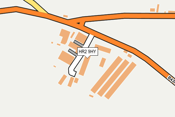
HR2 9HY lies on Gooses Foot Industrial Estate in Kingstone, Hereford. HR2 9HY is located in the Wormside electoral ward, within the unitary authority of Herefordshire, County of and the English Parliamentary constituency of Hereford and South Herefordshire. The Sub Integrated Care Board (ICB) Location is NHS Herefordshire and Worcestershire ICB - 18C and the police force is West Mercia. This postcode has been in use since August 1993.


GetTheData
Source: OS OpenMap – Local (Ordnance Survey)
Source: OS VectorMap District (Ordnance Survey)
Licence: Open Government Licence (requires attribution)
| Easting | 341556 |
| Northing | 235919 |
| Latitude | 52.018600 |
| Longitude | -2.853073 |
GetTheData
Source: Open Postcode Geo
Licence: Open Government Licence
| Street | Gooses Foot Industrial Estate |
| Locality | Kingstone |
| Town/City | Hereford |
| Country | England |
| Postcode District | HR2 |
➜ See where HR2 is on a map ➜ Where is Kingstone? | |
GetTheData
Source: Land Registry Price Paid Data
Licence: Open Government Licence
Elevation or altitude of HR2 9HY as distance above sea level:
| Metres | Feet | |
|---|---|---|
| Elevation | 90m | 295ft |
Elevation is measured from the approximate centre of the postcode, to the nearest point on an OS contour line from OS Terrain 50, which has contour spacing of ten vertical metres.
➜ How high above sea level am I? Find the elevation of your current position using your device's GPS.
GetTheData
Source: Open Postcode Elevation
Licence: Open Government Licence
| Ward | Wormside |
| Constituency | Hereford And South Herefordshire |
GetTheData
Source: ONS Postcode Database
Licence: Open Government Licence
| Gooses Foot Industrial Estate (B4348) | Kingstone | 78m |
| Gooses Foot Industrial Estate (B4368) | Kingstone | 100m |
| Primary School (B4349) | Kingstone | 422m |
| Primary School (B4349) | Kingstone | 436m |
| Hanley Court (B4348) | Kingstone | 484m |
GetTheData
Source: NaPTAN
Licence: Open Government Licence
GetTheData
Source: ONS Postcode Database
Licence: Open Government Licence


➜ Get more ratings from the Food Standards Agency
GetTheData
Source: Food Standards Agency
Licence: FSA terms & conditions
| Last Collection | |||
|---|---|---|---|
| Location | Mon-Fri | Sat | Distance |
| Kingstone P.o. | 16:30 | 12:15 | 778m |
| Highland View | 16:00 | 09:00 | 942m |
| Dews Corner | 16:15 | 10:30 | 1,344m |
GetTheData
Source: Dracos
Licence: Creative Commons Attribution-ShareAlike
The below table lists the International Territorial Level (ITL) codes (formerly Nomenclature of Territorial Units for Statistics (NUTS) codes) and Local Administrative Units (LAU) codes for HR2 9HY:
| ITL 1 Code | Name |
|---|---|
| TLG | West Midlands (England) |
| ITL 2 Code | Name |
| TLG1 | Herefordshire, Worcestershire and Warwickshire |
| ITL 3 Code | Name |
| TLG11 | Herefordshire, County of |
| LAU 1 Code | Name |
| E06000019 | Herefordshire, County of |
GetTheData
Source: ONS Postcode Directory
Licence: Open Government Licence
The below table lists the Census Output Area (OA), Lower Layer Super Output Area (LSOA), and Middle Layer Super Output Area (MSOA) for HR2 9HY:
| Code | Name | |
|---|---|---|
| OA | E00071203 | |
| LSOA | E01014098 | Herefordshire 021E |
| MSOA | E02002925 | Herefordshire 021 |
GetTheData
Source: ONS Postcode Directory
Licence: Open Government Licence
| HR2 9NE | 168m | |
| HR2 9HQ | 356m | |
| HR2 9EY | 475m | |
| HR2 9HG | Yew Tree Cottages | 486m |
| HR2 9HJ | 488m | |
| HR2 9HW | Tippetts Meadow | 532m |
| HR2 9HF | 697m | |
| HR2 9EX | Green Lane | 702m |
| HR2 9EP | St Michaels Close | 756m |
| HR2 9HE | 762m |
GetTheData
Source: Open Postcode Geo; Land Registry Price Paid Data
Licence: Open Government Licence