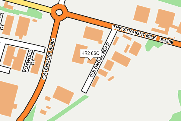
HR2 6SQ is located in the Dinedor Hill electoral ward, within the unitary authority of Herefordshire, County of and the English Parliamentary constituency of Hereford and South Herefordshire. The Sub Integrated Care Board (ICB) Location is NHS Herefordshire and Worcestershire ICB - 18C and the police force is West Mercia. This postcode has been in use since July 2017.


GetTheData
Source: OS OpenMap – Local (Ordnance Survey)
Source: OS VectorMap District (Ordnance Survey)
Licence: Open Government Licence (requires attribution)
| Easting | 353405 |
| Northing | 237741 |
| Latitude | 52.036113 |
| Longitude | -2.680671 |
GetTheData
Source: Open Postcode Geo
Licence: Open Government Licence
| Country | England |
| Postcode District | HR2 |
➜ See where HR2 is on a map ➜ Where is Hereford? | |
GetTheData
Source: Land Registry Price Paid Data
Licence: Open Government Licence
| Ward | Dinedor Hill |
| Constituency | Hereford And South Herefordshire |
GetTheData
Source: ONS Postcode Database
Licence: Open Government Licence
| Foxwood Court (Netherwood Road) | Rotherwas | 173m |
| Vincent Carey Road (The Straight Mile) | Rotherwas | 311m |
| Parkwood Court (Netherwood Road) | Rotherwas | 325m |
| Vincent Carey Road (The Straight Mile) | Rotherwas | 335m |
| Pikadish (Netherwood Road) | Rotherwas | 673m |
| Hereford Station | 3.4km |
GetTheData
Source: NaPTAN
Licence: Open Government Licence
GetTheData
Source: ONS Postcode Database
Licence: Open Government Licence


➜ Get more ratings from the Food Standards Agency
GetTheData
Source: Food Standards Agency
Licence: FSA terms & conditions
| Last Collection | |||
|---|---|---|---|
| Location | Mon-Fri | Sat | Distance |
| Rotherwas Industrial Estate | 17:15 | 07:15 | 794m |
| Hampton Park Road | 17:00 | 11:30 | 1,622m |
| Bunch Of Carrotts, Hampton Bish | 16:00 | 08:00 | 1,683m |
GetTheData
Source: Dracos
Licence: Creative Commons Attribution-ShareAlike
| Risk of HR2 6SQ flooding from rivers and sea | Low |
| ➜ HR2 6SQ flood map | |
GetTheData
Source: Open Flood Risk by Postcode
Licence: Open Government Licence
The below table lists the International Territorial Level (ITL) codes (formerly Nomenclature of Territorial Units for Statistics (NUTS) codes) and Local Administrative Units (LAU) codes for HR2 6SQ:
| ITL 1 Code | Name |
|---|---|
| TLG | West Midlands (England) |
| ITL 2 Code | Name |
| TLG1 | Herefordshire, Worcestershire and Warwickshire |
| ITL 3 Code | Name |
| TLG11 | Herefordshire, County of |
| LAU 1 Code | Name |
| E06000019 | Herefordshire, County of |
GetTheData
Source: ONS Postcode Directory
Licence: Open Government Licence
The below table lists the Census Output Area (OA), Lower Layer Super Output Area (LSOA), and Middle Layer Super Output Area (MSOA) for HR2 6SQ:
| Code | Name | |
|---|---|---|
| OA | E00070814 | |
| LSOA | E01014026 | Herefordshire 021A |
| MSOA | E02002925 | Herefordshire 021 |
GetTheData
Source: ONS Postcode Directory
Licence: Open Government Licence
| HR2 6BQ | Holme Lacy Road | 200m |
| HR2 6FE | Vincent Carey Road | 466m |
| HR2 6LD | Chapel Road | 562m |
| HR2 6LE | 563m | |
| HR2 6LA | Fir Tree Lane | 590m |
| HR2 6NR | The Straight Mile | 781m |
| HR2 6LF | 812m | |
| HR2 6LQ | 958m | |
| HR2 6JT | Thorn Business Park | 980m |
| HR2 6JR | Twyford Road | 1048m |
GetTheData
Source: Open Postcode Geo; Land Registry Price Paid Data
Licence: Open Government Licence