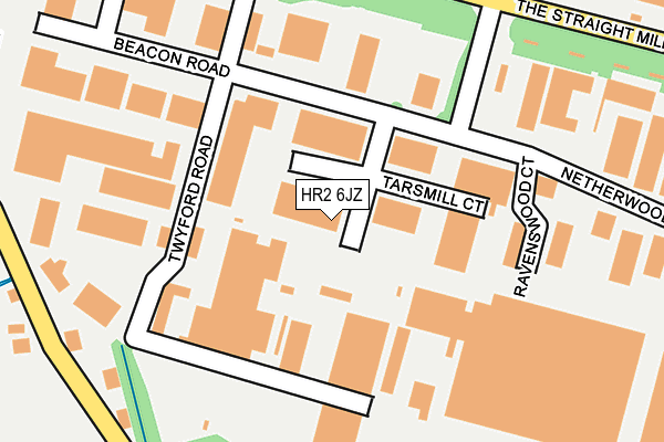
HR2 6JZ is located in the Dinedor Hill electoral ward, within the unitary authority of Herefordshire, County of and the English Parliamentary constituency of Hereford and South Herefordshire. The Sub Integrated Care Board (ICB) Location is NHS Herefordshire and Worcestershire ICB - 18C and the police force is West Mercia. This postcode has been in use since March 1983.


GetTheData
Source: OS OpenMap – Local (Ordnance Survey)
Source: OS VectorMap District (Ordnance Survey)
Licence: Open Government Licence (requires attribution)
| Easting | 352543 |
| Northing | 237861 |
| Latitude | 52.037118 |
| Longitude | -2.693253 |
GetTheData
Source: Open Postcode Geo
Licence: Open Government Licence
| Country | England |
| Postcode District | HR2 |
➜ See where HR2 is on a map ➜ Where is Hereford? | |
GetTheData
Source: Land Registry Price Paid Data
Licence: Open Government Licence
Elevation or altitude of HR2 6JZ as distance above sea level:
| Metres | Feet | |
|---|---|---|
| Elevation | 50m | 164ft |
Elevation is measured from the approximate centre of the postcode, to the nearest point on an OS contour line from OS Terrain 50, which has contour spacing of ten vertical metres.
➜ How high above sea level am I? Find the elevation of your current position using your device's GPS.
GetTheData
Source: Open Postcode Elevation
Licence: Open Government Licence
| Ward | Dinedor Hill |
| Constituency | Hereford And South Herefordshire |
GetTheData
Source: ONS Postcode Database
Licence: Open Government Licence
| Pikadish (Netherwood Road) | Rotherwas | 212m |
| Pikadish (Netherwood Road) | Rotherwas | 218m |
| Thorn Office Centre (Holme Lacy Road (B4299)) | Rotherwas | 229m |
| Thorn Office Centre (Holme Lacy Road (B4299)) | Rotherwas | 242m |
| Goodwin Way (Holme Lacy Road) | Lower Bullingham | 446m |
| Hereford Station | 2.9km |
GetTheData
Source: NaPTAN
Licence: Open Government Licence
GetTheData
Source: ONS Postcode Database
Licence: Open Government Licence


➜ Get more ratings from the Food Standards Agency
GetTheData
Source: Food Standards Agency
Licence: FSA terms & conditions
| Last Collection | |||
|---|---|---|---|
| Location | Mon-Fri | Sat | Distance |
| Rotherwas Industrial Estate | 17:15 | 07:15 | 235m |
| Hampton Park Road | 17:00 | 11:30 | 1,358m |
| Hoarwithy Road | 17:00 | 12:00 | 1,403m |
GetTheData
Source: Dracos
Licence: Creative Commons Attribution-ShareAlike
The below table lists the International Territorial Level (ITL) codes (formerly Nomenclature of Territorial Units for Statistics (NUTS) codes) and Local Administrative Units (LAU) codes for HR2 6JZ:
| ITL 1 Code | Name |
|---|---|
| TLG | West Midlands (England) |
| ITL 2 Code | Name |
| TLG1 | Herefordshire, Worcestershire and Warwickshire |
| ITL 3 Code | Name |
| TLG11 | Herefordshire, County of |
| LAU 1 Code | Name |
| E06000019 | Herefordshire, County of |
GetTheData
Source: ONS Postcode Directory
Licence: Open Government Licence
The below table lists the Census Output Area (OA), Lower Layer Super Output Area (LSOA), and Middle Layer Super Output Area (MSOA) for HR2 6JZ:
| Code | Name | |
|---|---|---|
| OA | E00070819 | |
| LSOA | E01014026 | Herefordshire 021A |
| MSOA | E02002925 | Herefordshire 021 |
GetTheData
Source: ONS Postcode Directory
Licence: Open Government Licence
| HR2 6JR | Twyford Road | 180m |
| HR2 6NR | The Straight Mile | 278m |
| HR2 6JP | 361m | |
| HR2 6JT | Thorn Business Park | 435m |
| HR2 6RB | Redbrook Close | 470m |
| HR2 6RE | Westbury Close | 496m |
| HR2 6FE | Vincent Carey Road | 501m |
| HR2 6EH | Holme Lacy Road | 527m |
| HR2 6RA | Goodwin Way | 539m |
| HR2 6RF | Thomas Close | 545m |
GetTheData
Source: Open Postcode Geo; Land Registry Price Paid Data
Licence: Open Government Licence