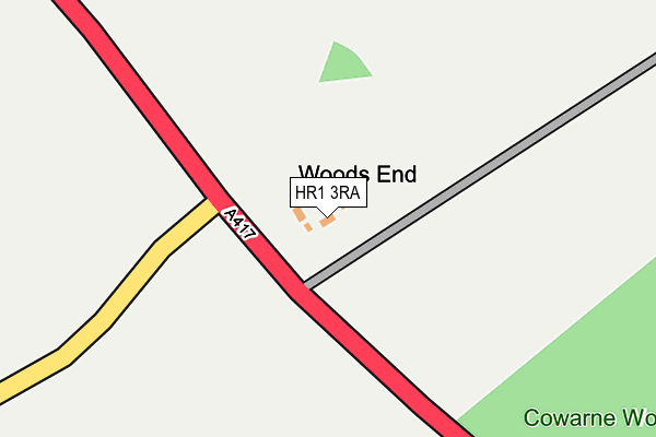
HR1 3RA is in Burley Gate, Hereford. HR1 3RA is located in the Three Crosses electoral ward, within the unitary authority of Herefordshire, County of and the English Parliamentary constituency of North Herefordshire. The Sub Integrated Care Board (ICB) Location is NHS Herefordshire and Worcestershire ICB - 18C and the police force is West Mercia. This postcode has been in use since January 1980.


GetTheData
Source: OS OpenMap – Local (Ordnance Survey)
Source: OS VectorMap District (Ordnance Survey)
Licence: Open Government Licence (requires attribution)
| Easting | 360537 |
| Northing | 246356 |
| Latitude | 52.114109 |
| Longitude | -2.577705 |
GetTheData
Source: Open Postcode Geo
Licence: Open Government Licence
| Locality | Burley Gate |
| Town/City | Hereford |
| Country | England |
| Postcode District | HR1 |
➜ See where HR1 is on a map | |
GetTheData
Source: Land Registry Price Paid Data
Licence: Open Government Licence
Elevation or altitude of HR1 3RA as distance above sea level:
| Metres | Feet | |
|---|---|---|
| Elevation | 90m | 295ft |
Elevation is measured from the approximate centre of the postcode, to the nearest point on an OS contour line from OS Terrain 50, which has contour spacing of ten vertical metres.
➜ How high above sea level am I? Find the elevation of your current position using your device's GPS.
GetTheData
Source: Open Postcode Elevation
Licence: Open Government Licence
| Ward | Three Crosses |
| Constituency | North Herefordshire |
GetTheData
Source: ONS Postcode Database
Licence: Open Government Licence
| Telephone Exchange (A465) | Burley Gate | 1,294m |
| Telephone Exchange (A465) | Burley Gate | 1,304m |
| Roundabout (A417) | Burley Gate | 1,367m |
| Roundabout (A417) | Burley Gate | 1,373m |
| A465 Roundabout (A465) | Burley Gate | 1,459m |
GetTheData
Source: NaPTAN
Licence: Open Government Licence
| Percentage of properties with Next Generation Access | 100.0% |
| Percentage of properties with Superfast Broadband | 100.0% |
| Percentage of properties with Ultrafast Broadband | 100.0% |
| Percentage of properties with Full Fibre Broadband | 100.0% |
Superfast Broadband is between 30Mbps and 300Mbps
Ultrafast Broadband is > 300Mbps
| Percentage of properties unable to receive 2Mbps | 0.0% |
| Percentage of properties unable to receive 5Mbps | 0.0% |
| Percentage of properties unable to receive 10Mbps | 0.0% |
| Percentage of properties unable to receive 30Mbps | 0.0% |
GetTheData
Source: Ofcom
Licence: Ofcom Terms of Use (requires attribution)
GetTheData
Source: ONS Postcode Database
Licence: Open Government Licence


➜ Get more ratings from the Food Standards Agency
GetTheData
Source: Food Standards Agency
Licence: FSA terms & conditions
| Last Collection | |||
|---|---|---|---|
| Location | Mon-Fri | Sat | Distance |
| Cowarne Court | 09:30 | 09:30 | 857m |
| Ocle Pychard | 11:15 | 11:15 | 948m |
| Burley Gate P.o. | 16:00 | 12:30 | 1,234m |
GetTheData
Source: Dracos
Licence: Creative Commons Attribution-ShareAlike
The below table lists the International Territorial Level (ITL) codes (formerly Nomenclature of Territorial Units for Statistics (NUTS) codes) and Local Administrative Units (LAU) codes for HR1 3RA:
| ITL 1 Code | Name |
|---|---|
| TLG | West Midlands (England) |
| ITL 2 Code | Name |
| TLG1 | Herefordshire, Worcestershire and Warwickshire |
| ITL 3 Code | Name |
| TLG11 | Herefordshire, County of |
| LAU 1 Code | Name |
| E06000019 | Herefordshire, County of |
GetTheData
Source: ONS Postcode Directory
Licence: Open Government Licence
The below table lists the Census Output Area (OA), Lower Layer Super Output Area (LSOA), and Middle Layer Super Output Area (MSOA) for HR1 3RA:
| Code | Name | |
|---|---|---|
| OA | E00070749 | |
| LSOA | E01014015 | Herefordshire 005G |
| MSOA | E02002909 | Herefordshire 005 |
GetTheData
Source: ONS Postcode Directory
Licence: Open Government Licence
| HR1 3QZ | 587m | |
| HR1 3RB | 862m | |
| HR1 3QT | Wynns Green Cottages | 961m |
| HR1 3QS | 1047m | |
| HR1 3QU | Upper Cottages | 1204m |
| HR1 3QX | 1220m | |
| HR8 2UA | Lower Mitchells Cottages | 1298m |
| HR1 3QR | 1314m | |
| HR1 3RE | 1582m | |
| HR1 3QN | 1611m |
GetTheData
Source: Open Postcode Geo; Land Registry Price Paid Data
Licence: Open Government Licence