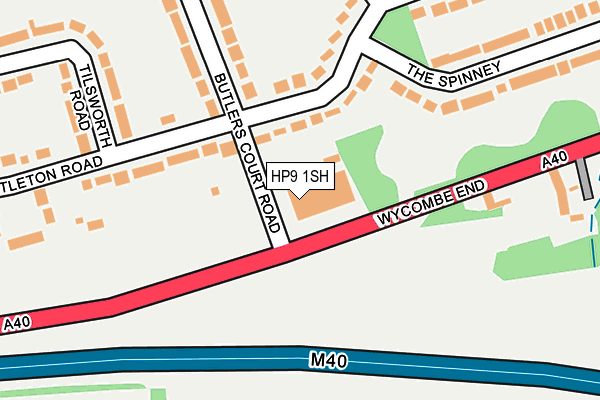
HP9 1SH is located in the Beaconsfield electoral ward, within the unitary authority of Buckinghamshire and the English Parliamentary constituency of Beaconsfield. The Sub Integrated Care Board (ICB) Location is NHS Buckinghamshire, Oxfordshire and Berkshire West ICB - 14Y and the police force is Thames Valley. This postcode has been in use since January 1980.


GetTheData
Source: OS OpenMap – Local (Ordnance Survey)
Source: OS VectorMap District (Ordnance Survey)
Licence: Open Government Licence (requires attribution)
| Easting | 493687 |
| Northing | 189859 |
| Latitude | 51.599792 |
| Longitude | -0.648742 |
GetTheData
Source: Open Postcode Geo
Licence: Open Government Licence
| Country | England |
| Postcode District | HP9 |
➜ See where HP9 is on a map ➜ Where is Beaconsfield? | |
GetTheData
Source: Land Registry Price Paid Data
Licence: Open Government Licence
Elevation or altitude of HP9 1SH as distance above sea level:
| Metres | Feet | |
|---|---|---|
| Elevation | 100m | 328ft |
Elevation is measured from the approximate centre of the postcode, to the nearest point on an OS contour line from OS Terrain 50, which has contour spacing of ten vertical metres.
➜ How high above sea level am I? Find the elevation of your current position using your device's GPS.
GetTheData
Source: Open Postcode Elevation
Licence: Open Government Licence
| Ward | Beaconsfield |
| Constituency | Beaconsfield |
GetTheData
Source: ONS Postcode Database
Licence: Open Government Licence
| Butlers Court Road (Wycombe End) | Beaconsfield Old Town | 38m |
| Butlers Court Road (Wycombe End) | Beaconsfield Old Town | 104m |
| High School (Wattleton Road) | Beaconsfield | 584m |
| High School (Wattleton Road) | Beaconsfield | 585m |
| Burkes Road (Wycombe Road) | Holtspur | 651m |
| Beaconsfield Station | 1.3km |
| Seer Green Station | 3km |
| Bourne End Station | 5km |
GetTheData
Source: NaPTAN
Licence: Open Government Licence
GetTheData
Source: ONS Postcode Database
Licence: Open Government Licence


➜ Get more ratings from the Food Standards Agency
GetTheData
Source: Food Standards Agency
Licence: FSA terms & conditions
| Last Collection | |||
|---|---|---|---|
| Location | Mon-Fri | Sat | Distance |
| Butlers Court Road | 17:15 | 12:00 | 76m |
| Pennington Road | 17:00 | 12:00 | 669m |
| Westfield Road | 17:00 | 12:00 | 736m |
GetTheData
Source: Dracos
Licence: Creative Commons Attribution-ShareAlike
The below table lists the International Territorial Level (ITL) codes (formerly Nomenclature of Territorial Units for Statistics (NUTS) codes) and Local Administrative Units (LAU) codes for HP9 1SH:
| ITL 1 Code | Name |
|---|---|
| TLJ | South East (England) |
| ITL 2 Code | Name |
| TLJ1 | Berkshire, Buckinghamshire and Oxfordshire |
| ITL 3 Code | Name |
| TLJ13 | Buckinghamshire |
| LAU 1 Code | Name |
| E06000060 | Buckinghamshire |
GetTheData
Source: ONS Postcode Directory
Licence: Open Government Licence
The below table lists the Census Output Area (OA), Lower Layer Super Output Area (LSOA), and Middle Layer Super Output Area (MSOA) for HP9 1SH:
| Code | Name | |
|---|---|---|
| OA | E00089817 | |
| LSOA | E01017799 | South Bucks 001D |
| MSOA | E02003688 | South Bucks 001 |
GetTheData
Source: ONS Postcode Directory
Licence: Open Government Licence
| HP9 1SD | Wattleton Road | 128m |
| HP9 1SE | Wattleton Road | 138m |
| HP9 1SF | Butlers Court Road | 200m |
| HP9 1XA | Wycombe End | 262m |
| HP9 1SB | The Spinney | 291m |
| HP9 1SG | Butlers Court Road | 300m |
| HP9 1RZ | The Spinney | 304m |
| HP9 1RY | Wattleton Road | 329m |
| HP9 1TP | Tilsworth Road | 337m |
| HP9 1TT | Wattleton Road | 347m |
GetTheData
Source: Open Postcode Geo; Land Registry Price Paid Data
Licence: Open Government Licence